
The River Severn, at 220 miles (354 km) long, is the longest river in Great Britain. It is also the river with the most voluminous flow of water by far in all of England and Wales, discharging an average of 107 m3/s (3,800 cu ft/s) into the Bristol Channel at Apperley, Gloucestershire. It rises in the Cambrian Mountains in mid Wales, at an altitude of 2,001 feet (610 m), on the Plynlimon massif, which lies close to the Ceredigion/Powys border near Llanidloes. The river then flows through Shropshire, Worcestershire and Gloucestershire. The county towns of Shrewsbury, Gloucester and the City of Worcester lie on its course.

Shropshire is a landlocked county in the West Midlands region of England. It is bordered by Wales to the west and the English counties of Cheshire to the north, Staffordshire to the east, Worcestershire to the southeast, and Herefordshire to the south. Shropshire Council was created in 2009, a unitary authority taking over from the previous county council and five district councils, covering Shropshire district. The borough of Telford and Wrekin has been a separate unitary authority since 1998, but remains part of the ceremonial county.

The abc conjecture is a conjecture in number theory, first proposed by Oesterlé and Masser. It is stated in terms of three positive integers, a, b and c that are relatively prime and satisfy a + b = c. If d denotes the product of the distinct prime factors of abc, the conjecture essentially states that d is usually not much smaller than c. In other words: if a and b are composed from large powers of primes, then c is usually not divisible by large powers of primes. A number of famous conjectures and theorems in number theory would follow immediately from the abc conjecture or its versions. American mathematician Dorian Goldfeld described the abc conjecture as "The most important unsolved problem in Diophantine analysis".

Telford is a large town in the borough of Telford and Wrekin and ceremonial county of Shropshire, England, about 15 miles (24 km) east of Shrewsbury, 21 miles (34 km) south west of Stafford, 19 miles (31 km) north west of Wolverhampton, and 28 miles (45 km) from Birmingham in the same direction. With an estimated population of 175,271 in 2017 and around 155,000 in Telford itself, Telford is the largest town in Shropshire, and one of the fastest-growing towns in the United Kingdom.

Oswestry is a market town, civil parish and historic railway town in Shropshire, England, close to the Welsh border. It is at the junction of the A5, A483 and A495 roads.

The River Clun runs mostly through Shropshire, England and joins the River Teme at Leintwardine, Herefordshire. The Clun Valley is part of the Shropshire Hills AONB.

Wellington is a market town in the unitary authority of Telford and Wrekin and ceremonial county of Shropshire, England where it forms part of Telford, with which it has gradually become contiguous. It is situated 3.5 miles (5.5 km) northwest of central Telford and 12 miles (19 km) east of Shrewsbury. The summit of The Wrekin lies 3 miles southwest of the town.

Much Wenlock is a market town and parish in Shropshire, England, situated on the A458 road between Shrewsbury and Bridgnorth. Nearby, to the northeast, is the Ironbridge Gorge, and the new town of Telford. The civil parish includes the villages of Homer, Wyke, Atterley, Stretton Westwood and Bourton. The population of the civil parish, according to the 2001 census, was 2,605, increasing to 2,877 at the 2011 Census. Notable historic attractions in the town are Wenlock Priory and the Guildhall.

Pontesbury is a village and civil parish in Shropshire and is approximately eight miles southwest of the county town of Shrewsbury. In the 2011 census, its population was 3,227. The village of Minsterley is just over a mile further southwest. The A488 road runs through the village, on its way from Shrewsbury to Bishop's Castle. The Rea Brook flows close by to the north with the village itself nestling on the northern edge of the Shropshire Hills AONB. Shropshire County Council in their current Place Plan detail the development strategy and refer to Pontesbury and neighbouring Minsterley as towns.

The name Rea Brook can refer to either of two brooks in Shropshire, England.

Albrighton is a large village and civil parish in Shropshire, England. It is located 7.5 miles (12.1 km) northwest of Wolverhampton and is best described as a dormitory village for the city. It is 11.3 miles (18.2 km) from Bridgnorth and used to be within the now defunct Bridgnorth district; it is now part of the Shropshire Council unitary authority.

Cosford is a village in Shropshire, England. It is located on the A41 road, which is itself just south of junction 3 on the M54 motorway. The village is very small and is mostly made up of dwellings that house Royal Air Force personnel who work at the adjacent RAF Cosford.
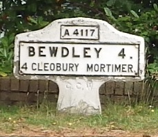
The A4117 is a single-carriageway 'A road' in western England, largely in Shropshire, which passes through part of the Wyre Forest and Clee Hills.

The River Rea is a small river that flows through south east Shropshire, England.
The Bagley Brook is a small watercourse that flows into the River Severn at Shrewsbury in Shropshire, England.
Bishop's Castle was a borough constituency in Shropshire represented in the House of Commons of the Parliament of the United Kingdom.
It was founded in 1584 and was a constituency of the House of Commons of the Parliament of England until 1707, then of the Parliament of Great Britain from 1707 to 1800, and of the Parliament of the United Kingdom from 1801 to 1832. It was represented by two burgesses.
The Bowes River is a river in the Mid West of Western Australia. It was named on 6 April 1839 by the explorer George Grey while on his second exploration expedition along the Western Australian coast. It was named for Mary Bowes, Dowager Countess of Strathmore, the wife of Sir William Hutt. Hutt was a British Liberal politician who was heavily involved in the colonization of New Zealand and South Australia, and the brother of John Hutt, the second governor of Western Australia. Sir William Hutt was a member of the 1836 select committee on Disposal of Lands in the British Colonies. Grey named the nearby Hutt River after Hutt.

The River Worfe is a river in Shropshire, England. The name Worfe is said to derive from the Old English meaning to wander which the river is notable for in its middle section. Mapping indicates that the river begins at Cosford Bridge where the Cosford Brook and Albrighton Brook meet.
Shit Brook is a culverted small stream in Much Wenlock, Shropshire, England.

Ledwyche Brook is a minor river in south Shropshire, England. It is sometimes referred to as the River Ledwyche and spelled variously, including "Ledwich" or "Ledwych". The brook is a tributary of the River Teme.
