Rafha Domestic Airport مطار رفحاء المحلي | |||||||||||
|---|---|---|---|---|---|---|---|---|---|---|---|
| Summary | |||||||||||
| Airport type | Public | ||||||||||
| Owner | General Authority of Civil Aviation | ||||||||||
| Operator | General Authority of Civil Aviation | ||||||||||
| Serves | Rafha Governorate | ||||||||||
| Location | Rafha, Northern Borders Province, Saudi Arabia | ||||||||||
| Opened | 1962 | ||||||||||
| Elevation AMSL | 1,474 ft / 449 m | ||||||||||
| Coordinates | 29°37′34.8″N043°29′26.5″E / 29.626333°N 43.490694°E | ||||||||||
| Map | |||||||||||
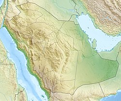 OERF Location of airport in Saudi Arabia | |||||||||||
| Runways | |||||||||||
| |||||||||||
| Sources: [1] | |||||||||||
Rafha Domestic Airport (IATA : RAH [2] , ICAO : OERF) is an airport serving Rafha Governorate in the Northern Borders Province of Saudi Arabia.