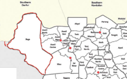
Raga County

Last updated
Raga County
Ragacounty.png
Raga County's Location (Highlighted in Red)
CountryFlag of South Sudan.svg  South Sudan
State Western Bahr el Ghazal
Named for Raga (Town)
Headquarters Raga
Area
  Total61,792.46 km2 (23,858.20 sq mi)
Population
  Total77,203
 (2017 estimate) [1]
Time zone UTC+2 (CAT)

Raga County is a county in Western Bahr el Ghazal, South Sudan. It is the largest county in the nation. In Arabic, Raga County can be known as "Raja". [2] [3]

Contents

Geography

Raga County is located in western part of South Sudan, it is bordering Sudan from north in Radom and Fifi in Hufrt-anahas (international border) in south it has border with Wau state in Khor-Hajar, while in the east the official border is Bora stream. In the west is bordering Republic Centre Africa, The total area is approximately 25.460 Kilometer squares.

Raga is one of the components of Bahr el Ghazal; it was a colonial province that covered the western Nile basin in the south of (Turco-Egyptian Sudan).

Historical administrative points

At the start of 1956, Raga County was a full district, which was when the Republic of Sudan had gained its independence.

Ethnic groups

As of 2013, ethnic groups reported in Raga County were Balanda, Banda, Buja, Feroghe, Kara, Kresh, Shat, and Yulu. [4]

Raga County is a home for Fertit ethnic groups namely:

Each group from the above mentioned have different native tongues, but they live together throughout the history of this area.

Population

Raga County's population is 54,340. It is the least populous county in Western Bahr el Ghazal.

Towns and cities

Related Research Articles

<span class="mw-page-title-main">Lakes State</span> State of South Sudan

Lakes State is a state in South Sudan. It has an area of 43,595.08 km2. Rumbek is the capital of the state. Lakes is in the Bahr el Ghazal region of South Sudan, in addition to Northern Bahr el Ghazal, Western Bahr el Ghazal, and Warrap states. Bahr el Ghazal itself was a former province which was split from the Anglo-Egyptian mudiriyat, or province of Equatoria in 1948. The eastern border was the White Nile with Jonglei State on the opposite bank. To the northeast lied the Unity State. Other borders included Warrap State towards the northwest, Western Equatoria to the south and west, and Central Equatoria to the south.

<span class="mw-page-title-main">Western Bahr el Ghazal</span> State of South Sudan

Western Bahr el Ghazal is a state in South Sudan. It has an area of 93,900 km2 (36,255 sq mi) and is the least populous state in South Sudan, according to the controversial Sudanese census conducted in 2008. It is part of the Bahr el Ghazal region. Its capital is Wau. The state shared international borders with Sudan to the north and the Central African Republic to the west. The portion now occupied by Raga County is the southern part of the historical region known as "Dar Fertit".

<span class="mw-page-title-main">Northern Bahr el Ghazal</span> State of South Sudan

Northern Bahr el Ghazal(Arabic: ولاية شمال بحر الغزال) is a state in South Sudan. It has an area of 30,543 km2 and is part of the Bahr el Ghazal region. It borders East Darfur in Sudan to the north, Western Bahr el Ghazal to the west and south, and Warrap and the disputed region of Abyei to the east. Aweil is the capital of the state.

<span class="mw-page-title-main">Warrap (state)</span> State of South Sudan

Warrap is one of the ten states in South Sudan, located in the Bahr el Ghazal region. The state became part of South Sudan after a successful secession from Sudan on 9 July 2011. Wanhalel, the place where first Jieng Customary Laws were initiated and hometown to prominent politician, Gen. Nhial Deng Nhial is located in Tonj South County of Warrap State The current governor is Kuol Muor Muor who replaced Manhiem Bol Malek in November, 2023.

Dār Fertit is a historical term for the lowlands south of Darfur and east of the highlands in the east of the modern-day Central African Republic that contain tributaries of the White Nile River. This region included parts of southwestern Sudan and northwestern South Sudan. In the present era, Fertit is a catch-all word for non-Dinka, non-Arab, non-Luo, non-Fur groups and tribes in Western Bahr el Ghazal, South Sudan. Even though these groups often speak different languages and have a history of inter-tribal violence, they have become more unified over time, mostly out of opposition to the Dinka people.

The Bongo–Bagirmi or Sara–Bongo–Bagirmi (SBB) languages are the major branch of the Central Sudanic language family with about forty languages. Principal groups include Bagirmi languages such as Naba and the Sara languages. They are spoken across CAR, Chad, South Sudan, Sudan and adjacent countries.

Raga is a town in South Sudan.

The Sere are an ethnic group numbering over 10,000 living in the South Sudanese state of Western Bahr el Ghazal. Their old home was a place called Ndedegumbva or Ndedekumbva, said to be recorded on the maps of old explorers.

<span class="mw-page-title-main">States of South Sudan</span> First-level administrative division of South Sudan

The States of South Sudan were created out of the three historic former provinces of Bahr el Ghazal (northwest), Equatoria (southern), and Greater Upper Nile (northeast). The states are further divided into 79 counties.

<span class="mw-page-title-main">Aweil West County</span> County in Northern Bahr el Ghazal, South Sudan

Aweil West County is an administrative area in Northern Bahr el Ghazal, South Sudan.

Yulu is a Central Sudanic language spoken by the Yulu people of South Sudan and the Central African Republic (CAR). It has an estimated 7,000–13,000 speakers.

The Luwo are a Nilotic ethnic group that live in the western parts of South Sudan. They are part of a larger group of ethno-linguistically related Luo peoples of East Africa. They speak the Luwo language which is a Northern Luo language.

<span class="mw-page-title-main">Lol State</span> State in South Sudan from 2015 to 2020

The Lol State was a state of South Sudan with the capital in Raga, that existed between 2 October 2015 and 22 February 2020. It was located in the Bahr el Ghazal region, which is in the northwest section of the country. Lol state bordered Haut-Mbomou and Haute-Kotto in the Central African Republic to the west, South Darfur and East Darfur in Sudan to the north, the disputed region of Kafia Kingi to the northwest, Aweil East State to the northeast, Aweil State to the east, Gbudwe State to the south, and Wau State to the southeast. The state was created alongside 27 other states after a decree issuing the creation of 28 states took place. It was dissolved at the conclusion of the South Sudanese Civil War.

<span class="mw-page-title-main">Wau State</span> State of South Sudan from 2015 to 2020

Wau State was a state in South Sudan that existed between 2 October 2015 and 22 February 2020. It was located in the Bahr el Ghazal region, and was part of the former state of Western Bahr el Ghazal. Wau State bordered Aweil State, Gbudwe State, Gogrial State, Lol State, and Tonj State.

<span class="mw-page-title-main">Eastern Lakes State</span> State of South Sudan from 2015 to 2020

Eastern Lakes State was a state in South Sudan that existed between 2 October 2015 and 22 February 2020. It was located in the Bahr el Ghazal region and it bordered Southern Liech to the north, Western States to the west, Amadi to the southwest, Terekeka to the southeast, and Jonglei to the east.

<span class="mw-page-title-main">Wau County</span> County of Western Bahr el Ghazal, South Sudan

Wau County is a county in the former state of Western Bahr el Ghazal, South Sudan. Wau County was home to the state's capital, Wau. It is the most populous county in the state with over 232,910 people.

Nagero County is one of the 10 counties of Western Equatoria, a state of South Sudan

The 2014 retreat from Western Bahr el Ghazal, also called the long march north, was an unorganized withdrawal by hundreds of Nuer Sudan People's Liberation Army (SPLA) deserters who sought to flee from Bahr el Ghazal to Sudan during the South Sudanese Civil War. After longstanding tensions between SPLA soldiers belonging to the Dinka and Nuer ethnic groups escalated on 25 April 2014, leading to a massacre of Nuer soldiers at Mapel in Western Bahr el Ghazal, a large number of Nuer SPLA soldiers deserted to escape ethnic prosecution and loyalist SPLA forces. Though some deserters joined SPLM-IO rebels or surrendered to the government, a large number of them marched northward, joined by other SPLA defectors from Northern Bahr el Ghazal. After covering over 400 kilometres (250 mi), this trek eventually arrived in Sudan on 4 August 2014, where they were disarmed.

<span class="mw-page-title-main">Aweil South County</span> County in Northern Barh el Ghazal, South Sudan

Aweil South County, sometimes called Paliet, is an administrative area in Northern Bahr el Ghazal, South Sudan bordering Warrap State to the south. It is located in the south eastern part of NBGs. It is also known by the name Paliet, and one of the counties consisting of three major Dinka tribal groups of Ajak, Boncuai and Kongdeer. It was founded in 2000, headquartered in Boncuai in a place called Mangar-Gier. In 2004, the headquarters were shifted to Malek Alel in Ajak. It is boardered to the north by Aweil East and to the west by Aweil Centre, to the south east by Gogrial State, and to the southwest by Western Barh el Ghazal state respectively.

References

  1. "South Sudan: States and counties". www.citypopulation.de. Retrieved 2024-02-14.
  2. "The 32 Federal States of the Republic of South Sudan". paanluelwel.com. 29 December 2018.
  3. "The 32 States of the Republic of South Sudan". hotinjuba.com. 29 December 2018.
  4. "Village Assessment Survey". International Organization for Migration South Sudan. 2013.