


Rainbow Bay is a bay, beach and locality at the southern end of Coolangatta within the City of Gold Coast, Queensland, Australia. [1] [2] [3]
Rainbow Bay is a bay, beach and locality at the southern end of Coolangatta within the City of Gold Coast, Queensland, Australia. [1] [2] [3]

The bay was originally but unofficially known as Shark/Sharks Bay. In 1925, the Point Danger Progress Association requested the Coolangatta Town Council to change the name to Rainbow Bay, which the council approved at its meeting on 31 May 1925. It is believed that this was the name originally given to the bay by Captain Henry John Rous, who surveyed the Point Danger area in 1828 in HMS Rainbow, a sixth-rate frigate. [1] [4] [5] In August 1925, the council erected directional signs to Rainbow Bay. [6] Rainbow Bay is one of the most popular beaches on the Gold Coast. The beach attracts surfers going to nearby Snapper Rocks and Greenmount Beach because of the spectacular waves, as the beach is included as part of the Superbank. The beach is also popular with families who flock to the sheltered beach because of the safety and lack of rips.
Rainbow Bay is home to Rainbow Bay Surf Lifesaving Club near Snapper Rocks.

Gold Coast is a coastal city and a region in the state of Queensland, Australia, approximately 66 kilometres (41 mi) south-southeast of the centre of the state capital Brisbane. With a population over 600,000, the Gold Coast is the sixth-largest city in Australia, the nation's largest non-capital city, and Queensland's second-largest city after Brisbane. The city's Central Business District is located roughly in the centre of the Gold Coast in the suburb of Southport, with the suburb holding more corporate office space than anywhere else in the city. The urban area of the Gold Coast is concentrated along the coast sprawling almost 60 kilometers, joining up with the Greater Brisbane Metropolitan Area to the north and to the state border with New South Wales to the south.

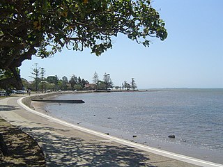
Sandgate is a northern coastal suburb in the City of Brisbane, Queensland, Australia. In the 2016 census, Sandgate had a population of 4,909 people.

Coolangatta is a coastal suburb in the City of Gold Coast, Queensland, Australia. It is the Gold Coast's southernmost suburb and it borders New South Wales. In the 2016 census, Coolangatta had a population of 5,948 people.

Caloundra is a coastal town and the southernmost town in the Sunshine Coast Region in South East Queensland, Australia.

Burleigh Heads is a suburb in the City of Gold Coast, Queensland, Australia. In the 2016 census, Burleigh Heads had a population of 10,077 people.

Wynnum is a coastal suburb in the City of Brisbane, Queensland, Australia. In the 2016 census, Wynnum had a population of 12,915 people. The suburb is a popular destination in Brisbane due to its coastline, jetty and tidal wading pool.
Manly is an eastern bayside suburb in the City of Brisbane, Queensland, Australia. In the 2016 census, Manly had a population of 4,064 people.

Snapper Rocks is a small rocky outcrop on the northern side of Point Danger at the southern end of Rainbow Bay on the Gold Coast, Queensland, Australia. It is a famous surf break and today the start of the large sand bank known to surfers as the Superbank.

Greenmount Beach is a beach located in Coolangatta on Queensland's Gold Coast in Australia.

Shorncliffe is a coastal north-eastern suburb in the City of Brisbane, Queensland, Australia. It is on the shore of Bramble Bay, part of Moreton Bay. In the 2016 census, Shorncliffe had a population of 1,870 people. The suburb attracts visitors to its historic Shorncliffe pier, and Lovers Walk, a walking path along the coastline between Shorncliffe and neighbouring Sandgate.

Tugun is a beach-side coastal suburb in the City of Gold Coast, Queensland, Australia. In the 2016 census, Tugun had a population of 6,588 people.
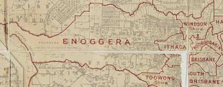
The Town of Ithaca is a former local government area of Queensland, Australia, located in inner western Brisbane.
The Shire of Tingalpa was a local government area in the south-eastern suburbs of Brisbane, Queensland, Australia. The shire, administered from Mount Cotton, covered an area of 120 square miles (311 km2), and existed as a local government entity from 1879 until 1949.

The Shire of Cleveland is a former local government area in the south-east of Queensland, Australia, centred on the town of Cleveland beside Moreton Bay.
The Shire of Waterford is a former local government area in the south-east of Queensland, Australia, centred on the town of Waterford. It existed between 1879 and 1948.

The Shire of Nerang was a local government area in South East Queensland, Australia. The shire existed as a local government entity from 1879 until 1949.
The Shire of Tamborine was a local government area in South East Queensland, Australia, centred on the village of Tamborine. It existed from 1890 to 1949.
The Town of Coolangatta was a local government area in South East Queensland, Australia, centred on Coolangatta. It existed from 1914 to 1949.
The Town of South Coast was a local government area in South East Queensland, Australia.

White Patch is a coastal town and locality of Bribie Island in the Moreton Bay Region, Queensland, Australia. In the 2016 census the locality of White Patch had a population of 142 people.