Related Research Articles

India is the second most populated country in the world with a sixth of the world's population. According to the 2019 revision of the World Population Prospects the population stood at 1,352,642,280. In January 2022, India's population crossed 1.41 billion.

Jammu and Kashmir was a region formerly administered by India as a state from 1954 to 2019, constituting the southern and southeastern portion of the larger Kashmir region, which has been the subject of a dispute between India, Pakistan and China since the mid-20th century. The underlying region of this state were parts of the former princely state of Jammu and Kashmir, whose western districts, now known as Azad Kashmir, and northern territories, now known as Gilgit-Baltistan, are administered by Pakistan. The Aksai Chin region in the east, bordering Tibet, has been under Chinese control since 1962.

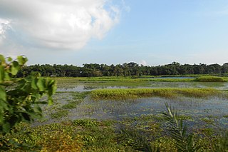
Narsingdi District is a district in central Bangladesh. It is located 50 km north-east of Dhaka, capital city of Bangladesh. It is a part of the Dhaka Division. The district is famous for its textile craft industry. Narsingdi is bordered by Kishoreganj in the north and north-east, Brahmanbaria in the east and south-east, Comilla in the south and south-east, Narayanganj in the south and south-west and Gazipur in the west.

Panna district is a district of the Sagar Division, within the Madhya Pradesh state in central India. The town of Panna is the district headquarters.

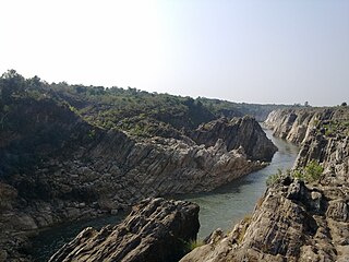
Jabalpur district is a district of Madhya Pradesh state in central India. The city of Jabalpur is the administrative headquarters of the district.
The decennial Census of India has been conducted 15 times, as of 2011. While it has been undertaken every 10 years, beginning in 1872 under British Viceroy Lord Mayo, the first complete census was taken in 1881. Post 1949, it has been conducted by the Registrar General and Census Commissioner of India under the Ministry of Home Affairs, Government of India. All the censuses since 1951 were conducted under the 1948 Census of India Act. The last census was held in 2011, whilst the next was to be held in 2021. But it has been postponed due to the COVID-19 pandemic.
Meghna Heli Bridge, codenamed Operation Cactus Lilly, was an aerial operation of the Indian Air Force during the Indo-Pakistani War of 1971, commencing India's involvement in Bangladesh Liberation War. It took place on 9 December, when the Indian Air Force (IAF) airlifted the IV Corps of the Indian Army and Mukti Bahini fighters from Brahmanbaria to Raipura in Narsingdi over the River Meghna, bypassing the destroyed Meghna Bridge and Pakistani defences in Ashuganj.

Raipura is an Upazila of Narsingdi District in the Narsingdi District belonging to Dhaka Division.

Bhabhanpura is a village on the outskirts of Varanasi city, located 7 km away from the heart of the city. Total population of the village is 2,992.

The 2011 Census of India or the 15th Indian Census was conducted in two phases, house listing and population enumeration. The House listing phase began on 1 April 2010 and involved the collection of information about all buildings. Information for National Population Register (NPR) was also collected in the first phase, which will be used to issue a 12-digit unique identification number to all registered Indian residents by Unique Identification Authority of India. The second population enumeration phase was conducted between 9 and 28 February 2011. Census has been conducted in India since 1872 and 2011 marks the first time biometric information was collected. According to the provisional reports released on 31 March 2011, the Indian population increased to 1.21 billion with a decadal growth of 17.70%. Adult literacy rate increased to 74.04% with a decadal growth of 9.21%. The motto of the census was 'Our Census, Our future'.
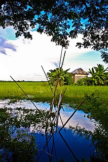
Karai Tala is a village in Chandarkandi Union of Raipura Upazila, Narsingdi District, Bangladesh. According to the 2011 Bangladesh census, it had a population of 2,470. There is a primary school. There are three mosques and one temple. There are two major Eidgah fields for two mosque-based mahallas. The second Eidgah was established in 2011 by praying Eid Ul Fitr, which is situated in the northern area of this village. Mayl Basa is a well known public place where people meet daily.

Raipura is a town which comes under the jurisdiction of Panna district, Madhya Pradesh, India. It is one of the nine tehsils of Panna. It is about 113 km from the district headquarters. It is surrounded by Damoh and Katni districts.
Savli is one of the 182 Legislative Assembly constituencies of Gujarat state in India. It is part of Vadodara district.

National Highway 35 is a National Highway in India. This highway runs entirely in the state Uttar Pradesh.
Narsingdi-5 is a constituency represented in the Jatiya Sangsad of Bangladesh since 1996 by Rajiuddin Ahmed Raju of the Awami League.
Narsingdi-3 is a constituency represented in the Jatiya Sangsad of Bangladesh since 2019 by Zahirul Haque Bhuiyan Mohan of the Awami League.
National Highway 731AG, commonly referred to as NH 731AG is a national highway in India. It is a spur road of National Highway 31. NH-731AG runs in the state of Uttar Pradesh in India.

Jammu and Kashmir is a region administered by India as a union territory and consisting of the southern portion of the larger Kashmir region, which has been the subject of a dispute between India and Pakistan since 1947, and between India and China since 1962. The Line of Control separates Jammu and Kashmir from the Pakistani-administered territories of Azad Kashmir and Gilgit-Baltistan in the west and north. It lies to the north of the Indian states of Himachal Pradesh and Punjab and to the west of Ladakh, which is also subject to the dispute as a part of Kashmir, and administered by India as a union territory.