Nadar is a Tamil caste of India. Nadars are predominant in the districts of Kanyakumari, Thoothukudi, Tirunelveli and Virudhunagar.
Kottar is a locality and a bazaar area of Nagercoil, Tamil Nadu state, in the southernmost part of Peninsular India; though a part of Nagercoil today, it is the original town around which the city of Nagercoil grew. It was an ancient trade centre of both Pandyans and Cheras at various times. The ancient mercantile centre of Kottar was established on the banks of the Pahrali River (Pazhayar).
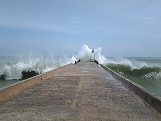
Colachel is a coastal town in the far south of India, located in the Kanyakumari district of Tamil Nadu. It is a natural harbor on the Malabar coast, located 20 km north-west of Kanyakumari, the southernmost tip of India. As of 2011 the municipality had a population of 23,227 and a metropolitan population of 47,007.
Panagudi is a Panchayat town in Tirunelveli district in the Indian State of Tamil Nadu.
Verkilambi is an interior rural area the district of Kanyakumari at the state of Tamil Nadu. This is a grade – I Town panchayat spread in a total area of 15.7 Sq. km and consists of 18 wards, represented by 18 councilors. The Executive officer is the administrative head and the elected Chairman is the political head of this Town Panchayat. This was constituted as Kumarankudy Village, Pathmanapapuram MLA Constituency, Nagercoil MP Constituency. The town is located at a distance of 5 km from Ponmanai Town Panchayat on the East, 5 km from Thiruvattar Town Panchayat on the west. 3 km from Kothanalloor Town Panchayat on the South. This town is located along the Kanyakumari, Thiruvananthapuram, National High way and Colachel – Kulasekaram state high way Road through this TP. This TP Constitutes its village component to talking an area of 3.25 Sq. km up graded as town Panchayat
Mylaudy is one of the town panchayats in Kanniyakumari district in the Indian state of Tamil Nadu. It is a municipality rich in fields, mountains, rivers and natural resources. Before 1950, Mylaudy was part of South Travancore. Now it is in Kanniyakumari district of Tamil Nadu.
Kulasekharam is a town located in the district of Kanyakumari, Tamil Nadu, India. It is one of the most important business centres in the district, after Marthandam.
The caste system among South Asian Christians often reflects stratification by sect, location, and the caste of their predecessors. There exists evidence to show that Christian individuals have mobility within their respective castes. But, in some cases, social inertia caused by their old traditions and biases against other castes remain, causing caste system to persist among South Asian Christians, to some extent. Christian priests, nuns, Dalits and similar groups are found in India, Pakistan, Bangladesh, and Nepal.
South Kallikulam is a panchayat village located in Tirunelveli district in the Indian state of Tamil Nadu. The village is famous for the Our Lady of Snow church located at the heart of the Terku (South) Kallikulam. It is also the base for the Tirunelveli Dakshina Mara Nadar Sangam College
Maravankudieruppu is a Nadar village in the jurisdiction of Nagercoil Corporation, located three kilometres south of Nagercoil Centre, the capital of Kanyakumari district in the state of Tamil Nadu in India. The Village settlement was created by Swamy Adiyaar Thirupaappu and his descendants. The younger brother of Chaeran Chenguttuvan settled his family with five sons in Thirupappur near Kaanthaloor Chaalai and ruling the south Chaera Kingdom from the Panagaattu Palace in Kollam. The kingdom was later named Vaenaadu, and had control from Nanjil Nadu in the South and just below Kodum Kalloor in the North. Thirupaappu or Thiruvadi is the suffix used by the five Royal clans of the Venad Kings. Thirupaappu is the Royal clan of Venad Kingdom, Eraniel Fort represents the history of Thirupaappu royal clan.
Marthal is a village in Tamil Nadu, India. It is 10 km (6.2 mi) from Nagercoil.
Thoothoor is a coastal Village located in the southern district of Tamil Nadu, called Kanyakumari, Taluk Killiyur, bordering the state of Kerala in India.

Mangavilai is a village in Kanyakumari district of Tamil Nadu, India. It is administered under Dharmapuram Panchayat, and is located 9 km away from Nagercoil, the district headquarters of Kanyakumari. The name Mangavilai means 'indestroyable fame'.
Thoothoor - Chinnathurai is a small village in Kanyakumari district of Tamil Nadu, at the southern tip of peninsular India Under the Parent village of Thoothoor. The two major towns nearby are Thiruvananthapuram in Kerala state to the west and Nagercoil to the east. The town is located on the coast and is historically a fishing village, specializing in catching sharks and other large fishes.

Christianity in the state of Tamil Nadu, India is the second largest religion in the state. According to tradition, St. Thomas, one of the twelve apostles, landed in Malabar Coast in AD 52. In the colonial age many Portuguese, Dutch, British and Italian Christians came to Tamil Nadu. Priests accompanied them not only to minister the colonisers but also to spread the Christian faith among the non-Christians in Tamil Nadu. Currently, Christians are a minority community comprising 6% of the total population. Christians are mainly concentrated in the southern districts of Tamil Nadu - Kanyakumari, Thoothukudi and Tirunelveli.
Nadar climbers, or Pannayeri Nadars, are a sub-caste of today's Nadar community. They were regarded as the largest Nadar sub-caste. Their traditional occupation was climbing trees and gathering the sap of coconuts to make palm wine. Due to new economic opportunities, the majority of Nadar climbers have given up their traditional occupation.

This article gives a list of the territories of the dioceses of the Catholic Church in India.
Kalugumalai riots of 1895 was a violent conflict between Nadars who had recently converted to Roman Catholicism and Maravars who were traditional Tamil military caste during 1895 in Kalugumalai in Madras Presidency, British India. A total of ten people were killed and numerous people were injured. The temple chariot of Kalugasalamoorthy Temple was also burnt during the riots. The contention of the communities were over the usage of the Car streets round the temple by Nadars, which were opposed by the other communities quoting private ownership and religious sanctity.
Christianity in Kanyakumari district is its second largest religion. The Catholic Church has about 500,000 followers, while the Protestant groups have about 400,000 members.