
Bavaria, officially the Free State of Bavaria, is a landlocked state of Germany, occupying its southeastern corner. With an area of 70,550.19 square kilometres (27,239.58 sq mi) Bavaria is the largest German state by land area comprising roughly a fifth of the total land area of Germany. With 13 million inhabitants, it is Germany's second-most-populous state after North Rhine-Westphalia. Bavaria's main cities are Munich, Nuremberg, and Augsburg.
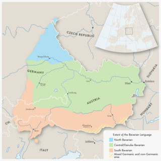
Austro-Bavarian is a major group of Upper German varieties spoken in the southeast of the German language area, much of Bavaria, most of Austria and South Tyrol in Italy, as well as Samnaun in Switzerland. Before 1945, Austro-Bavarian was also prevalent in parts of the southern Czech Republic and western Hungary. Bavarian forms a continuum of more or less mutually intelligible local and regional variants.

The Upper Palatinate is one of the seven administrative districts of Bavaria, Germany, located in the east of Bavaria.
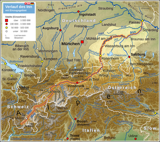
The Inn is a river in Switzerland, Austria and Germany. It is a right tributary of the Danube and is 518 kilometres (322 mi) long. The highest point of its drainage basin is the summit of Piz Bernina, at 4,049 metres (13,284 ft). The Engadine, the valley of the En, is the only Swiss valley whose waters end up in the Black Sea.

The Salzach is a river in Austria and Germany. It is a right tributary of the Inn and is 227 kilometres (141 mi) in length, its flow eventually joins the Danube. Its drainage basin of 6,829 km2 (2,637 sq mi) comprises large parts of the Northern Limestone and Central Eastern Alps. 83% of its drainage basin lies in Austria, the remainder in Germany (Bavaria). Its largest tributaries are Lammer, Berchtesgadener Ache, Saalach, Sur and Götzinger Achen.
The Regen is a river in Bavaria, Germany, and a left tributary of the Danube, at Regensburg, Germany. The source of its main headstream, the Great Regen, is in the Bohemian Forest on the territory of the Czech Republic, near Železná Ruda. The river crosses the border after a few kilometres, at Bayerisch Eisenstein. The name in German evolved from the name in Latin, but its meaning is unknown. The Romans called the river variously Regana, Reganus (masculine), and Reganum (neuter).
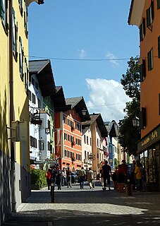
Kitzbühel is a medieval town situated in the Kitzbühel Alps along the river Kitzbüheler Ache in Tyrol, Austria, about 100 km (62 mi) east of the state capital Innsbruck and is the administrative centre of the Kitzbühel district (Bezirk). Kitzbühel is a ski resort of international renown and its ski season lasts from mid October to early May. During winter and early spring it is frequented primarily by upper-class clientele from Austria and from abroad.

Bavarian Alps is a summarizing term of several mountain ranges of the Northern Limestone Alps in the German state of Bavaria.

Bavarians are an ethnographic group of Germans of the Bavaria region, a state within Germany. The group's dialect or speech is known as the Bavarian language, native to Altbayern, roughly the territory of the Electorate of Bavaria in the 17th century.

The Duchy of Bavaria was a frontier region in the southeastern part of the Merovingian kingdom from the sixth through the eighth century. It was settled by Bavarian tribes and ruled by dukes (duces) under Frankish overlordship. A new duchy was created from this area during the decline of the Carolingian Empire in the late ninth century. It became one of the stem duchies of the East Frankish realm which evolved as the Kingdom of Germany and the Holy Roman Empire.

Krimml is a municipality in Zell am See District, in the federal state of Salzburg, Austria, in the Pinzgau region.

The Kingdom of Bavaria was a German state that succeeded the former Electorate of Bavaria in 1805 and continued to exist until 1918. The Bavarian Elector Maximilian IV Joseph of the House of Wittelsbach became the first King of Bavaria in 1805 as Maximilian I Joseph. The crown would go on being held by the Wittelsbachs until the kingdom came to an end in 1918. Most of Bavaria's present-day borders were established after 1814 with the Treaty of Paris, in which Bavaria ceded Tyrol and Vorarlberg to the Austrian Empire while receiving Aschaffenburg and Würzburg. With the unification of Germany into the German Empire in 1871, the kingdom became a federated state of the new empire and was second in size, power, and wealth only to the leading state, the Kingdom of Prussia. In 1918, Bavaria became a republic after the German Revolution, and the kingdom was thus succeeded by the current Free State of Bavaria.
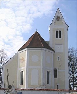
Moosach is a municipality in the Upper Bavarian district of Ebersberg and a member of the Verwaltungsgemeinschaft of Glonn.
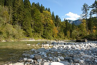
The Brandenberger Ache is a river of Bavaria, Germany, and of the Kufstein District, Tyrol, Austria.

The Großache is a river, 79 kilometres (49 mi) long, in the east of the Austrian state of Tyrol and the Bavarian region of Chiemgau.
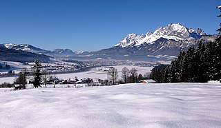
The Leukental is a valley in North Tyrol in the district of Kitzbühel in Austria. The Leukental runs north to south from the Thurn Pass to the Bavarian border, but is not just defined as the main valley but includes several smaller side valleys. The river flowing through the Leukental is known as the Jochberger Ache from its source at the Thurn Pass to Kitzbühel, then as the Kitzbühler Ache from Kitzbühel to St. Johann in Tirol and, from its confluence with the Fieberbrunner Ache near St. Johann in Tirol, as the Großache. After leaving the Leukentals and Tyrol the river is known in Bavaria as the Tiroler Ache until it discharges into the Chiemsee lake, and its valley is known as the Achental. The parishes in the Leukental are: Jochberg, Aurach bei Kitzbühel, Kitzbühel, Oberndorf in Tirol, St. Johann in Tirol, Kirchdorf and Kössen.

The Leutascher Ache is a river of Tyrol, Austria and of Bavaria, Germany, a left tributary of the Isar.

Berchtesgadener Ache is a river of Bavaria, Germany and of Salzburg, Austria. It is formed at the confluence of the Ramsauer Ache and the Königsseer Ache in Berchtesgaden. It flows into the Salzach near Anif.
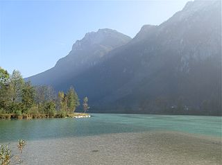
Kieferbach is a river of Tyrol, Austria and Bavaria, Germany. It flows into the Inn near Kiefersfelden.
Stoißer Ache is a river of Bavaria, Germany. It flows into the Saalach near Piding.


