East Java is a province of Indonesia located in the easternmost third of Java island. It has a land border only with the province of Central Java to the west; the Java Sea and the Indian Ocean border its northern and southern coasts, respectively, while the narrow Bali Strait to the east separates Java from Bali by around 2.29 kilometres (1.42 mi). Located in eastern Java, the province also includes the island of Madura, as well as the Kangean islands and other smaller island groups located further east and the Masalembu archipelago to the north. Its capital is Surabaya, the second largest city in Indonesia, a major industrial center and also a major business center. Banyuwangi is the largest regency in East Java and the largest on the island of Java.

The Bromo, or Mount Bromo is an active somma volcano, a Hindu pilgrimage site, and part of the Tengger mountains, in East Java, Indonesia. At 2,329 meters (7,641 ft) it is not the highest peak of the massif, but is the most active and famous. The area is one of the most visited tourist destinations in East Java, and the volcano is included in the Bromo Tengger Semeru National Park. The name Bromo comes from the Javanese pronunciation of Brahma, the Hindu god of creation. At the mouth of the crater, there is an idol of Ganesha, the Hindu god of wisdom which is being worshipped by the Javanese Hindus. Mount Bromo is located in the middle of a plain called "Sea of Sand", a nature reserve that has been protected since 1919.

Mount of the Holy Cross is a high and prominent mountain summit in the northern Sawatch Range of the Rocky Mountains of North America. The 14,011-foot (4270.5 m) fourteener is located in the Holy Cross Wilderness of White River National Forest, 6.6 miles (10.7 km) west-southwest of the Town of Red Cliff in Eagle County, Colorado, United States. The summit of Mount of the Holy Cross is the highest point in Eagle County and the northern Sawatch Range.

Huayna Potosí is a mountain in Bolivia, located near El Alto and about 25 km north of La Paz in the Cordillera Real.

The Semeru, or Mount Semeru is an active volcano located in East Java, Indonesia. It is located in a subduction zone, where the Indo-Australian plate subducts under the Eurasia plate. It is the highest mountain on the island of Java. The name "Semeru" is derived from Meru, the central world mountain in Hinduism, or Sumeru, the abode of gods. This stratovolcano is Mahameru, meaning "The Great Mountain" in Sanskrit. It is one of the more popular hiking destinations in Indonesia.

Bromo Tengger Semeru National Park is a national park located in East Java, Indonesia, to the east of Malang and Lumajang, to the south of Pasuruan and Probolinggo, and to the southeast of Surabaya, the capital of East Java. It is the only conservation area in Indonesia that has a sand sea, the Tengger Sand Sea, across which is the caldera of an ancient volcano (Tengger) from which four new volcanic cones have emerged. This unique feature covers a total area of 5,250 hectares at an altitude of about 2,100 meters (6,900 ft). The massif also contains the highest mountain in Java, Mount Semeru, four lakes and 50 rivers. It is named after the Tengger tribe. The explosion of the volcano that created the caldera, happened ca. 45.000 years ago, in an event similar to the Krakatau eruption.

Illampu is the fourth highest mountain in Bolivia. It is located in the northern section of the Cordillera Real, part of the Andes, east of Lake Titicaca. It lies just north of the slightly higher Janq'u Uma, near the town of Sorata. Laguna Glaciar, located in the Illampu-Janq'u Uma massif, is the 17th highest lake in the world.

Mount Agassiz, at 13,899 feet (4,236 m), is one of the 20 highest peaks of California. It is the northernmost and easiest to climb of the major Palisades summits. This peak is not to be confused with the 9,967-foot (3,038 m) peak by the same name in Desolation Wilderness, also in the California Sierra.

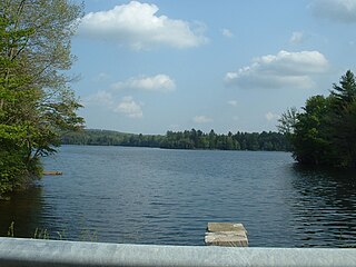
Lake Ashmere, or Ashmere Lake, is a small lake in rural Berkshire County of Massachusetts, located in Peru and Hinsdale, Massachusetts.

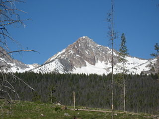
Williams Peak, at 10,636 feet (3,242 m) high is the 6th highest peak in the Sawtooth Mountains of Idaho and is located within the Sawtooth Wilderness portion of the Sawtooth National Recreation Area. The peak lies 0.75 mi (1,210 m) north-northeast of Thompson Peak, the highest peak in the range.

Castle Peak is a mountain in the western United States, the highest peak in the White Cloud Mountains of central Idaho and the Idaho Batholith. Located in Custer County, it is the 25th highest peak in the state, and the ninth most prominent.

The Cemoro Lawang is a very small hamlet north-east of Mount Bromo, Indonesia with an altitude of 2,217 meters above sea level. Administratively, this hamlet is a part of Ngadisari Village, Sukapura, Probolinggo Regency. Cemoro Lawang is one of many routes that point to Tengger Caldera from the Probolinggo route. There is a viewpoint to see Mount Batok and Mount Bromo. It is principally a base for early morning climbs of Mt Bromo, an active volcano that stands in the middle of a Sand Sea. Many visitors approach the mountain from Surabaya which is about three hours drive away; others come from Bali.

Puncak Jaya or Carstensz Pyramid on the island of New Guinea, with an elevation of 4,884 m (16,024 ft), is the highest mountain peak of an island on Earth, and the highest peak in Indonesia. The mountain is located in the Sudirman Range of the highlands of Mimika Regency, Central Papua, Indonesia. Puncak Jaya is ranked 5th in the world by topographic isolation.

Lumajang Regency is a Regency located in the East Java province of Indonesia. It covers an area of 1,790.90 sq. km, and had a population of 1,006,458 at the 2010 Census and 1,119,251 at the 2020 Census. The mid 2022 official estimate was originally stated to be 1,137,230, but was revised down to 1,097,504. The official estimate for mid 2023 was 1,108,487. The regency shares its land borders with Jember Regency, Probolinggo Regency, and Malang Regency, while it borders the Indian Ocean to the south.
Ranu Tompe is a mountain lake located in Bromo Tengger Semeru National Park, East Java, Indonesia. Geographically, Ranu Tompe is isolated and far from human access. Ranu Tompe is only known from satellite images and maps of the area.
Tenggerese is a language used by the Tenggerese people in the mountain region of the Bromo Tengger Semeru National Park which includes Pasuruan Regency, Probolinggo Regency, Malang Regency and Lumajang Regency of East Java, Indonesia.

Hizbul Wathan Football Club is a professional Indonesian football team based in Sidoarjo Regency, East Java. They compete in the third tier of Indonesian league, Liga 3.

Ranu Pani or Ranupani is a volcanic lake in Ranu Pani Village, Senduro District, Lumajang Regency, East Java. Ranu Pani is part of the Bromo Tengger Semeru National Park (TNBTS). Initially, the area of Ranu Pani was around one hectare, but now it is estimated to be only 0.75 hectares due to the rapid sedimentation rate. The population of Ranu Pani is around 2,000 people.

Greater Malang is a region in East Java, Indonesia, encompassing the municipality of Malang and its hinterland. About 3 million people in East Java reside in Greater Malang. The principal city, Malang is well known as the home of notable universities in Indonesia, and the nearby Batu, is well known as a tourism centre in East Java.

An eruption of Mount Semeru, a volcano in East Java province of the Indonesian island of Java, began on 4 December 2021. The eruption began after heavy precipitation caused the collapse of the lava dome at the summit. Pyroclastic flows and lahars damaged at least 5,205 homes and several public buildings. At least 69 people died, 104 more were injured, while more than five remain missing.


