Rasopasno

Last updated
Rasopasno
Village
Rasopasno 20210927 161110 131.jpg
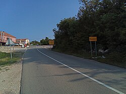
Entrance to Rasopasno
Krk location map.png
Red pog.svg
Rasopasno
Croatia location map.svg
Red pog.svg
Rasopasno
Coordinates: 45°07′22″N14°33′57″E / 45.12287°N 14.56572°E / 45.12287; 14.56572
CountryFlag of Croatia.svg Croatia
County Flag of Primorje-Gorski Kotar County.png Primorje-Gorski Kotar
Municipality Dobrinj
Area
[1]
  Total
2.9 km2 (1.1 sq mi)
Population
 (2021) [2]
  Total
125
  Density43/km2 (110/sq mi)
Time zone UTC+1 (CET)
  Summer (DST) UTC+2 (CEST)

Rasopasno is a village on the Croatian island of Krk. It is part of the municipality of Dobrinj. As of 2021, it had 125 inhabitants. [2] It is located to the east of Malinska and to the north of Gabonjin.

Contents

Governance

Local

It is the seat of its own local committee  [ hr ]. [3]

References

  1. Register of spatial units of the State Geodetic Administration of the Republic of Croatia. Wikidata   Q119585703.
  2. 1 2 "Population by Age and Sex, by Settlements" (xlsx). Census of Population, Households and Dwellings in 2021. Zagreb: Croatian Bureau of Statistics. 2022.
  3. DGU (2025). "Mjesna samouprava". Geoportal.dgu.hr (in Serbo-Croatian).

Commons-logo.svg Media related to Rasopasno at Wikimedia Commons