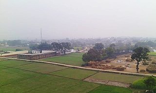
Ugu is a town and a nagar panchayat in Unnao district in the Indian state of Uttar Pradesh. First officially classified as a town for the 1981 census, Ugu is an old town with medieval ruins that hosts a biweekly market and an annual mela. It is located on the main Unnao-Hardoi road, a bit northwest of Safipur. Some of the main items manufactured here are shoes, slippers, furniture, and lipstick cover. As of 2011, the population is 6,318, in 1,044 households.
Zamania is a town in the Indian state of Uttar Pradesh. Its municipal council is subordinate to the Ghazipur District. It is also the administrative head of Zamania tehsil,. It is also a very historical town, it derives its name from Ali Quli Khan Zaman, who was also known as Khan Zaman or Zaman Khan, he was a governor of Jaunpur, and Ghazipur during the time of Akbar.
Bahadurganj is a Municipality located in Zahurabad pargama of the Kasimabad Tehsil in Ghazipur district of Uttar Pradesh, India. Bahadurganj is located one the banks of Tamsa and Bhainsahi rivers.The town also served as the capital of Qasimabad estate.
Yusufpur Mohammadabad is a town and a Township in Ghazipur district in the Indian state of Uttar Pradesh. Haydaria village near Mohammadabad is the starting point of Purvanchal Expressway.

Arangi is a small village of Kamsaar located in Seorai tehsil of Ghazipur district, Uttar Pradesh, India. The village is located in the eastern parts Varanasi division, situated almost at the border of Uttar Pradesh and Bihar, on the left bank of the river Karmnasha. Arangi contains an old monument to Buddha.

Kusi is a village of Kamsaar in Ghazipur district in the Indian state of Uttar Pradesh. The village has also Jama masjid Kusi. The nearest railway station is Dildar nagar. As of 2011 census the main population of the village lived in an area of 62 acres and had 796 households. The family of Kusi were one of the largest zamindars of Ghazipur and their zamindari was known as Kusi Kusi zamindari it became a Zamindari chieftaincy in year 1858 which was ruled by the family of Kusi and Bhaksi, it had 15 villages with an area of 94 km² in year 1901.

Saraila is a village in Kamsaar in the Indian state of Uttar Pradesh.Saraila is a village in Seorai Tehsil in Ghazipur District of Uttar Pradesh, India. It belongs to Varanasi Division. It is located 30 km to the south of District headquarters Ghazipur. 11 km from Seorai. 372 km from State capital Lucknow. The village was also a part of Daudpur Estate which had its capital at Dewaitha during Mughal and early British era.
Sihani is a village in Kamsaar, in Ghazipur district, Uttar Pradesh, India. As of 2011 census the main population of the village lived in 18.7 acres and had 220 households.
Kahraicha is a village of Kamsaar in Ghazipur district of Uttar Pradesh, India. The village Raimala also is a lart of Khraicha making it a village of hectares. As of 2011 census the main population of the village lived in an area 12 acres and 165 house holds.
Sendura is a village in Kamsaar of Ghazipur District in Uttar Pradesh, India. It was a part of Mircha village and its Gram Panchayat but was later, made a separate village. Most of the people living in Sendura are Hindus but it also has large communities of Muslim Pathans from Mircha village and nearby villages. As of the 2011 census the main village of 27 acres and had 371 house holds.
Asaichandpur, also known as Ashiya Chand Pur and previously known as Alipur, is a village in Zamania Tehsil in the Ghazipur District of Uttar Pradesh, India. The land where Asaichandpur is located was owned by the descendants of Mahmud Khan of Rasulpur, the eldest son of Daud Khan. Asaichandpurn was once a small settlement of farmers. The village's population increased to more than 1,200 by 2011.
Sarhuja is a village of Dildarnagar Kamsar located in Zamania tehsil of Ghazipur district, Uttar Pradesh, India. The village have large population of Kamsaar Pathaans.
Dewaitha is a village of Dildarnagar Kamsar,in Zamania tehsil of Ghazipur, India, located on the banks of the Karmanasa River and it's tributary Eknaiya, The village had a population of 7,104 as of the 2011 Census of India. The place is inhabited by Kamsar Pathans..

Rasulpur is a village in Purwa block of Unnao district, Uttar Pradesh, India. As of 2011, its population is 617, in 118 households, and it has no schools and no healthcare facilities.

Rasulpur is a village in Nawabganj block of Unnao district, Uttar Pradesh, India. As of 2011, its population is 1,326, in 221 households, and it has no schools or healthcare facilities.

Rasulpur is a village in Bachhrawan block of Rae Bareli district, Uttar Pradesh, India. As of 2011, its population is 1,907, in 364 households. It is located 3 km from Bachhrawan, the block headquarters, and the main staple foods are wheat and rice.

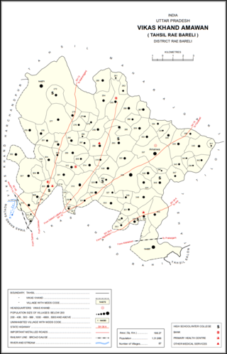
Rasulpur is a village in Amawan block of Rae Bareli district, Uttar Pradesh, India. It is located 29 km from Raebareli, the district headquarters. As of 2011, its population is 514, in 94 households.

Rasulpur is a village in Sareni block of Rae Bareli district, Uttar Pradesh, India. It is located 19 km from Lalganj, the tehsil headquarters. As of 2011, Rasulpur has a population of 1,343 people, in 257 households. It has two primary schools and no healthcare facilities. Rasulpur serves as the headquarters of a nyaya panchayat which also includes 12 other villages.

Newada is a village in Unchahar block of Raebareli district, Uttar Pradesh, India. It is located 29 km from Raebareli, the district headquarters. As of 2011, it has a population of 814 people, in 137 households.

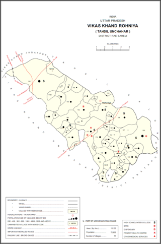
Rasulpur is a village in Rohaniya block of Rae Bareli district, Uttar Pradesh, India. One of the largest villages in the historical pargana of Salon, it is located 48 km from Raebareli, the district headquarters. As of 2011, it has a population of 7,671 people, in 1,379 households. It has one primary school and no healthcare facilities.


