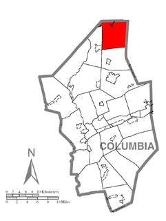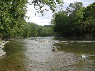
Fishing Creek is a 29.98-mile (48.25 km) long tributary of the Susquehanna River in Columbia County, Pennsylvania, in the United States. It joins the Susquehanna River near the census-designated place of Rupert and the town of Bloomsburg. The watershed has an area of 385 square miles (1,000 km2).
Huntington Creek is a tributary of Fishing Creek in Luzerne and Columbia counties, Pennsylvania, in the United States. It is approximately 29.5 miles (47.5 km) long.

Little Fishing Creek is a tributary of Fishing Creek in Sullivan County, Lycoming County, and Columbia County, in Pennsylvania, in the United States. It is approximately 23.5 miles (37.8 km) long and flows through eight townships. The watershed of the creek has an area of 68.1 square miles (176 km2). The creek has six named tributaries, of which the largest are Spruce Run and West Branch Run.

West Creek is a tributary of Fishing Creek, in Columbia County and Sullivan County, in Pennsylvania, in the United States. It is 9.1 miles (14.6 km) long and flows through Davidson Township in Sullivan County and Jackson Township, Sugarloaf Township, Benton Township, and Benton in Columbia County. The water temperature of the creek ranges from 0 °C (32 °F) to 25 °C (77 °F). The discharge ranges from 0 to nearly 10 cubic meters per second. Rock formations in the watershed include the Trimmers Rock Formation, the Catskill Formation, and the Huntley Mountain Formation. The creek's watershed has an area of 16.6 square miles, most of which is agricultural, forested, or urban land. A small number of dams, mills, and schoolhouses were built on West Creek in the 19th and early 20th century. West Creek has the highest level of biodiversity of any stream in the upper Fishing Creek watershed.

Green Creek is a tributary of Fishing Creek in Columbia County, Pennsylvania, in the United States. It is approximately 12.7 miles (20.4 km) long and flows through Jackson Township, Greenwood Township, and Orange Township. The watershed of the creek has an area of 36.8 square miles (95 km2). Green Creek has three named tributaries: Little Green Creek, Rickard Hollow, and Mud Run. The creek is not designated as an impaired waterbody and is a relatively large stream, contributing a significant amount of water to Fishing Creek. A valley known as the Greenwood Valley is located in the vicinity of Green Creek. The creek's own valley was likely affected by glaciation during the Ice Age.
West Branch Fishing Creek is one of the northernmost major tributaries of Fishing Creek in Sullivan County, Pennsylvania and Columbia County, Pennsylvania, in the United States. It is 11.1 miles (17.9 km) long and flows through Davidson Township, Sullivan County and Sugarloaf Township, Columbia County. The creek's watershed has an area of 33.5 square miles, nearly all of which is forested land.

West Branch Run is a tributary of Little Fishing Creek in Lycoming County and Columbia County, in Pennsylvania, in the United States. It is approximately 7.3 miles (11.7 km) long and flows through Jordan Township, Lycoming County and. The area of the stream's watershed is 10.20 square miles (26.4 km2). The stream's only named tributary is Shingle Run. West Branch Run flows through a valley known as California Hollow, which is listed as a "locally significant site" on the Columbia County Natural Areas Inventory. The Shoemaker Covered Bridge also crosses the stream, as does at least one other bridge in Lycoming County.

Rickard Hollow is a tributary of Green Creek in Columbia County, Pennsylvania, in the United States. It is approximately 2.6 miles (4.2 km) long and flows through Fishing Creek Township. The watershed of the stream has an area of 2.22 square miles (5.7 km2). The stream itself has two unnamed tributaries and sewage is discharged into it. The exact origin of its name is not known.

Little Green Creek is a tributary of Green Creek in Columbia County, Pennsylvania, in the United States. It is approximately 4.7 miles (7.6 km) long and flows through Greenwood Township. The watershed of the creek has an area of 5.01 square miles (13.0 km2). At least two bridges have been built over the creek and at least one ridge and one hillside is in its vicinity.
East Branch Raven Creek is a tributary of Raven Creek in Columbia County and Luzerne County, in Pennsylvania, in the United States. It is approximately 3.7 miles (6.0 km) and flows through Benton Township in Columbia County and Fairmount Township in Luzerne County. The watershed of the creek has an area of 3.86 square miles (10.0 km2). It has one named tributary, which is known as Stine Hollow. East Branch Raven Creek is a freestone stream that is inhabited by brook trout. At least one bridge crosses it. The creek is named after Raven Creek.

Culley Run is a tributary of Fishing Creek in Columbia County, Pennsylvania, in the United States. It is approximately 1.4 miles (2.3 km) long and flows through Benton Township. The stream's watershed has an area of 1.45 square miles (3.8 km2). Shale, sandstone, alluvium, and glacial till can be found in the watershed. At least one bridge crosses the stream. The stream is most likely named after Alexander Colley, Sr.

Marsh Run is a tributary of Coles Creek in Luzerne County and Columbia County, in Pennsylvania, in the United States. It is approximately one mile (1.6 km) long and flows through Fairmount Township in Luzerne County and Sugarloaf Township in Columbia County. The stream's watershed has an area of 0.44 square miles (1.1 km2). Wild trout reproduce throughout the stream. It is named after marshes, which can be found in the vicinity of the stream. Alluvium and Wisconsinian Outwash area also present, as is bedrock consisting of sandstone and shale. The stream has one unnamed tributary.
Rough Run is a tributary of West Branch Fishing Creek in Sullivan County and Columbia County, in Pennsylvania, in the United States. It is approximately 1.3 miles (2.1 km) long and flows through Davidson Township in Sullivan County and Sugarloaf Township in Columbia County. The watershed of the stream has an area of 0.72 square miles (1.9 km2). Glacial till and bedrock consisting of shale and sandstone can be found along the stream. It is named for the speed of its waters and the foliage along the sides of the stream.

Elk Run is tributary of West Branch Fishing Creek in Sullivan County and Columbia County, in Pennsylvania, in the United States. It is approximately 4.8 miles (7.7 km) long and flows through Davidson Township in Sullivan County and Sugarloaf Township in Columbia County. The watershed of the stream has an area of 7.49 square miles (19.4 km2). The stream has three named tributaries: Gallows Run, Hog Run, and Long Run. Elk Run is considered to be an Exceptional Value stream and a Migratory Fishery. The forests surrounding it are deemed by the Sullivan County Natural Areas Inventory to be a "locally significant" area. The stream is named for an elk that was killed in it in the 1840s.
Spencer Run is a tributary of West Creek in Columbia County, Pennsylvania, in the United States. It is approximately 2.1 miles (3.4 km) long and flows through Jackson Township and Benton Township. The watershed of the stream has an area of 2.07 square miles (5.4 km2). Wild trout naturally reproduce in the stream. The surficial geology in the area mainly features Illinoian Till, Illinoian Leg, alluvium, colluvium, and bedrock.
York Hollow is a tributary of West Creek in Columbia County, Pennsylvania, in the United States. It is approximately 2.5 miles (4.0 km) long and flows through Jackson Township and Sugarloaf Township. The watershed of the stream has an area of 1.47 square miles (3.8 km2). Wild trout naturally reproduce in the stream. The surficial geology in the area mainly consists of Illinoian Till, Illinoian Lag, alluvium, colluvium, and bedrock.

Davis Hollow is a tributary of Fishing Creek in Columbia County, Pennsylvania, in the United States. It is approximately 1.4 miles (2.3 km) long and flows through Benton Township. The watershed of the stream has an area of 0.80 square miles (2.1 km2). The surficial geology in its vicinity mainly consists of alluvium, alluvial terrace, Wisconsinan Till, Wisconsinan Lag, Illinoian Flow-Till, and Illinoian Lag.
Karnes Hollow is a tributary of Fishing Creek in Columbia County, Pennsylvania, in the United States. It is approximately 1.1 miles (1.8 km) long and flows through Fishing Creek Township and Benton Township. The watershed of the stream has an area of 0.90 square miles (2.3 km2). The stream is named after a valley whose etymology is unknown. The surficial geology in its vicinity consists of colluvium, alluvium, Illinoian Till, Illinoian Lag, and bedrock consisting of sandstone and shale.

Bee Sellers Hollow is a tributary of Fishing Creek in Columbia County, Pennsylvania, in the United States. It is approximately 1.8 miles (2.9 km) long and flows through Stillwater. The watershed of Bee Sellers Hollow has an area of 1.58 square miles (4.1 km2). The stream is not considered to be impaired. The surficial geology in the area consists mainly of bedrock, along with alluvium, colluvium, Illinoian Till, and Illinoain Lag.
Bell Creek is a tributary of Pine Creek in Luzerne County, Pennsylvania, in the United States. It is approximately 4.0 miles (6.4 km) long and flows through Fairmount Township and Huntington Township. The creek is a freestone stream in the ridge and valley physiographic province. Wild trout naturally reproduce within the creek. It has one named tributary, which is known as Ashs West Branch, and two unnamed tributaries.