Culley Run is a tributary of Fishing Creek in Columbia County, Pennsylvania, in the United States. It is approximately 1.4 miles (2.3 km) long and flows through Benton Township. The stream's watershed has an area of 1.45 square miles (3.8 km2). Shale, sandstone, alluvium, and glacial till can be found in the watershed. At least one bridge crosses the stream. The stream is most likely named after Alexander Colley, Sr.
Rough Run is a tributary of West Branch Fishing Creek in Sullivan County and Columbia County, in Pennsylvania, in the United States. It is approximately 1.3 miles (2.1 km) long and flows through Davidson Township in Sullivan County and Sugarloaf Township in Columbia County. The watershed of the stream has an area of 0.72 square miles (1.9 km2). Glacial till and bedrock consisting of shale and sandstone can be found along the stream. It is named for the speed of its waters and the foliage along the sides of the stream.
Laurel Run is a tributary of West Branch Fishing Creek in Sullivan County, Pennsylvania, in the United States. It is approximately 1.2 miles (1.9 km) long and flows through Davidson Township. The stream is in the United States Geological Survey quadrangle of Elk Grove. Wisconsinan Flow-Till, Boulder Colluvium, Wisconsinan Till Moraine, alluvium, and alluvial fan occur in the vicinity of the stream, as does bedrock consisting of sandstone and shale. The southern terminus of the late Wisconsinan glaciation is also in the area. A wood plank bridge on stone masonry abutment walls crosses the stream.

Turtle Creek is a tributary of the Susquehanna River in Luzerne County, Pennsylvania, in the United States. It is approximately 2.5 miles (4.0 km) long and flows through Conyngham Township. The watershed of the creek has an area of 1.59 square miles (4.1 km2). Wisconsinan Bouldery Till, Wisconsinan Ice-Contact Stratified Drift, Wisconsinan Outwash, alluvium, alluvial terrace, fill, and coal dumps all occur in the vicinity of the creek. The creek has been the subject of a flood protection project. Its watershed is designated as a Coldwater Fishery and a Migratory Fishery.
Spencer Run is a tributary of West Creek in Columbia County, Pennsylvania, in the United States. It is approximately 2.1 miles (3.4 km) long and flows through Jackson Township and Benton Township. The watershed of the stream has an area of 2.07 square miles (5.4 km2). Wild trout naturally reproduce in the stream. The surficial geology in the area mainly features Illinoian Till, Illinoian Leg, alluvium, colluvium, and bedrock.
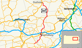
York Hollow is a tributary of West Creek in Columbia County, Pennsylvania, in the United States. It is approximately 2.5 miles (4.0 km) long and flows through Jackson Township and Sugarloaf Township. The watershed of the stream has an area of 1.47 square miles (3.8 km2). Wild trout naturally reproduce in the stream. The surficial geology in the area mainly consists of Illinoian Till, Illinoian Lag, alluvium, colluvium, and bedrock.
Slip Run is a tributary of West Branch Fishing Creek in Sullivan County, Pennsylvania, in the United States. It is approximately 1.1 miles (1.8 km) long and flows through Davidson Township. The watershed of the stream has an area of 0.53 square miles (1.4 km2). Wild trout naturally reproduce within the stream. Surficial geology in the area mainly consists of alluvium, Boulder Colluvium, Wisconsinan Till Moraine, Wisconsinan Till, and bedrock consisting of sandstone and shale.

Kingsbury Brook is a tributary of Huntington Creek in Luzerne County, Pennsylvania, in the United States. It is approximately 1.5 miles (2.4 km) long and flows through Huntington Township. The watershed of the stream has an area of 1.27 square miles (3.3 km2) and it has two unnamed tributaries. Wild trout naturally reproduce in the stream. The surficial geology in its vicinity mainly consists of alluvium, Wisconsinan Till, Wisconsinan Ice-Contact Stratified Drift, bedrock, and wetlands.
Karnes Hollow is a tributary of Fishing Creek in Columbia County, Pennsylvania, in the United States. It is approximately 1.1 miles (1.8 km) long and flows through Fishing Creek Township and Benton Township. The watershed of the stream has an area of 0.90 square miles (2.3 km2). The stream is named after a valley whose etymology is unknown. The surficial geology in its vicinity consists of colluvium, alluvium, Illinoian Till, Illinoian Lag, and bedrock consisting of sandstone and shale.

Bee Sellers Hollow is a tributary of Fishing Creek in Columbia County, Pennsylvania, in the United States. It is approximately 1.8 miles (2.9 km) long and flows through Stillwater. The watershed of Bee Sellers Hollow has an area of 1.58 square miles (4.1 km2). The stream is not considered to be impaired. The surficial geology in the area consists mainly of bedrock, along with alluvium, colluvium, Illinoian Till, and Illinoain Lag.

Black Ash Creek is a tributary of Rogers Creek in Luzerne County, Pennsylvania, in the United States. It is approximately 1.9 miles (3.1 km) and flows through Ross Township. The watershed of the creek has an area of 1.46 square miles (3.8 km2). The creek is not impaired. The surficial geology in its vicinity consists of alluvium, Wisconsinan Outwash, Wisconsinan Till, and bedrock.
Thurston Hollow is a tributary of Moneypenny Creek in Wyoming County, Pennsylvania, in the United States. It is approximately 1.4 miles (2.3 km) long and flows through Eaton Township. The stream's watershed has an area of 1.62 square miles (4.2 km2). Thurston Hollow is not designated as an impaired waterbody. The surficial geology in its vicinity consists of Wisconsinan Till, alluvium, and bedrock. It has one unnamed tributary.
Broad Hollow Run is a tributary of Bowman Creek in Wyoming County, Pennsylvania, in the United States. It is approximately 1.0 mile (1.6 km) long and flows through Noxen Township. The watershed of the stream has an area of 1.04 square miles (2.7 km2). The surficial geology in the vicinity of the stream consists of alluvium, alluvial fan, and Wisconsinan Till. Its watershed is designated as a High-Quality Coldwater Fishery and a Migratory Fishery.

Field Brook is a tributary of Tunkhannock Creek in Susquehanna County and Wyoming County, in Pennsylvania, in the United States. It is approximately 5.8 miles (9.3 km) long and flows through Lathrop Township in Susquehanna County and Nicholson Township in Wyoming County. The watershed of the stream has an area of 7.41 square miles (19.2 km2). The stream has one named tributary, which is known as East Branch Field Brook. The surficial geology in the vicinity of Field Brook consists of alluvium, Wisconsinan Till, alluvial terrace, alluvial fan, bedrock, wetlands, and a lake. The watershed of the stream is designated as a Coldwater Fishery and a Migratory Fishery.
East Branch Martins Creek is a tributary of Martins Creek in Susquehanna County, Pennsylvania, in the United States. It is approximately 5.1 miles (8.2 km) long and flows through New Milford Township and Harford Township. The watershed of the creek has an area of 7.36 square miles (19.1 km2). The creek is not designated as an impaired waterbody. The surficial geology in its vicinity consists of Wisconsinan Till, alluvium, alluvial fan, Wisconsinan Ice-Contact Stratified Drift, and bedrock.
Brish Run is a tributary of Pine Creek in Luzerne County, Pennsylvania, in the United States. It is approximately 1.5 miles (2.4 km) long and flows through Fairmount Township. The watershed of the stream has an area of 0.66 square miles (1.7 km2). The stream has one unnamed tributary. The surficial geology in the vicinity of Brish Run mostly consists of Wisconsinan Till, but there is alluvium near its mouth and also bedrock in the area. The stream is being considered for wild trout designation.
Buck Run is a tributary of Little Muncy Creek in Lycoming County, Pennsylvania, in the United States. It is approximately 1.3 miles (2.1 km) long and flows through Jordan Township. The watershed of the stream has an area of 0.81 square miles (2.1 km2). The surficial geology near the stream mostly consists of Illinoian Till and Illinoian Lag, with some alluvium and bedrock. The stream is a Coldwater Fishery and is being considered for wild trout designation. It has one unnamed tributary.

West Branch Little Muncy Creek is a tributary of Little Muncy Creek in Sullivan County and Lycoming County, in Pennsylvania, in the United States. It is approximately 3.5 miles (5.6 km) long and flows through Davidson Township in Sullivan County and Franklin Township and Jordan Township in Lycoming County. The watershed of the creek has an area of 4.33 square miles (11.2 km2). The creek has one named tributary, which is known as West Creek. The surficial geology in the vicinity of West Branch Little Muncy Creek includes alluvium, bedrock, fill, Wisconsinan and Reworked Illinoian Till, Wisconsinan Till, Wisconsinan Flow-Till, Wisconsinan Till Moraine, and Boulder Colluvium. The creek designated as a Coldwater Fishery and a Migratory Fishery and is being considered for addition to the wild trout waters list of the Pennsylvania Fish and Boat Commission.
Big Run is a tributary of Little Muncy Creek in Lycoming County, Pennsylvania, in the United States. It is approximately 4.3 miles (6.9 km) long and flows through Penn Township and Franklin Township. The watershed of the stream has an area of 3.99 square miles (10.3 km2). The stream is impaired by a high total concentration of nitrogen. A number of bridges have been constructed across it.
Tinker Hollow is a tributary of Little Creek in Susquehanna County, Pennsylvania, in the United States. It is approximately 1.0 mile (1.6 km) long and flows through Clifford Township. The watershed of the stream has an area of 1.33 square miles (3.4 km2). The stream is not designated as an impaired waterbody and has wild trout naturally reproducing within it. The surficial geology in its vicinity includes Wisconsinan Till, alluvium, Wisconsinan Ice-Contact Stratified Drift, bedrock, and a lake.