Raymond | |
|---|---|
| Coordinates: 33°52′41″N98°23′47″W / 33.8781540°N 98.3964396°W | |
| Country | United States |
| State | Texas |
| County | Clay |
| Elevation | 1,070 ft (326 m) |
| USGS Feature ID | 1380417 |
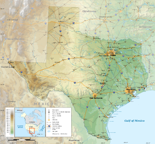
Raymond is a ghost town in Clay County, Texas, United States. [1]
Raymond | |
|---|---|
| Coordinates: 33°52′41″N98°23′47″W / 33.8781540°N 98.3964396°W | |
| Country | United States |
| State | Texas |
| County | Clay |
| Elevation | 1,070 ft (326 m) |
| USGS Feature ID | 1380417 |
Raymond is a ghost town in Clay County, Texas, United States. [1]
Raymond is situated on U.S. Route 287 and the Fort Worth and Denver Railway. It was established in the late nineteenth century. [2] [3]

Clay County is a county located in the far western part of U.S. state North Carolina. As of the 2020 census, the county population was 11,089. The county seat is Hayesville.

Clay County is a county located in the U.S. state of Texas. As of the 2020 census, its population was 10,218. The county seat is Henrietta. The county was founded in 1857 and later organized in 1860. It is named in honor of Henry Clay, famous American statesman, Kentucky Senator and United States Secretary of State.

Wilbarger County is a county located in the North Texas region of the U.S. state of Texas. As of the 2020 census, the population was 12,887. The county seat is Vernon. The county was created in 1858 and later organized in 1881. Wilbarger is named for Josiah Pugh Wilbarger and Mathias Wilbarger, two early settlers.

Real County is a county located on the Edwards Plateau in the U.S. state of Texas. As of the 2020 census, its population was 2,758. The county seat is Leakey. The county is named for Julius Real (1860–1944), a former member of the Texas State Senate. The Alto Frio Baptist Encampment is located in an isolated area of Real County southeast of Leakey.

Limestone County is a county in the U.S. state of Texas. As of the 2020 census, its population was 22,146. Its county seat is Groesbeck. The county was created in 1846.

DeWitt County is a county located in the U.S. state of Texas. As of the 2020 census, its population was 19,824. The county seat is Cuero. The county was founded in 1846 and is named for Green DeWitt, who founded an early colony in Texas.

Crosby County is a county located in the U.S. state of Texas. As of the 2020 census, its population was 5,133. The county seat is Crosbyton. The county was founded in 1876 and later organized in 1886. Both the county and its seat are named for Stephen Crosby, a land commissioner in Texas.

Bandera County is a county in the U.S. state of Texas. It is located in the Hill Country and its county seat is Bandera. Bandera county was settled by German and Polish emigrants in the mid 1800s. Many residents are descendants of those same emigrants.

Henrietta is a city in and the county seat of Clay County, Texas, United States. It is part of the Wichita Falls metropolitan statistical area. The population was 3,111 at the 2020 census, a decline of 30 from the 2010 tabulation of 3,141.

Raymondville is a city in and the county seat of Willacy County, Texas, United States. The population was 10,236 at the 2020 census. It may be included as part of the Brownsville–Harlingen–Raymondville and the Matamoros–Brownsville metropolitan areas.

The Colorado River is an approximately 862-mile-long (1,387 km) river in the U.S. state of Texas. It is the 11th longest river in the United States and the longest river with both its source and its mouth within Texas.

The geography of Texas is diverse and large. Occupying about 7% of the total water and land area of the U.S., it is the second largest state after Alaska, and is the southernmost part of the Great Plains, which end in the south against the folded Sierra Madre Oriental of Mexico. Texas is in the South Central United States of America, and is considered to form part of the U.S. South and also part of the U.S. Southwest.

The Austin–Round Rock–San Marcos metropolitan statistical area, or Greater Austin, is a five-county metropolitan area in the U.S. state of Texas, as defined by the Office of Management and Budget. The metropolitan area is situated in Central Texas on the western edge of the American South and on the eastern edge of the American Southwest, and borders Greater San Antonio to the south.

The Wichita River, part of the Red River watershed, lies in north-central Texas. Rising in northeastern Knox County at the confluence of its North and South Forks, the river flows 90 miles (140 km) northeast across Baylor, Archer, Wichita, and Clay counties before joining the Red River just west of Byers Bend in northern Clay County.

Mission Nuestra Señora del Espíritu Santo de Zúñiga, also known as Aranama Mission or Mission La Bahía, was a Roman Catholic mission established by Spain in 1722 in the Viceroyalty of New Spain—to convert native Karankawa Indians to Christianity. Together with its nearby military fortress, Presidio La Bahía, the mission upheld Spanish territorial claims in the New World against encroachment from France. The third and final location near Goliad, Texas is maintained now as part of Goliad State Park and Historic Site

Native American tribes in Texas are the Native American tribes who are currently based in Texas and the Indigenous peoples of the Americas who historically lived in Texas.
Deer Creek is a ghost town in Clay County, Texas, United States.
Prospect is a ghost town in Clay County, Texas, United States.