Rebbena

Last updated

Rebbena is a village of Kumaram Bheem Asifabad district in the state of Telangana in India. Lord Venkateshwara temple in Gangapur is a nearby temple to visit. This temple was built in the 16th century by a VishwaBrahamin Mummadi pothaji and large number of devotees come from Maharashtra, Chhattisgarh and Andhra to Gangapur jatra held on magha pournami every year. [1] —Transport—Asifabad Road station is situated in Rebbena town. Which is main connectivity to district headquarter.

Kumaram Bheem Asifabad district District of Telangana in India

Komaram Bheem Asifabad is a district in the Indian state of Telangana. It was a part of the Adilabad district prior to the re-organisation of districts in the state.

Telangana State in southern India

Telangana is a state in India situated on the centre-south stretch of the Indian peninsula on the high Deccan Plateau. It is the twelfth largest state and the twelfth-most populated state in India with a geographical area of 112,077 km2 (43,273 sq mi) and 35,193,978 residents as per 2011 census. On 2 June 2014, the area was separated from the northwestern part of Andhra Pradesh as the newly formed 29th state with Hyderabad as its historic permanent capital. Its other major cities include Warangal, Nizamabad, Khammam and Karimnagar. Telangana is bordered by the states of Maharashtra to the north, Chhattisgarh to the east, Karnataka to the west, and Andhra Pradesh to the east and south. The terrain of Telangana region consists mostly of hills, mountain ranges, and thick dense forests distribution of 27,292 sq. km. As of 2019, the state of Telangana is divided into 33 districts.

India Country in South Asia

India, also known as the Republic of India, is a country in South Asia. It is the seventh largest country by area and with more than 1.3 billion people, it is the second most populous country as well as the most populous democracy in the world. Bounded by the Indian Ocean on the south, the Arabian Sea on the southwest, and the Bay of Bengal on the southeast, it shares land borders with Pakistan to the west; China, Nepal, and Bhutan to the northeast; and Bangladesh and Myanmar to the east. In the Indian Ocean, India is in the vicinity of Sri Lanka and the Maldives, while its Andaman and Nicobar Islands share a maritime border with Thailand and Indonesia.
Related Research Articles

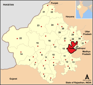
Sawai Madhopur district District of Rajasthan in India

Sawai Madhopur District is a district of Rajasthan state in North-Western India. Sawai Madhopur is the chief town and district headquarters.Sawai Madhopur District comes under Bharatpur Divisional Commissionerate.

Pur Chaman District District in Farah Province, Afghanistan

Pur Chaman is a mountainous district in Farah Province, Afghanistan. Its population is approximately 95% Tajik with a Pashtun minority. The main village, also called Purchaman 33°8′29″N63°51′41″E is situated at 1431 m altitude.

Gangapur, Maharashtra city in Maharashtra, India

'Gangapur is a city and a municipal council in Aurangabad district in the state of Maharashtra, India.

Gangapur, Bhilwara Municipality in Rajasthan, India

Gangapur is a city and a municipality in Bhilwara district in the state of Rajasthan, India.

Gangapur, Sawai Madhopur Subdistrict in Rajasthan, India

Gangapur City is a Nagar Parishad in Sawai Madhopur District in the state of Rajasthan, India. In terms of population, it is the 18th largest city in Rajasthan.

Kaghaznagar Town in Telangana, India

Kagaznagar is a town, and a municipality in Komaram Bheem Asifabad district in the state of Telangana in India.

Chathannoor Town in Kerala, India

Chathannoor is a town in Kerala situated at the Kollam District on the banks of Ithikkara River. It is about 16 km from Kollam City. Chathannoor is around 55 km north of the state capital Thiruvananthapuram.

Wankidi is a mandal in Kumaram Bheem Asifabad district of the Indian state of Andhra Pradesh.

Sirpur (Telangana) Village in Telangana, India

Sirpur is a village in east part of Kumaram Bheem Asifabad district of the Indian state of Telangana. Kumaram Bheem Asifabad district is a part of the Adilabad district prior to the re-organisation of districts in the state. It is located in Sirpur (T) mandal of Kaghaznagar revenue division. Sirpur-T is a village and a Mandal in Kumaram Bheem Asifabad district, It is notable for Sirpur paper mills.bIt rests on the banks of river Wardha. Sirpur is around 160 km west of Adilabad city. Sirpur, formerly known as Suryapuram, was ruled by the Gond King, Ballala. Sipurt Fort is a major tourist attraction, The Gond King, Bhim Ballal Sing built Sirpur Fort in 9th century AD. The modern town grew around the fort. Distinction of the town is the Sirpur Paper Mills, one of the biggest paper mills in India and hence the name Sirpur Kagaznagar. Hyderabad Airport is the nearest airport. Sirpur Town Railway Station and Sirpur Kagaznagar Railway Station serve the town.

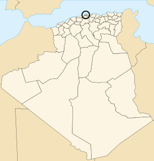
Zéralda District District in Algiers, Algeria

Zéralda is a district in Algiers Province, Algeria. It was named after its capital, Zéralda. It is the least populous district in the province, and used to be part of Tipaza Province.

Voskehat, Armavir Place in Armavir, Armenia

Voskehat is a town in the Armavir Province of Armenia.

Wólka Włościańska Village in Łódź, Poland

Wólka Włościańska is a village in the administrative district of Gmina Wielgomłyny, within Radomsko County, Łódź Voivodeship, in central Poland. It lies approximately 6 kilometres (4 mi) north-west of Wielgomłyny, 19 km (12 mi) east of Radomsko, and 84 km (52 mi) south of the regional capital Łódź.

Lubcz, Opole Voivodeship Village in Opole, Poland

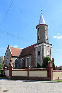
Lubcz is a village in the administrative district of Gmina Grodków, within Brzeg County, Opole Voivodeship, in south-western Poland. It lies approximately 5 kilometres (3 mi) north of Grodków, 19 km (12 mi) south-west of Brzeg, and 42 km (26 mi) west of the regional capital Opole.

Privina Glava Village in Vojvodina, Serbia

Privina Glava is a village in Serbia. It is situated in the Šid municipality, in the Srem District, Vojvodina province. The village has a Serb ethnic majority and its population numbering 221 people.

Faljenovići Village in Republika Srpska, Bosnia and Herzegovina

Faljenovići is a village in the municipality of Višegrad, Bosnia and Herzegovina.

Veshnyaki District District in Moscow, Russia

Veshnyaki District is an administrative district (raion) of Eastern Administrative Okrug, and one of the 125 raions of Moscow, Russia. The area of the district is 10.72 square kilometers (4.14 sq mi).

Savatula Gundam Waterfalls is one of many waterfalls located in Kumaram Bheem Asifabad district in the Indian state of Telangana. It is located 30 kilometres (19 mi) from Asifabad and 350 kilometres (220 mi) from Hyderabad.

Asifabad, India Census town in Telangana, India

Asifabad is a census town and the district headquarters of Asifabad district in the Indian state of Telangana. It is located in Asifabad mandal of Asifabad revenue division.

Wankidi Village in Telangana, India

Wankidi is a mandal headquarter in Asifabad district of the Indian state of Telangana. It is located in of Asifabad revenue division.

References

  1. "Mandals in Adilabad district". Panchayat Informatics Division. Archived from the original on 2007-03-27. Retrieved 2007-02-28.

Coordinates: 19°08′29″N79°43′05″E / 19.14139°N 79.71806°E / 19.14139; 79.71806

Geographic coordinate system Coordinate system

A geographic coordinate system is a coordinate system that enables every location on Earth to be specified by a set of numbers, letters or symbols. The coordinates are often chosen such that one of the numbers represents a vertical position and two or three of the numbers represent a horizontal position; alternatively, a geographic position may be expressed in a combined three-dimensional Cartesian vector. A common choice of coordinates is latitude, longitude and elevation. To specify a location on a plane requires a map projection.