
Alsace is a cultural region and a territorial collectivity in Eastern France, on the west bank of the upper Rhine next to Germany and Switzerland. In 2017, it had a population of 1,889,589. Alsatian culture is characterized by a blend of Germanic and French influences.

Haut-Rhin is a department in the Grand Est region of France, named after the river Rhine. Its name means Upper Rhine. Haut-Rhin is the smaller and less populated of the two departments of the former administrative Alsace region, the other being the Bas-Rhin. Especially after the 1871 cession of the southern territory known since 1922 as Territoire de Belfort, although it is still densely populated compared to the rest of metropolitan France.

Belfort is a commune in the Bourgogne-Franche-Comté region in Northeastern France, situated between Lyon and Strasbourg, approximately 25 km (16 mi) from the France–Switzerland border. It is the prefecture of the Territoire de Belfort department.

Mulhouse is a subprefecture of the Haut-Rhin department in the Grand Est region of Eastern France, close to the Swiss and German borders. With a population of 108,942 in 2018 in the commune and 246,692 inhabitants in 2017 in the urban unit, it is the largest city in Haut-Rhin and second largest in Alsace after Strasbourg. Mulhouse is the principal commune of the 39 communes which make up the communauté d'agglomération of Mulhouse Alsace Agglomération.

Sélestat is a commune in the Grand Est region of France. An administrative division (sous-préfecture) of the Bas-Rhin department, the town lies on the Ill river, 17 kilometres (11 mi) from the Rhine and the German border. Sélestat is located between the largest communes of Alsace, Strasbourg and Mulhouse.

Alsace Grand Cru is an Appellation d'Origine Contrôlée for wines made in specific parcels of the Alsace wine region of France. The Grand Cru AOC was recognized in 1975 by the INAO with subsequent expansion in 1983, 1992 and 2007.
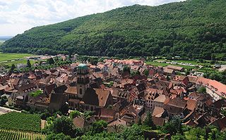
Kaysersberg is a historical town in Alsace in northeastern France. The name is German for Emperor's Mountain. The high fortress that dominates the town serves as a reminder of both its strategic importance and its warlike past.

Eguisheim is a commune in the Haut-Rhin department in Grand Est in north-eastern France. It lies in the historical region of Alsace. The village lies on the edge of the Ballons des Vosges Nature Park, where the Vosges meet the Upper Rhine Plain.
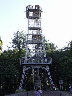
The Tour du Belvédère is a 20 metre tall observation tower located on Belvédère mountain near Mulhouse in Alsace, France. Tour du Belvédère was designed by Ph. Ant. Fauler, built in 1898 and is reminiscent of the Eiffel Tower.

Thann is a commune in the northeastern French department of Haut-Rhin, in Grand Est. It is the sous-préfecture of the arrondissement of Thann-Guebwiller and part of the canton of Cernay. Its inhabitants are known as Thannois.

The arrondissement of Mulhouse is an arrondissement of France in the Haut-Rhin department in the Grand Est region. It has 79 communes. Its population is 351,012 (2016), and its area is 707.1 km2 (273.0 sq mi).
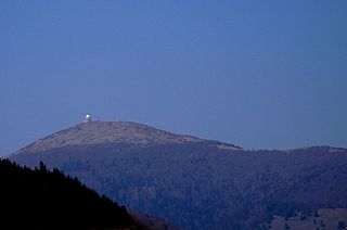
The Grand Ballon or Great Belchen is the highest mountain of the Vosges, located 25 kilometres (16 mi) northwest of Mulhouse, France. It is also the highest point of the Grand-Est French region.
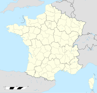
Rouffach is a commune in the Haut-Rhin department in Grand Est in north-eastern France.

The Taennchel is one of the summits of the Vosges Mountains, rising to 988 metres (3,241 ft). The Taennchel rises at the East of France, in the département of Haut-Rhin, halfway between Strasbourg to the North and Mulhouse to the South, around 60 km (40 mi) from both cities.

Rixheim is a commune in the Haut-Rhin department in Grand Est in northeastern France. It forms part of the Mulhouse Alsace Agglomération, the inter-communal local government body for the Mulhouse conurbation.
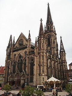
Jean-Baptiste Schacre (1808–1876) was a French architect.

The Temple Saint-Étienne is a Calvinist church located in the city of Mulhouse, Alsace, France. Its congregation forms part of the Protestant Reformed Church of Alsace and Lorraine. Because of its central location on the main square of Mulhouse, the Place de la Réunion, and its 97 metre high bell tower, it is sometimes referred to as the "Cathedral of Mulhouse". The church was designed by the city architect Jean-Baptiste Schacre, who also designed the large Catholic St. Stephen's Church.

The Schönberg is located on the southern outskirts of Freiburg im Breisgau and at 644.9 meters above sea level the Hausberg of the municipality of Ebringen.
The Mulhouse Alsace Agglomération is the Communauté d'agglomération, a type of local government structure, covering the metropolitan area of the city of Mulhouse in the department of Haut-Rhin and the region of Grand Est, northeastern France. Its population was 277,999 in 2014, of which 112,812 in Mulhouse proper. The current president of the agglomeration community is Fabian Jordan, elected January 2017.


