Rebbo

Last updated • 4 min readFrom Wikipedia, The Free Encyclopedia
Rebbo
Walled structures at Rebbo Ruin.jpg
Dry stone wall at Rebbo
Israel location map with stripes.svg
Archaeological site icon (red).svg
Location within Israel
Coordinates 31°39′51.23″N34°58′47.833″E / 31.6642306°N 34.97995361°E / 31.6642306; 34.97995361
Grid position1481/1183 PAL

Rebbo [1] or Horvat Rebbo (Hebrew : חורבת רִבּוֹא, lit. "Rebbo ruins"), alternative spellings: Robbo, Ribbo; in Arabic Khurbet Rubba (lit. "Rubba ruins"), is an ancient site in Israel, mentioned by Eusebius in his Onomasticon as possibly referring to a site by a similar name in the Book of Joshua. [2] [3] The site, which is now a ruin, sits on a hill 414 metres (1,358 ft) above sea level, in the Shephelah region, and is now part of the Adullam-France Park, maintained by the Jewish National Fund (KKL). It lies about 1.5 km. to the west of Aderet as the crow flies, and about 11 kilometres (7 mi) northeast of Beit Guvrin National Park.

Contents

The site is quite extensive and contains tunnels believed to have been in use during the Bar Kokhba revolt. Tombs from the Second Temple period, agricultural features and cisterns (now covered with iron gratings) can be seen on the site. Many lentisk mastic trees (Pistacia lentiscus) and buckthorns (Rhamnus lycioides) cover the site.

In ancient sources

Eusebius (4th century) writes in his Onomasticon that in his day it was a village, called in Koinē Greek : Ῥοββώ and situated "in the territory of Eleutheropolis (Beit Gubrin) to the east." [4] [Note 1] Some have cast doubt on V.L. Trumper's view in Historical Sites in Central Palestine (1918) that Rebbo, located 3 km. west of Adullam, is to be recognised in the name rbt mentioned in the list of Thutmose III, and which place is also called rbt / rbd in the el-Amarna tablets. According to these sources, the king of Jerusalem complained before Pharaoh that certain people from Gezer, from Gath and Keilah had conspired together and forcibly taken away lands belonging to Rubutu. [7] [8] [9] The site's current name was fixed by the Government Naming Committee in Israel. [10]

Archaeological surveys

Victor Guérin (1863)

French explorer, Victor Guérin, visited the site, which he called Khirbet Rebba, in 1863, and wrote of his impressions of the site: "The ruins are fairly large and cover the summit and slopes of a hill. Many cisterns and vaults embedded in the rock attest to its great antiquity. The houses, of very small dimensions, were for the most part constructed of medium-sized and generally well squared stones; they litter the ground everywhere with their debris. An edifice, also overthrown from top to bottom, seems to have been a church, which proves that, in the Christian era, this town was still inhabited. Six sections of mutilated columns lie in this place. I also notice, on a beautiful rectangular block, two carved Greek crosses." [11]

Conder and Kitchener (1878)

The ruin appears in Conder and Kitchener's 1878 Survey of Palestine map under the name Khurbet Rubba. They noted under "Rabba" that it was a "city of Judah, mentioned with Kirjath Jearim (Joshua XV. 60). In the Onomasticon a place called Rebbo is mentioned as east of Eleutheropolis, which might be the same. A good-sized ruin named Rubba is found in the low hills south of the valley of Elah, north-east of Bayt Jibrin, which would be in a suitable position for the early Christian site." [12] They found there "Caves, cisterns, and heaps of stones, ruined walls, bases of pillars and shafts much worn, two lintel stones with crosses, both measuring about 7 feet by 2½ feet." [13]

Aapeli Saarisalo (pre-1931)

The site was surveyed by Finnish archaeologist Aapeli Saarisalo  [ fi ] in the early 20th century, who concluded that the village was inhabited as late as the Byzantine and Early Arab periods. [14]

Notes

  1. There were two towns bearing nearly the same name; one in the territorial domain of Issachar, called Hebrew: הרבית, romanized: Rabbith, [5] and the other in the territorial domain of Judah, called Hebrew: הרבה, romanized: Rabbah. [6] Both towns are described in Jerome's version of the Onomasticon under the same entry (s.v. Rabboth), although the entry is marked by a lacuna in the Greek Vatican manuscript.

Related Research Articles

<span class="mw-page-title-main">Adullam</span> Archaeological site in Israel

Adullam is an ancient ruin once numbered among the thirty-six cities of Canaan whose kings "Joshua and the children of Israel smote" (Joshua 12:7–24). After that, it fell as an inheritance to the tribe of Judah and was included in the northern division of the Shephelah "lowland" cities of the land of Judah (Joshua 15:35).

<span class="mw-page-title-main">Suruh</span> Village in Acre, Mandatory Palestine

Suruh, was a Palestinian Arab hamlet, located 28.5 kilometers (17.7 mi) northeast of Acre. It became depopulated in the 1948 Arab-Israeli war.

<span class="mw-page-title-main">Azekah</span> Ruins of an ancient town in Israel

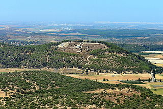
Azekah was an ancient town in the Shephela guarding the upper reaches of the Valley of Elah, about 26 km (16 mi) northwest of Hebron.

<span class="mw-page-title-main">Zanoah</span> Place in Jerusalem, Israel

Zanoah is a moshav in central Israel. Located adjacent to Beit Shemesh, it falls under the jurisdiction of Mateh Yehuda Regional Council. In 2022 it had a population of 530.

<span class="mw-page-title-main">Maresha</span> Archaeological site in southern Israel

Maresha was an Iron Age city mentioned in the Hebrew Bible, whose remains have been excavated at Tell Sandahanna, an archaeological mound or 'tell' renamed after its identification to Tel Maresha. The ancient Judahite city became Idumaean after the fall of Judah in 586 BCE, and after Alexander's conquest of the region in 332 BCE became Hellenised under the name Marisa or Marissa. The tell is situated in Israel's Shephelah region, i.e. in the foothills of the Judaean Mountains, about 1.5 kilometres (0.93 mi) south of Beit Gubrin.

<span class="mw-page-title-main">Keilah</span> Biblical settlement

Keilah was a city in the lowlands of the Kingdom of Judah. It is now a ruin known as Khirbet Qeyla near the modern village of Qila, Hebron, 7 miles (11 km) east of Bayt Jibrin and about 3 kilometres (1.9 mi) west of Kharas.

al-Karmil Village in West Bank, Palestine

al-Karmil is a Palestinian village located twelve kilometers south of Hebron. The village is in the Hebron Governorate Southern West Bank, within Area A under total Palestinian control. According to the Palestinian Central Bureau of Statistics, the village had a population of 9,740 in 2017. The primary health care facilities for the village are designated by the Ministry of Health as level 2.

<span class="mw-page-title-main">Sallama</span> Place in Northern, Israel

Sallama is a Bedouin village in northern Israel. Located in the Galilee near the Tzalmon Stream, it falls under the jurisdiction of Misgav Regional Council. In 2022 its population was 3,552. The village was recognized by the state in 1976.

<span class="mw-page-title-main">Khirbat Umm Burj</span> Place in Hebron, Mandatory Palestine

Khirbat Umm Burj was a Palestinian Arab village in the Hebron Subdistrict, sometimes designated in modern maps as Burgin. Its ruins are today located within the borders of Israel. It occupied an extensive site, stretching about 30 dunams on the crest of a hill, rising some 430 metres (1,410 ft) above sea level, and commanding a good prospect of the surrounding region. It was depopulated during the 1948 Arab–Israeli War on October 28, 1948, during the third stage of Operation Yo'av under the command of Yigal Allon. The site is located 17 km northwest of Hebron.

<span class="mw-page-title-main">Dayr Aban</span> Place in Jerusalem, Mandatory Palestine

Dayr Aban was a Palestinian Arab village in the Jerusalem Subdistrict, located on the lower slope of a high ridge that formed the western slope of a mountain, to the east of Beit Shemesh. It was formerly bordered by olive trees to the north, east, and west. The valley, Wadi en-Najil, ran north and south on the west-side of the village.

<span class="mw-page-title-main">Khirbat al-Tannur</span> Place in Jerusalem, Mandatory Palestine

Khirbat al-Tannur, also known as Allar al-Sifla, was a Palestinian Arab hamlet in the Jerusalem Subdistrict, near Allar. It was depopulated during the 1948 Arab–Israeli War on October 21, 1948, under Operation Ha-Har. It was located 18.5 km west of Jerusalem.

<span class="mw-page-title-main">Khirbat Zakariyya</span> Village in Ramle, Mandatory Palestine

Khirbat Zakariyya was a Palestinian village in the Ramle Subdistrict of Mandatory Palestine. It was depopulated during the 1948 Arab–Israeli War on July 12, 1948, under the second stage of Operation Dani. It was located 9 km (5.6 mi) east of Ramla.

Moresheth-Gath, also Moreshet-Gat, was a town of the tribe of Judah in ancient Israel mentioned in the Bible. It was located in the Shephelah region between Lachish and Achzib.

<span class="mw-page-title-main">Horvat 'Ethri</span> Archeological site in Israel

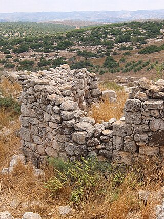
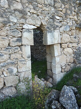
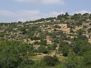
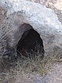
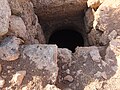
Horvat 'Ethri, or Umm Suweid, is an archaeological site situated in the Judean Lowlands in modern-day Israel. Excavations at the site have uncovered the remains of a partially restored Jewish village from the Second Temple period. The site features an ancient synagogue, wine presses, cisterns, mikvehs, stone ossuaries, and an underground hideout system.

<span class="mw-page-title-main">Adullam-France Park</span> National Park and Nature Reserve in Israel

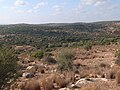
Adullam-France Park, also known as Parc de France-Adoulam, is a sprawling park of 50,000 dunams (ca. 12,350 acres) in the Central District of Israel, located south of Beit Shemesh. The park, established in 2008 for public recreation, features two major hiking and biking trails, and four major archaeological sites from the Second Temple period. It stretches between Naḥal Ha-Elah, its northernmost boundary, to Naḥal Guvrin, its southernmost boundary. To its west lies the Beit Guvrin-Beit Shemesh highway, and to its east the "green line" – now territories under joint Israeli-Palestinian Arab control – which marks its limit.

Khirbet Ibziq, Kh. Ibzîk, the ruin of Ibzîk, p.n. is the name of a village with two ruins in the West Bank, separated by one kilometer and referred to in the Manasseh Hill Country Survey as Khirbet Ibziq and Khirbet Ibziq. They are about twenty kilometers northeast of Nablus. The "Lower" site is to the northeast of the "Upper" site.

<span class="mw-page-title-main">Chezib of Judah</span> Canaanite - Israelite town of Judah

Chezib, also known as Achzib of Judah, is a biblical place-name associated with the birth of Judah's son, Shelah (Genesis 38:5), corresponding to the Achzib of the Book of Joshua (15:44), a town located in the low-lying hills of the plain of Judah, known as the Shefela. In I Chronicles 4:22, the town is rendered as Chozeba. The place is now a ruin.

<span class="mw-page-title-main">Khirbet et-Tibbaneh</span> An ancient ruin in the Judean mountains

Khirbet et-Tibbâneh (Arabic: خربة التبانة), sometimes referred to by historical geographers as the Timnah of Judah, is a small ruin situated on a high ridge in the Judaean mountains, in the Sansan Nature Reserve, 622 metres (2,041 ft) above sea level, about 3 kilometers east of Aviezer and ca. 7 kilometers southeast of Bayt Nattif.

<span class="mw-page-title-main">Lavnin</span>

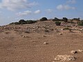
Lavnin (Hebrew: חורבת לבנין)(Arabic: خربة تل البيضة), is a late Bronze Age archaeological site situated in Israel's Adullam region, rising some 389 metres (1,276 ft) above sea level. The site lies 8 kilometres (5.0 mi) northwest of Beit Gubrin, and about 1 kilometer west-north-west of Khirbat Umm Burj, directly south of Nehusha.

<span class="mw-page-title-main">Horvat Maon (Hebron Hills)</span> Ancient biblical settlement near Hebron

Horvat Maon/Horvat Ma'on, Arabic: Khirbet Ma'in or Tell Máîn, is an archaeological site in the Hebron Hills, West Bank, rising 863 metres (2,831 ft) above sea level, where the remains of the ancient town of Ma'on have been excavated. The town, now a ruin, is mentioned in the Book of Joshua and the Books of Samuel. It still had a Jewish population during the Roman and Byzantine periods, and a synagogue was discovered there. The site was ultimately abandoned around the time of the Muslim conquest.

References

  1. Palmer, 1881, p. 401
  2. Notley & Safrai, 2005, pp. 136–137 (§ 778)
  3. Press, 1955, p. 853 (Hebrew), who writes under the entry רבוא, "Eusebius identifies it with Kh. Ribba north of Umm Burj in the vicinity of Hebron."
  4. Notley & Safrai, 2005, pp. 136–137 (§ 778)
  5. Joshua 19:20
  6. Joshua 15:60
  7. Press, 1955, p. 851 (note 2). Cf. Trumper, V.L. (1918), p. 14
  8. Cf. Rainey (1983), p. 4, for another identification of the site mentioned in the Amarna letters as Rubbuti.
  9. The Amarna Letters. Translated by William L. Moran. Baltimore, London: The Johns Hopkins University Press. 1992. p. 334. ISBN   0-8018-4251-4.
  10. "State of Israel Records", Collection of Publications, no. 277 (PDF) (in Hebrew), Jerusalem: Government of Israel, 1953, p. 638, (p. 630) The names of the settlements were mostly determined at different times by the 'Names Committee for the Settlements,' under the auspices of the Jewish National Fund (est. 1925), while [other] names were added by the Government Naming Committee.
  11. Guérin, 1869, pp. 336–337
  12. Conder & Kitchener, 1883, SWP III, p. 314
  13. Conder & Kitchener, 1883, SWP III, p. 360
  14. Saarisolo, A. (1931), p. 16

Bibliography