
Troon is a town in South Ayrshire, situated on the west coast of Ayrshire in Scotland, about eight miles north of Ayr and three miles northwest of Glasgow Prestwick Airport.

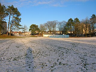
Crosbie Castle and the Fullarton estate lie near Troon in South Ayrshire. The site was the home of the Fullarton family for several centuries. The lands were part of the feudal Barony of Corsbie Fullartoune (sic). The Crosbie Castle ruins were eventually used as an ice house after the new Fullarton House mansion was built. The mansion house was later demolished and the area set aside as a public park and golf course.
New Farm Loch was situated in a low-lying area between the farms of Holehouse and New Farm in the Parish of Kilmarnock, New Farm Loch, East Ayrshire in Scotland. The loch was mostly artificial, having been developed as a curling pond, fed by the Hillhouse Burn through seasonal flooding. The loch was drained via Holehouse Farm Burn.
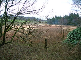
Littlestane Loch, was situated in the mid-Ayrshire clayland near Stanecastle, Irvine, North Ayrshire, Scotland. It is nowadays (2011) only visible as an area of permanent water in the Scottish Wildlife Trust Sourlie Nature Reserve. The loch was natural, sitting in a hollow created by glaciation. The loch waters outflow was via the Red Burn that flows into the River Garnock. The site of Littlestane Loch site is partly built over and much of the site is now public open space lying within the Parish of Girdle Toll.

Fail Loch or Faile Loch was situated in a low-lying area near the old monastery of Fail in the Parish of Tarbolton, South Ayrshire, Scotland. The old Lochlea Loch lies nearby and its waters still feed into Fail Loch via the Mill Burn.
Hessilhead Loch or Hazelhead Loch was situated in a low-lying area near the old Castle of Hessilhead in the Parish of Beith, North Ayrshire, Scotland. The old loch, used in the defence of the castle, was probably infilled when the castle ruins were landscaped in the 19th century.

Knockewart Loch or Loch Jargon was situated in a hollow lying area beneath Knockewart Hill in the Parish of Ardrossan, North Ayrshire, Scotland. The old loch has become largely drained and overgrown since the late 19th century.

The Blae Loch is a small freshwater loch situated in a hollow in a low-lying area beneath Blaelochhead Hill in the Parish of Beith, North Ayrshire, Scotland.

The Galrigs Loch was a substantial freshwater loch situated in low lying area between Newfield and Dundonald in South Ayrshire, Scotland. It was drained in the early 18th century.

Clevens Loch was a substantial freshwater loch situated in a low-lying area below Clevance Farm and Langholm Farm in Dundonald parish, South Ayrshire, Scotland.

The Loch of Trabboch or Dalrympleston Loch (NS440211) was situated in a low-lying area below the old Castle of Trabboch, once held by the Boyd family in the Parish of Stair, East Ayrshire, Scotland.

Lochend Loch, which once had nearly three acres in surface area is now only a small freshwater loch remnant. It lies in the South Ayrshire Council Area, lying on the hill above Joppa, between Gallowhill and Lochend Farm.

Lowes Loch, The Lochs or Loch of Hill is now a small natural freshwater loch in the North Ayrshire Council Areas, Scotland, lying in a glacial kettle hole, once of greater extent, lying below Brownmuir and Lochland Hills on the Threepwood Road, near Beith, in the Parish of Beith. The loch may once have had a small island within it.

Carcluie Loch is a small freshwater loch in the South Ayrshire Council Area, lying in a glacial Kettle Hole, Parish of Dalrymple, Scotland.
South Palmerston Loch or Flush, previously known as Loch of the Hill, lying to the east of the 500 ft Back hill Mount. It was one of several small lochs within the Parish of Ochiltree. The loch, lying in a glacial kettle hole, drained into the Lugar Water via the Burnock Water.

Whitehill Loch, previously known as Hillhouse Loch was a freshwater loch in the East Ayrshire Council Area, now drained, near Galston, in the Parish of Riccarton, lying in a glacial Kettle Hole.
Carse Loch is situated in a low-lying area, surrounded by woodland, close to the A76 at Friar's Carse, in Dumfries and Galloway, Parish of Dunscore. It was once used as a monastic fish pond and the friars are said to have hidden their treasures on the crannog in times of danger. The loch is located about 7 miles from Dumfries and 2 miles from Auldgirth.
Loans is a village in South Ayrshire near Troon, Scotland. It is located in Dundonald parish on the A759 at the junction with the B746 and a minor road to Dundonald.

Loch Libo is a freshwater loch in East Renfrewshire, Parish of Neilston, Scotland. The Lugton Water has its source from the southern end of loch, running 14 miles before reaching its confluence with the River Garnock near Kilwinning. The village of Uplawmoor and the hamlet of Shillford lie nearby. 3 mi (4.8 km) away to the northeast is the town of Neilston.
What now survives of the old Caprington Loch (NS402352) is situated near Earlston, Riccarton, East Ayrshire, Scotland. The loch was a natural feature, sitting in a hollow on the old Caprington Castle estate. The loch waters drain via the Todrigs Burn that flows into the River Irvine to the east of Gatehead village. It was partly drained, probably sometime after the 1820s, as were so many other lochs, as part of 18th and 19th centuries extensive agricultural improvements and the only area of open water that remains does so as it was once used as a curling pond for the Caprington Castle Estate owners and their employees or tenants.


