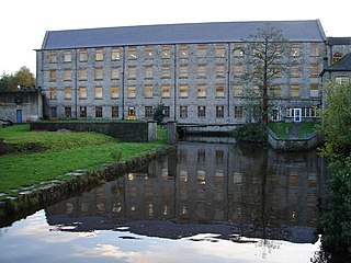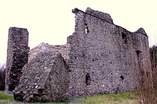
Celbridge is a town and townland on the River Liffey in County Kildare, Ireland. It is 23 km (14 mi) west of Dublin. Both a local centre and a commuter town within the Greater Dublin Area, it is located at the intersection of the R403 and R405 regional roads. As of the 2016 census, Celbridge was the third largest town in County Kildare by population, with over 20,000 residents.

Carton House is a country house and surrounding demesne that was the ancestral seat of the Earls of Kildare and Dukes of Leinster for over 700 years. Located 23 km west of Dublin, in Maynooth, County Kildare, the Carton Demesne is a 1,100 acres estate, from an original estate of 70,000 acres. For two hundred years, the Carton Demesne was the finest example in Ireland of a Georgian-created parkland landscape. In the 2000s, much of the demesne was redeveloped into two golf courses and the house into a hotel complex.

Thomas FitzGerald, 10th Earl of Kildare, also known as Silken Thomas, was a leading figure in 16th-century Irish history.

Maynooth Castle is a ruined 12th century castle in Maynooth, County Kildare, Ireland which stands at the entrance to the South Campus of Maynooth University. Constructed in the early 13th century, it became the primary residence of the Kildare Fitzmaurice and Fitzgerald family.

Kilkea Castle is located 5 km (3.1 mi) northwest of Castledermot, County Kildare, Ireland near the village of Kilkea on the R418 regional road from Athy to Tullow. It was a medieval stronghold, for over 700 years, of the Fitzgeralds, earls of Kildare.

Adare Manor is a manor house located on the banks of the River Maigue in the village of Adare, County Limerick, Ireland, the former seat of the Earl of Dunraven and Mount-Earl. The present house was built in the early 19th century, though retaining some of the walls of the 17th-century structure. It is now the Adare Manor Hotel & Golf Resort, a luxury hotel, and contains the Michelin-starred Oak Room restaurant.

Calverstown is a small village in County Kildare, Ireland. It lies 6 km (3.7 mi) south of the town of Kilcullen and about 16 km (9.9 mi) from each of the towns of Athy, Kildare, Naas and Newbridge. It is an old settlement located close to the archaeological sites of Dún Ailinne and Old Kilcullen. The village has a stream running through it with another to the south. As of the 2016 census, Calverstown had a population of 699.
Kilteel is the name of a village, townland and civil parish located in the barony of South Salt, County Kildare, Ireland. The townland of Kilteel Upper contains the remains of a church with a decorated Romanesque chancel arch, the ruins of a 13th-century preceptory of the Knights Hospitaller and a well-preserved 15th-century tower house. The historic settlement is located on the southwest corner of the English Pale and served an important function as a border fortress during the medieval period.
Mulhussey is a townland and village in County Meath, Ireland. It has a school, a castle with accompanying cemetery, a nearby church at the edge of the Kilcloon parish in Kilcock, and a religious antiquity, St Bridgid's Well, located in Calgath near Mulhussey.
Sir John Alan was a leading English-born statesman in sixteenth century Ireland. He was a member of the Irish House of Commons, and held the offices of Master of the Rolls in Ireland, Chancellor of the Exchequer of Ireland and Lord Chancellor of Ireland. Though he was childless himself, one of his brothers, William, founded a prominent landowning dynasty in County Kildare. The family's holdings included lands at Celbridge, St. Wolstan's and Kilteel, County Kildare, as well as substantial lands in County Dublin. They also acquired a baronetcy.

There are numerous Bermingham monuments in Ireland particularly in counties Kildare, Offaly, Galway, and Dublin. Most are now in a poor state. Athenry Castle in Galway has been restored, using building techniques similar to those employed when it was originally built.
Donadea is a civil parish in the barony of Ikeathy and Oughterany in the north of County Kildare, Ireland. There are seven townlands in the parish. There are no large centres of population in the parish. Donadea is noted for its public forest park which is one of the most popular outdoor venues in county Kildare. The nearest villages are Staplestown and Prosperous. The parish name is derived from a church, traditionally said to have been founded by Saint Patrick. A small 17th-century church of the Church of Ireland, St Peter's, still exists within the Donadea demesne.
Rathmore, a village, civil parish and District electoral division in County Kildare, Ireland, is located at the western edge of the Wicklow Mountains in the barony of Naas North. The original settlement was at the southwest corner of the English Pale, serving an important function as a border fortress during the medieval period.

Jigginstown Castle is a ruined 17th-century house and National Monument near Naas, County Kildare, Ireland. It was constructed in the late 1630s when Ireland was under the reign of Charles I (1625–1649). At the time it was one of the largest buildings in Ireland, and the first to be constructed of red brick: the plans provided for pavement and columns of Kilkenny marble.

Kindlestown Castle is a castle and a National Monument in Delgany, Ireland.

Athlumney Castle is a tower house and fortified house and a National Monument in Navan, Ireland.

Ballymalis Castle is a tower house and National Monument located in County Kerry, Ireland.

Donaghcumper Church is a ruined medieval church in Celbridge, Ireland. On the Record of Monuments and Places it bears the code KD011-013.

White's Castle is a 16th-century tower house in Athy, County Kildare, Ireland. Built on the site of an earlier 15th-century castle, White's Castle was built to guard the main river crossing in Athy and was extended over successive centuries.

Killashee Round Tower is an Irish round tower that forms part of the monastic remnants of Killashee, County Kildare, Ireland. On the Record of Monuments and Places its number is KD024-003.


