Regode | |
---|---|
Coordinates: 17°59′00″N77°50′00″E / 17.9833°N 77.8333°E Coordinates: 17°59′00″N77°50′00″E / 17.9833°N 77.8333°E | |
Country | |
State | Telangana |
District | Medak |
Elevation | 506 m (1,660 ft) |
Population (2001) | |
• Total | 3,267 |
Languages | |
• Official | Telugu |
Time zone | UTC+5:30 (IST) |
PIN | 502290 |
Vehicle registration | TS-23 |
Vidhan Sabha constituency | Andole |
Website | telangana |
Regod is a village and Mandal in Medak district of Telangana, India. [1]
A tehsil is an administrative division in some countries of South Asia. It is an area of land within a city or town that serves as its administrative centre, with possible additional towns, and usually a number of villages. The terms in India have replaced earlier geographical terms, such as pargana, pergunnah and thannah.
Medak district is a district located in the Indian state of Telangana. Medak is the district headquarters. The district shares boundaries with Sangareddy, Kamareddy, Siddipet and Medchal districts.
Telangana is a state in India situated on the centre-south stretch of the Indian peninsula on the high Deccan Plateau. It is the twelfth largest state and the twelfth-most populated state in India with a geographical area of 112,077 km2 (43,273 sq mi) and 35,193,978 residents as per 2011 census. On 2 June 2014, the area was separated from the northwestern part of Andhra Pradesh as the newly formed 29th state with Hyderabad as its historic permanent capital. Its other major cities include Warangal, Nizamabad and Karimnagar. Telangana is bordered by the states of Maharashtra to the north, Chhattisgarh to the east, Karnataka to the west, and Andhra Pradesh to the east and south. The terrain of Telangana region consists mostly of hills, mountain ranges, and thick dense forests covering an area of 27,292 sq. km. As of 2019, the state of Telangana is divided into 33 districts.
Regode mandal is bounded by Manoor, Narayankhed, Shankarampet, Alladurg, Andole, Pulkal, Munpalle and Raikode mandals.
Manoor is a Mandal in Medak district of Telangana, India. 502286
Narayankhed is a city in the Sangareddy district of the Indian state of Telangana.
Alladurg or Allahdurg is a village in Medak district, Telangana, India.
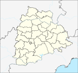
REGODE is located at 17°59′00″N77°50′00″E / 17.9833°N 77.8333°E . [2] It has an average elevation of 506 metres (1663 ft).
According to Indian census, 2001, the demographic details of Regode mandal is as follows: [3]
Regode village has a population of 3,267 in 2001. [4]
The villages in Regode mandal include: Chowderpalle, Devnoor, Dosapalle, Dudiyal, Gajwada, Jagriyal, Khaderabad, Kondapur, Kothwalpalle, Marpalle, Medikonda, Nirjipala, Pyararam, Pocharam, R. Itikyal, Regode, Saipet, Sindole, Timmapoor,Tatipally, T.Lingampalle, M.Venkatapoor, Usrikpalle, Darakastupally,PeddaThanda,Bhoothkoor, etc..
Mandasa is a village in Srikakulam district of the Indian state of Andhra Pradesh. Mandasa is also known by the name Manjusha.
Sadasivpet is a town in sangareddy district of the Indian state of Telangana.
Kankipadu is a census town in Krishna district of the Indian state of Andhra Pradesh. It is also the mandal headquarters of Kankipadu mandal in Vijayawada revenue division. The town is located on the banks of the Paleru River which is a tributary of the Krishna River.
Kaviti is a village in Srikakulam district of the Indian state of Andhra Pradesh. Kaviti mandal is bordered by Ichchapuram mandal to the north, Kanchili and Sompeta manals to the south, Odisha state to the west and the Bay of Bengal to the east.
Beluguppa is a village in Anantapur district of the Indian state of Andhra Pradesh. It is the headquarters of Beluguppa mandal in Kalyandurg revenue division.
Garladinne is a village in Anantapur district of the Indian state of Andhra Pradesh. It is the mandal headquarters of Garladinne mandal in Anantapur revenue division.
Putlur is a village in Anantapur district of the Indian state of Andhra Pradesh. It is the mandal headquarters of Putlur mandal in Anantapur revenue division.
Settur is a village in Anantapur district of the Indian state of Andhra Pradesh. It is the headquarters of Settur mandal in Kalyandurg revenue division.
Tadimarri is a village in Anantapur district of the Indian state of Andhra Pradesh. It is the mandal headquarters of Tadimarri mandal in Dharmavaram revenue division.
Mudigubba is a town and MANDAL Headquarters in Anantapur district of the Indian state of Andhra Pradesh. It is located in Mudigubba mandal of Dharmavaram revenue division.
Ramagiri is a village in Anantapur district of the Indian state of Andhra Pradesh. It is the mandal headquarters of Ramagiri mandal in Dharmavaram revenue division.
Pebbair is a village and a Mandal in Wanaparthy district in the state of Telangana, India. The Pebbair Mandal extends from Pampuram village in the North to Yaparla village in the south..
Ramayampet is a town and mandal in Medak district in Indian state of Telangana. It is the biggest town in Medak district and is 80 km (50 mi) from Hyderabad.
Amarapuram is a village in Anantapur district, Andhra Pradesh.
Kohir Deccan is a town and Mandal headquarters in the Sangareddy district of Telangana, India. Kohir is on the Deccan Plateau in Telangana, neighbouring Karnatake state (Bidar). Kohir, Zaheerabad, Bidar, and neighbouring places brings to mind the Red Planet, and the land is usually red roads, red stones on streets with red houses made of red soil and black soil in agriculture land. Kohir was named after the distinctive red soil of the region. Kohir in local slang means "red diamond". The "Pati Matti" once mixed with water turns into very strong material fit for construction of multistoried buildings. These mud houses are unbreakable and can withstand even the harsh climate of this region. Kohir is bounded by Zahirabad, Jharasangam and Munpalle mandals of Sangareddy district and Rangareddy district. In Kohir, 50% of people are living Muslims, 30% are Hindu and 20% are Christians.
Kangti is a city in Kangti Mandal in the Narayankhed taluka of the Sangareddy district in the Indian state of Telangana.
Papannapet is a village in Medak district of Telangana, India. It is bounded by Sankarampet, Tekmal, Kulcharam and Medak mandals of Medak district and Nizamabad district. Papannapet has an average elevation of 445 metres (1463 ft).
Kulcharam is a village and mandal in Medak district of Telangana, India.
Nyalkal is a village in Medak district of Telangana, India.
mandal was made by Sri kalleti Rajeshwar Gupta who was a resident of this village and sarpanch of this village
,
This article about a location in Medak district, Telangana is a stub. You can help Wikipedia by expanding it. |