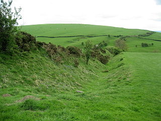
Offa's Dyke is a large linear earthwork that roughly follows the border between England and Wales. The structure is named after Offa, the Anglo-Saxon king of Mercia from AD 757 until 796, who is traditionally believed to have ordered its construction. Although its precise original purpose is debated, it delineated the border between Anglian Mercia and the Welsh kingdom of Powys.

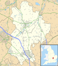
Little Barford is a hamlet and civil parish in the Borough of Bedford in Bedfordshire, England about 7 miles (11 km) northeast of the county town of Bedford.

North East Bedfordshire is a constituency represented in the House of Commons of the Parliament of the United Kingdom since 2019 by Richard Fuller, of the Conservative Party.

Barford St Martin is a village and civil parish in Wiltshire, England, about 2.5 miles (4 km) west of Wilton, around the junction of the A30 and the B3089. Barford is known as one of the Nadder Valley villages, named for the River Nadder which flows through the parish.

Great Barford is a village and civil parish in Bedfordshire, England, a few miles north-east of Bedford. It lies on the River Great Ouse at grid reference TL129523. It is twinned with Wöllstein, Germany. The village is bypassed by the busy A421 road on the way between Bedford and St Neots in Cambridgeshire, the bypass opening on 24 August 2006.

Essendine is a village and civil parish at the eastern end of the county of Rutland in the East Midlands of England, located 5 miles north of Stamford and 6 miles south of Bourne. The population of the civil parish at the 2011 census was 448. It lies on the West Glen, close by the earthworks of a small castle.

Crawford Castle, substantially in ruins, is located on the north bank of the River Clyde, around half a mile north of Crawford, South Lanarkshire, Scotland. The ruins stand on an earlier motte and bailey earthwork. The castle is also known as Lindsay Tower, after its former owners, the Lindsay family. The strategic location of the castle, at NS954213, guards the strategically important Mennock Pass from England into the upper Clyde Valley.

British Camp is an Iron Age hill fort located at the top of Herefordshire Beacon in the Malvern Hills. The hill fort is protected as a Scheduled Ancient Monument and is owned and maintained by Malvern Hills Conservators. The fort is thought to have been first constructed in the 2nd century BC. A Norman castle was built on the site.

Elmley Castle was a late 11th-century earthwork and timber castle which received stone additions in the 12th and possibly 13th centuries, located 0.5 miles (0.8 km) south of the village of Elmley Castle and 12 miles (19 km) southeast of the city of Worcester, in Worcestershire. Nothing but the earthworks survive.
Renhold is a village and civil parish located on the River Ouse, in the hundred of Bedford, in the county of Bedfordshire, England. The parish church is situated some 4 miles (6.5 km) east-north-east of Bedford town centre. Bedfordshire County Council estimated the population of Renhold to be 1,800 in 2005, and forecast an increase to 2,320 by 2010.

Priddy Circles are a linear arrangement of four circular earthwork enclosures near the village of Priddy on the Mendip Hills in Somerset, England. The circles have been listed as Scheduled Ancient Monuments, and described as 'probable Neolithic ritual or ceremonial monuments similar to a henge'.

Risinghoe Castle, sometimes known as Goldington Castle, is a 20-foot mound, located in the former village of Goldington, a parish in the hundred of Barford, in the county of Bedfordshire, England. The village of Goldington has now been incorporated into the town of Bedford, and the castle is now officially is located in Newnham ward. The mound is located on the north side of the River Ouse, three miles east of Bedford Castle and a mile west of Renhold Castle
Higham Gobion Castle was once believed to be an 11th-century castle located in the village of Higham Gobion. Now it is part of the civil parish of Shillington, in the English county of Bedfordshire. It has since been determined that the site was in fact a fishery with a breeding island that was mistaken for a defendable moated building of some sort.
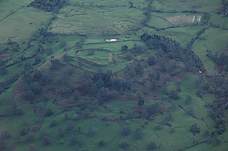
Great Barford Castle, later known as "Creakers Manor", was a Norman castle located in the village of Great Barford, in the county of Bedfordshire, England.
Gannocks Castle is located in the village of Tempsford, in the county of Bedfordshire, England. It is located 6 miles east of Great Barford Castle and 9 miles east of Bedford Castle.

Pilsbury Castle was a Norman castle in Derbyshire near the present-day village of Pilsbury, overlooking the River Dove.
Littledean Camp was originally a castle overlooking the village of Littledean in Gloucestershire, England, notable for its unique early Norman design.

The site of Ebsbury, in Wiltshire, England, includes the remains of an Iron Age enclosed settlement, field system and possible hill fort, and a Romano-British enclosed settlement.


