
Highland Township is one of the twelve townships of Defiance County, Ohio, United States. The population at the 2020 census was 2,284.

Richland Township is one of the twelve townships of Defiance County, Ohio, United States. The 2020 census found 3,063 people in the township.

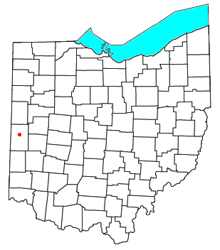
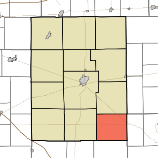
Tiffin Township is one of twelve townships in Defiance County, Ohio, United States. The 2020 census reported 1,586 residents in the township.

Dawn is an unincorporated community in northern Richland Township, Darke County, Ohio, United States. It lies at the intersection of U.S. Route 127 with Burch Road. It is located between the villages of Ansonia and Versailles, approximately 8 miles (12.75 km) north of Greenville, the county seat of Darke County.
Beamsville in an unincorporated community in central Richland Township, Darke County, Ohio, United States. It lies near the intersection of U.S. Route 127 and the Stillwater River, approximately 6 miles north of Greenville, the county seat of Darke County.

Richland Township is one of fourteen townships in Miami County, Indiana, United States. As of the 2010 census, its population was 1,179 and it contained 480 housing units.
Richland Township is one of twelve townships in Rush County, Indiana. As of the 2010 census, its population was 337 and it contained 138 housing units.

Hackleman is a small unincorporated community in central Liberty Township, Grant County, Indiana.
Mill Creek is an unincorporated community in northern Lincoln Township, LaPorte County, Indiana, United States. It lies along CR875E, east of the city of La Porte, the county seat of LaPorte County. Although Mill Creek is unincorporated, it has a post office, with the ZIP code of 46365. It is possible to reach Mill Creek from Upper Fish Lake by way of a shallow stream that feeds the lake: this stream passes under a railroad bridge about a half mile east of the town. Mill Creek is not an actual creek, it is south of La Porte.
Bentonville is an unincorporated community in central Posey Township, Fayette County, Indiana, United States.

Velpen is an census-designated place in southeastern Marion Township, Pike County, in the U.S. state of Indiana. It lies along State Road 257 southeast of the city of Petersburg, the county seat of Pike County. Although Velpen is unincorporated, it has a post office, with the ZIP code of 47590.

St. Croix is an unincorporated community in northern Oil Township, Perry County, in the U.S. state of Indiana.
Paris Crossing is an unincorporated community in southern Montgomery Township, Jennings County, Indiana, United States. It lies along State Road 250, south of the town of Vernon, the county seat of Jennings County. Its elevation is 623 feet (190 m), and it is located at 38°49′46″N85°38′53″W. Although Paris Crossing is unincorporated, it has a post office, with the ZIP code of 47270.

Norman is an unincorporated community in northwestern Owen Township, Jackson County, Indiana, United States. It lies along State Road 58 northwest of the town of Brownstown, the county seat of Jackson County. Its elevation is 869 feet (265 m), and it is located at 38°57′9″N86°16′30″W. Because the community had two different names, the Board on Geographic Names officially decided in favor of "Norman" in 1943. Although Norman is unincorporated, it has a post office, with the ZIP code of 47264.
Falmouth is an unincorporated community in Fayette and Rush counties in the U.S. state of Indiana. Located at the northeastern corner of Union Township and the southeastern corner of Washington Township in Rush County and along the northwestern edge of Fairview Township in Fayette County, it lies at the intersection of CR800E with CR600N /CR400N(Fayette County). Falmouth sits northwest of Connersville and northeast of Rushville, the county seats of Fayette and Rush counties respectively. Although Falmouth is unincorporated, it has a post office, with the ZIP code of 46127.

Derby is an unincorporated community along the Ohio River in far southern Union Township, Perry County, in the U.S. state of Indiana. It lies at the intersection of State Roads 66 and 70 above the city of Tell City, the county seat of Perry County. Its elevation is 453 feet (138 m), and it is located at 38°1′49″N86°31′38″W. Although Derby is unincorporated, it has a post office, with the ZIP code of 47525.
Branchville is an unincorporated community in southern Oil Township, Perry County, in the U.S. state of Indiana. It lies along CR40 northeast of the city of Tell City, the county seat of Perry County. Its elevation is 433 feet (132 m), and it is located at 38°9′49″N86°34′47″W. Although Branchville is unincorporated, it has a post office, with the ZIP code of 47514. The Branchville Correctional Facility is located near the community.
Homer is an unincorporated community in central Walker Township, Rush County, in the U.S. state of Indiana. Although Homer is unincorporated, it has a post office, with the ZIP code of 46146.
Tobinsport is a small unincorporated community located along the Ohio River in Tobin Township, Perry County, in the U.S. state of Indiana. Directly across the river is Cloverport, Kentucky. It is at the southernmost point of Perry County.

Ray is an unincorporated community in both Steuben County, Indiana and Branch County, Michigan in the United States. Located along the local "State Line Road," the small community straddles the border between the two states. The Indiana Northeastern Railroad travels southwest-northeast through Ray. Its elevation is 1,079 feet (329 m), making it the highest populated place in northern Indiana.


