Related Research Articles

County Tipperary is a county in Ireland. It is in the province of Munster and the Southern Region. The county is named after the town of Tipperary, and was established in the early 13th century, shortly after the Norman invasion of Ireland. It is Ireland's largest inland county and shares a border with eight counties, more than any other. The population of the county was 167,895 at the 2022 census. The largest towns are Clonmel, Nenagh and Thurles.

Nenagh is the county town of County Tipperary in Ireland. Nenagh used to be a market town, and the site of the East Munster Ormond Fair.

Dromineer is a small village and townland in County Tipperary, Ireland. It is on the shores of Lough Derg, 8 km north-west of Nenagh on the R495 road. It is also a civil parish in the historical barony of Ormond Lower. Historic documents describe the places as "Dromynnyre"; the earliest form of the name dating from 1302 was Dromynwyr.
Ardcroney, officially Ardcrony, is a village and townland in County Tipperary, Ireland, 9 km (5.6 mi) north of Nenagh. It also forms a civil parish in the historical barony of Ormond Lower. It is halfway between Nenagh and Borrisokane on the N52 road.

Borrisokane is a town in County Tipperary, Ireland. It is 15 km north of Nenagh, at the junction of the N52 and N65 roads. At the 2022 census, it had a population of 1,117. The Ballyfinboy River flows through the town on its way to Lough Derg, 12 km (7 mi) to the west. It is also a civil parish in the historical barony of Ormond Lower and an Ecclesiastical parish in the Roman Catholic Diocese of Killaloe.
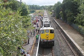
Birdhill railway station serves the town of Birdhill in County Tipperary, Ireland.
Kilgevrin is a townland near the village of Milltown in north County Galway, Ireland. It is situated in the civil parish of Liskeevy, in the historical barony of Dunmore. Kilgevrin is 3.1 square kilometres (1.2 sq mi) in area, and is bounded on the north by the parish of Addergoole and townland of Banagher, on the east by both Banagher and Clashaghanny and on the south and west by the parish of Kilbannon and Tuam.

Moneygall is a village in Offaly and also borders Tipperary, in Ireland. It is situated on the R445 road between Dublin and Limerick. There were 374 people living in the village as of the 2022 census. Moneygall has a Catholic church, motorway service station, a car sales and repair centre, a national school, a Garda station and a pub. The nearest Church of Ireland church, Borrisnafarney, is 2 km from the village beside the former Loughton Demesne.

Portroe is a village in County Tipperary, Ireland. The village is located on the R494 regional road, 2km from the eastern shore of Lough Derg and 11km west of the town of Nenagh. Portroe spans the townlands of Garrykennedy, Glencrue and Shesharoe.
Eminiska is a small townland in the historical barony of Ormond Lower, County Tipperary, Ireland. Situated between Borrisokane and Cloughjordan, it has an area of approximately 1.15 square kilometres (0.44 sq mi). As of the 2011 census, Eminiska townland had a population of 17 people.
Johnstown is a townland in the Barony of Ormond Lower, County Tipperary, Ireland. It is located in the civil parish of Killodiernan.
Cloghjordanpark, A townland in the Barony of Ormond Lower, County Tipperary, Ireland. Located to the east of Cloughjordan, the townland is always spelled without the letter "u."
Ballymoreen, or Ballymurreen, is a townland in the civil parish of the same name in County Tipperary in Ireland. It is within the historical barony of Eliogarty in the south-east corner of North Tipperary, between Littleton and Horse and Jockey. Evidence of ancient settlement in Ballymurreen include a number of ringfort sites, a ruined church and graveyard dating to at least the 17th century, and the former site of a tower house and bawn. The townland, which is 1.3 square kilometres (0.5 sq mi) in area, had a population of 65 as of the 2011 census.
Ballinderry is a village and a townland in the historical Barony of Ormond Lower, County Tipperary, Ireland. It is located between Terryglass and Nenagh where the R493 road crosses the Ballyfinboy River.

The Nenagh River rises in the Silvermine Mountains in County Tipperary, Ireland. It flows east of Nenagh and into Lough Derg just north of Dromineer.

Garrykennedy is a townland, settlement and harbour in the historical Barony of Owney and Arra, County Tipperary, Ireland. It is located on the eastern shore of Lough Derg, 2 km north of Portroe.
The Ollatrim River rises in County Tipperary, Ireland. It joins the Nenagh River east of Nenagh town and together they flow into Lough Derg north of Dromineer. A short section of the river forms the border between County Offaly and County Tipperary. The river flows through the Townland of Ollatrim.
Knockalton Lower is a townland in the historical Barony of Ormond Upper, County Tipperary, Ireland.

Killoscully is a small village, townland and civil parish in County Tipperary, Ireland. Located approximately 8 kilometres (5 mi) northeast of Newport, overlooked by the Silvermine Mountains, the linear village has a Catholic church, graveyard, community centre and public house. The church, the Church of the Sacred Heart, was built in 1874 and is in the parish of Ballinahinch and Killoscully in the Roman Catholic Archdiocese of Cashel and Emly. The local Gaelic Athletic Association club, Ballinahinch GAA, is also in Ballinahinch and Killoscully parish. Some scenes for the fictional TV show, Killinaskully, were filmed in the area.

Kilmanahan is a townland in the historical barony of Glenahiry in County Waterford, Ireland. The townland, which has an area of approximately 2.75 square kilometres (1.06 sq mi), had a population of 40 people as of the 2011 census.
References
- ↑ "Cill Ó Sealbhaigh / Richmond". logainm.ie. Placenames Database of Ireland. Retrieved 16 November 2020.
- ↑ "Richmond Townland, Co. Tipperary". townlands.ie. Retrieved 16 November 2020.
- ↑ "CD170 - Tipperary Population by Private Households, Occupied and Vacancy Rate by Townlands, CensusYear and Statistic". Census 2011. Central Statistics Office. April 2011. Retrieved 16 November 2020– via data.gov.ie.
Richmond, Nenagh Rural, Co. Tipperary [..] 153
- ↑ "Final Record of Protected Structures List (2010)" (PDF). tipperarycoco.ie. Tipperary County Council. Retrieved 17 November 2020.
52°52′35″N8°13′53″W / 52.8764°N 8.2313°W
| | This article related to the geography of County Tipperary, Ireland is a stub. You can help Wikipedia by expanding it. |