Riemst

Last updated

Riemst
Riemst - Sint-Martinuskerk.jpg
Flag of Riemst.svg
Riemst wapen.svg
Location of Riemst
Riemst
Belgium location map.svg
Red pog.svg
Riemst
Location in Belgium
Location of Riemst in Limburg
Riemst Limburg Belgium Map.svg
Coordinates: 50°48′N05°36′E / 50.800°N 5.600°E / 50.800; 5.600
CountryFlag of Belgium (civil).svg  Belgium
Community Flemish Community
Region Flemish Region
Province Limburg
Arrondissement Tongeren
Government
  MayorMark Vos (CD&V)
  Governing party/ies CD&V
Area
  Total58.06 km2 (22.42 sq mi)
Population
 (2018-01-01) [1]
  Total16,665
  Density290/km2 (740/sq mi)
Postal codes
3770
NIS code
73066
Area codes 012
Website www.riemst.be

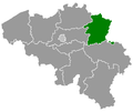
Riemst (Dutch pronunciation: [rimst] ; Limburgish : Riems) is a small town and a municipality in the Belgian province of Limburg. Riemst is in the Flemish speaking area of Belgium.

Contents

On January 1, 2018 Riemst had a total population of 16,665. [2] The total area is 57.88 km² which gives a population density of 276 inhabitants per km².

Riemst was the site of the Battle of Lauffeld, fought in 1747.

The bridge in the Borough Vroenhoven was part of the start of WW2, when the Germans launched a coordinated attack on the area. [3]

Paul Schiepers (born in 1919) was the last mayor of the borough of Riemst before it joined with the other boroughs to form the current town of Riemst. He died on August 18, 1978. [4]

Boroughs

Genoelselderen, Herderen, Kanne, Membruggen, Millen, Riemst, Val-Meer, Lafelt, Vlijtingen, Vroenhoven, Heukelom and Zichen-Zussen-Bolder

Elderen (wine) castle at Genoelselderen Wijnkasteel Genoelselderen 22-09-2021 12-34-11.jpg
Elderen (wine) castle at Genoelselderen
Neercanne castle at Kanne Chateau neercanne.jpg
Neercanne castle at Kanne
Bridge Albert Canal near Vroenhoven Pont Vroenhoven 1935.jpg
Bridge Albert Canal near Vroenhoven
Albert Canal near Kanne AlbertkanaalKanne 4575.jpg
Albert Canal near Kanne

Related Research Articles

<span class="mw-page-title-main">Tremelo</span> Municipality in Flemish Community, Belgium

Tremelo is a municipality located in the Belgian province of Flemish Brabant, in Flanders. The municipality comprises the towns of Baal and Tremelo proper. On January 1, 2006, Tremelo had a total population of 13,725. The total area is 21.57 km² which gives a population density of 636 inhabitants per km².

<span class="mw-page-title-main">Beernem</span> Municipality in Flemish Community, Belgium

Beernem is a rural municipality in the Belgian province of West Flanders, located southeast of Bruges. The municipality comprises the towns of Beernem proper, Oedelem and Sint-Joris. On January 1, 2006 Beernem had a total population of 14,642, mostly in Beernem proper and Oedelem. The total area is 71.68 km² which gives a population density of 204 inhabitants per km².

<span class="mw-page-title-main">Anzegem</span> Municipality in Flemish Community, Belgium

Anzegem is a municipality located in the Belgian province of West Flanders. The municipality comprises the towns of Anzegem proper, Gijzelbrechtegem, Ingooigem, Kaster, Tiegem and Vichte. On 1 January 2006 Anzegem had a total population of 14,609. The total area is 41.79 km² which gives a population density of 349 inhabitants per km².

<span class="mw-page-title-main">Deerlijk</span> Municipality in Flemish Community, Belgium

Deerlijk is a municipality located in the Belgian province of West Flanders. The municipality only comprises the town of Deerlijk proper. On January 1, 2006, Deerlijk had a total population of 11,310. The total area is 16.82 km² which gives a population density of 673 inhabitants per km².

<span class="mw-page-title-main">Lichtervelde</span> Municipality in Flemish Community, Belgium

Lichtervelde is a municipality located in the Belgian province of West Flanders. The municipality comprises only the town of Lichtervelde. On January 1, 2006 Lichtervelde had a total population of 8,400. The total area is 25.93 km² which gives a population density of 324 inhabitants per km². The church is 64 m high. In this town the inventor Charles Joseph Van Depoele was born.

<span class="mw-page-title-main">Meulebeke</span> Municipality in Flemish Community, Belgium

Meulebeke is a municipality located in the Belgian province of West Flanders. The municipality comprises only the town of Meulebeke proper. On January 1, 2006, Meulebeke had a total population of 10,980. The total area is 29.35 km² which gives a population density of 374 inhabitants per km².

<span class="mw-page-title-main">Haaltert</span> Municipality in Flemish Community, Belgium

Haaltert is a municipality located in the Belgian province of East Flanders in the Denderstreek. The municipality comprises the towns of Denderhoutem, Haaltert proper, Heldergem and Kerksken. In 2021, Haaltert had a total population of 18,892. The total area is 30.30 km². The current mayor of Haaltert is Veerle Baeyens, from the N-VA.

<span class="mw-page-title-main">Lebbeke</span> Municipality in Flemish Community, Belgium

Lebbeke is a municipality located in the Belgian province of East Flanders in the Denderstreek. The municipality comprises the towns of Denderbelle, Lebbeke proper and Wieze. In 2021, Lebbeke had a total population of 19,560. The total area is 27.31 km². Lebbeke is home to the chocolate factory Callebaut.

<span class="mw-page-title-main">Assenede</span> Municipality in Flemish Community, Belgium

Assenede is a municipality located in the Belgian province of East Flanders. The municipality comprises the towns of Assenede proper, Bassevelde, Boekhoute and Oosteeklo. On 1 January 2021, Assenede had a total population of 14,369. The total area is 87.22 km².

<span class="mw-page-title-main">Lochristi</span> Municipality in Flemish Community, Belgium

Lochristi is a municipality located in the Belgian province of East Flanders. The municipality is composed of the towns of Beervelde, Lochristi proper, Zaffelare and Zeveneken. As of 2021, Lochristi had a total population of 22,621. The total area is 60.34 km2 (23.30 sq mi).

<span class="mw-page-title-main">Oosterzele</span> Municipality in Flemish Community, Belgium

Oosterzele is a municipality located in the Flemish province of East Flanders, in Belgium. The municipality comprises the towns of Balegem, Gijzenzele, Landskouter, Moortsele, Oosterzele proper and Scheldewindeke. In 2021, Oosterzele had a total population of 13,740. The total area is 43.12 km². Its twin town is Oberkirch in Germany.

<span class="mw-page-title-main">Lierde</span> Municipality in the Belgian province of East Flanders

Lierde is a municipality located in the Flemish Ardennes, the hilly southern part of the Belgian province of East Flanders in the Denderstreek. The municipality comprises the towns of Deftinge, Hemelveerdegem, Sint-Maria-Lierde and Sint-Martens-Lierde. In 2021, Lierde had a total population of 6,626. The total area is 26.13 km². Lierde borders to Brakel, Zottegem, Herzele and Geraardsbergen. Lierde is known for the Ronde van vlaanderen, a bike race where cyclists climb all the hills of the Flemish Ardennes.

<span class="mw-page-title-main">Stekene</span> Municipality in Flemish Community, Belgium

Stekene is a municipality located in the Belgian province of East Flanders. Since 1976, the municipality has comprised the towns of Kemzeke, Klein-Sinaai and Stekene proper. It also includes the village Koewacht. In 2021, Stekene had a total population of 18,863. The total area is 44.80 km2.

<span class="mw-page-title-main">Schilde</span> Municipality in Flemish Community, Belgium

Schilde is a municipality located in the Belgian province of Antwerp. The municipality comprises the towns of Schilde proper and 's-Gravenwezel. In 2021, Schilde had a total population of 19,925. The total area is 35.99 km². It has one of the highest per capita income levels in Flanders. Schilde is home to Rugbyclub Diabolos.

<span class="mw-page-title-main">Stabroek</span> Municipality in Flemish Community, Belgium

Stabroek is a municipality located in the Belgian province of Antwerp. The municipality comprises the towns of Hoevenen and Stabroek proper. In 2021, Stabroek had a total population of 18,680. The total area is 21.51 km². In 2008 Stabroek celebrated its 750-year-old existence.

<span class="mw-page-title-main">Wommelgem</span> Municipality in Flemish Community, Belgium

Wommelgem is a municipality located in the Belgian province of Antwerp. The municipality only comprises the town of Wommelgem proper. In 2021, Wommelgem had a total population of 12,991. The total area is 13.01 km².

<span class="mw-page-title-main">Vorselaar</span> Municipality in Flemish Community, Belgium

Vorselaar is a municipality located in the Belgian province of Antwerp. The municipality comprises only the town of Vorselaar proper. In 2021, Vorselaar had a total population of 7,995. The total area is 27.62 km2.

<span class="mw-page-title-main">Herne, Belgium</span> Municipality in Flemish Community, Belgium

Herne is a municipality in the province of Flemish Brabant, in Flanders, one of the three regions of Belgium. It is also situated in the region of the Pajottenland. The municipality comprises the towns of Herfelingen, Herne proper and Sint-Pieters-Kapelle. On January 1, 2006, Herne had a total population of 6,407. The total area is 44.63 km² which gives a population density of 144 inhabitants per km².

<span class="mw-page-title-main">Keerbergen</span> Municipality in Flemish Community, Belgium

Keerbergen is a municipality located in the Belgian province of Flemish Brabant. The municipality comprises only the town of Keerbergen proper. On January 1, 2006, Keerbergen had a total population of 12,444. The total area is 18.39 km² which gives a population density of 677 inhabitants per km².

<span class="mw-page-title-main">Tielt-Winge</span> Municipality in Flemish Community, Belgium

Tielt-Winge is a municipality located in the Belgian province of Flemish Brabant. The municipality comprises the towns of Houwaart, Meensel-Kiezegem, Sint-Joris-Winge and Tielt. On 1 January 2006, Tielt-Winge had a total population of 10,009. The total area is 44.16 km² which gives a population density of 227 inhabitants per square kilometre.

References

  1. "Wettelijke Bevolking per gemeente op 1 januari 2018". Statbel. Retrieved March 9, 2019.
  2. Wettelijke bevolking per gemeent fgov.be
  3. "De Brug van Vroenhoven".
  4. Newsletter riemst.be