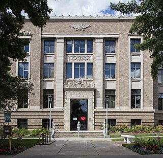
Garfield County is a county located in the U.S. state of Colorado. As of the 2020 census, the population was 61,685. The county seat is Glenwood Springs. The county is named in honor of United States President James A. Garfield. Garfield County is included in the Glenwood Springs, CO Micropolitan Statistical Area, which is also included in the Edwards-Glenwood Springs, CO Combined Statistical Area.

St. Vrain Creek is a tributary of the South Platte River, approximately 32.2 miles (51.8 km) long, in north central Colorado in the United States. It drains part of the foothills north of Boulder and the Colorado Piedmont area in the vicinity of Longmont.

Battlement Mesa is a large prominent mesa in western Colorado in the United States. It sits along the Garfield-Mesa county line, between the Colorado River to the north and Plateau Creek to the south.

The Roan Cliffs are a series of desert mountains and cliffs in eastern Utah and western Colorado, in the western United States that are distinct from the Book Cliffs.

The Arikaree River is a 156-mile-long (251 km) river in the central Great Plains of North America. It lies mostly in the American state of Colorado, draining land between the North and South Forks of the Republican River, and it flows into the North Fork in Nebraska after flowing a short distance through Kansas. It is a designated area within the Colorado Natural Areas Program to protect native and uncommon species that may be endangered or threatened.

Kanab Creek is one of the many tributaries of the Colorado River. It begins in Kane County, Utah, just south of the watershed to the Great Basin and flows 125 miles (201 km) south to the Colorado River.
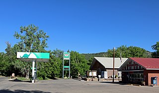
Beulah is an unincorporated community and a post office located within the Beulah Valley census-designated place in Pueblo County, Colorado, United States. The Beulah Post Office has the ZIP code 81023. Beulah is a part of the Beulah Valley CDP. Beulah lies along State Highway 78 about 21 miles southwest of Pueblo, in the foothills of the Wet Mountains.
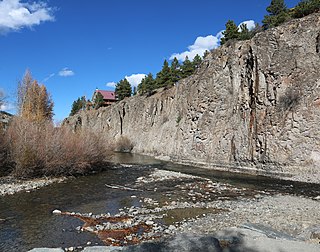
Lawson is a small unincorporated community situated along Clear Creek in Clear Creek County, Colorado, United States. Lawson is a part of the Downieville-Lawson-Dumont census-designated place.
Bovina is an unincorporated community in Lincoln County, Colorado, United States.
Stoner Creek is a stream in Dolores County, Colorado, in the United States.

Buford is an unincorporated community in Rio Blanco County, Colorado, United States.
Caddoa Creek is a stream in the U.S. state of Colorado.

Cebolla Creek is a stream in Gunnison and Hinsdale counties in Colorado, United States, that is a tributary of the Gunnison River.

Dove Creek is a stream in the U.S. state of Colorado.

Leopard Creek is a stream located entirely within San Miguel County, Colorado.
Lay Creek is a stream in the U.S. state of Colorado.

Oxford is an unincorporated community in on the Southern Ute Indian Reservation in La Plata County, Colorado, United States.

Timpas Creek is a stream in the U.S. state of Colorado.
Troublesome Creek is a stream in the U.S. state of Colorado. It is a tributary of the Colorado River.
Henson Creek is a stream in Hinsdale County, Colorado, United States. It rises near Sunshine Mountain in the San Juan Mountains. It merges with Lake Fork Gunnison River in the town of Lake City.
