Rindschleiden

Last updated
Rindschleiden
Randschelt
Randschelt Scheld 4372.jpg
Country Flag of Luxembourg.svg  Luxembourg
Canton Redange
Commune Wahl, Luxembourg
Population
  Total0
Time zone UTC+1 (CET)
  Summer (DST) UTC+2 (CEST)

Rindschleiden (Luxembourgish: Randschelt) is a village in northwestern Luxembourg. [1]

It is situated in the commune of Wahl and has a population of 0. [2]

It is known as the "smallest locality in Luxembourg", since it is the only village in Luxembourg with no current population.

Related Research Articles

<span class="mw-page-title-main">Canton of Redange</span> Canton in Nord, Luxembourg

Redange is a canton in the northwest of Luxembourg. The capital is Redange, otherwise known as Redange-sur-Attert. It borders the cantons of Wiltz to the north, Diekirch and Mersch to the east, Capellen to the south and Belgium to the west.

<span class="mw-page-title-main">Communes of Luxembourg</span> Aspect of Luxembourgish geography

Luxembourg's 102 communes conform to LAU Level 2 and are the country's lowest administrative divisions.

<span class="mw-page-title-main">Useldange</span> Commune in Redange, Luxembourg

Useldange is a commune and small town in western Luxembourg, in the canton of Redange.

<span class="mw-page-title-main">Lannen</span> Village in Redange, Luxembourg

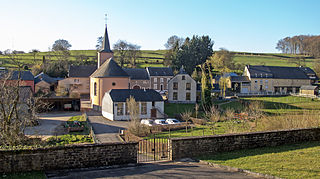
Lannen is a village in northwestern Luxembourg.

<span class="mw-page-title-main">Nagem</span> Village in Redange, Luxembourg

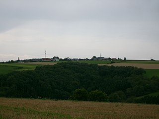
Nagem is a village in northwestern Luxembourg.

<span class="mw-page-title-main">Landscheid (Tandel)</span> Village in Luxembourg

Landscheid is a village in northeastern Luxembourg.

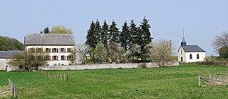
Merscheid is a village in northeastern Luxembourg.

<span class="mw-page-title-main">Seltz (Tandel)</span> Village in Luxembourg

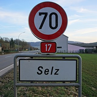
Seltz is a village in northeastern Luxembourg.

<span class="mw-page-title-main">Weiler (Putscheid)</span> Village in Luxembourg

Weiler is a village in northeastern Luxembourg.

<span class="mw-page-title-main">Brattert</span> Village in Luxembourg

Brattert is a village in northwestern Luxembourg.

<span class="mw-page-title-main">Ehner</span> Village in Luxembourg

Ehner is a village in northwestern Luxembourg.

<span class="mw-page-title-main">Eltz (Redange)</span> Village in Luxembourg

Eltz is a village in northwestern Luxembourg.

<span class="mw-page-title-main">Flatzbour</span> Village in Luxembourg

Flatzbour is a village in northwestern Luxembourg.

<span class="mw-page-title-main">Haut-Martelange</span> Village in Luxembourg

Haut-Martelange is a village in northwestern Luxembourg.

<span class="mw-page-title-main">Heispelt</span> Village in Luxembourg

Heispelt is a village in northwestern Luxembourg.

<span class="mw-page-title-main">Huttange</span> Village in Luxembourg

Huttange is a village in northwestern Luxembourg.

<span class="mw-page-title-main">Kuborn</span> Village in Luxembourg

Kuborn is a village in northwestern Luxembourg.

<span class="mw-page-title-main">Levelange</span> Village in Luxembourg

Levelange is a village in northwestern Luxembourg.

<span class="mw-page-title-main">Petit-Nobressard</span> Village in Luxembourg

Petit-Nobressard is a village in northwestern Luxembourg.

<span class="mw-page-title-main">Schwebach</span> Village in Luxembourg

Schwebach is a village in northwestern Luxembourg.

References

  1. "Geoportail". map.geoportail.lu. Retrieved 2022-05-24.
  2. "Statistiques - Luxembourg". statistiques.public.lu (in French). Retrieved 2022-05-24.

Coordinates: 49°50′59″N5°54′00″E / 49.84972°N 5.90000°E / 49.84972; 5.90000