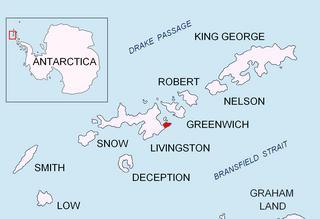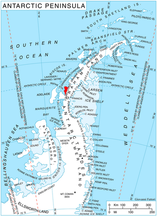
Dobrudzha Glacier is situated on the southeast side of Tangra Mountains, Burgas Peninsula, eastern Livingston Island in the South Shetland Islands, northeast of Magura Glacier, southeast of Iskar Glacier and southwest of Ropotamo Glacier. It is bounded by Ruse Peak and Asen Peak to the north and by Kuber Peak to the west and flows southeastward into Bransfield Strait. The glacier is named after the Dobrudzha region in northeastern Bulgaria.

Iskar Glacier is a glacier in Livingston Island, South Shetland Islands in Antarctica situated southeast of lower Huron Glacier, west-southwest of Sopot Ice Piedmont, and north of Dobrudzha and Magura Glaciers. It drains the north slopes of the Tangra Mountains between Helmet Peak to the west and Delchev Peak to the east, and flows northward into Bruix Cove between Yana Point and Rila Point.

Kaliakra Glacier is a glacier in northeastern Livingston Island, Antarctica extending 3.8 nautical miles in east-west direction and 4.3 nautical miles in north-south direction, and situated southeast of Saedinenie Snowfield, southwest of Panega Glacier, north of Struma Glacier and upper Huron Glacier, and northeast of Perunika Glacier. It is bounded by Melnik Ridge and Bowles Ridge to the south, by Hemus Peak, Gurev Gap, Gleaner Heights, Elhovo Gap, Leslie Hill, Leslie Gap and Radnevo Peak to the west, and Miziya Peak and Samuel Peak to the north. The glacier drains eastwards into Moon Bay south of Perperek Knoll and north of Sindel Point.

Medven Glacier is a 2.5 km long and 1.5 km wide glacier on Ioannes Paulus II Peninsula, Livingston Island in the South Shetland Islands, Antarctica situated east of Etar Snowfield, south of Urdoviza Glacier and north of Berkovitsa Glacier. It is bounded by the east slopes of Oryahovo Heights and drains eastwards into Prisoe Cove, Hero Bay between Remetalk Point and Agüero Point. Bulgarian mapping in 2005 and 2009.

Murgash Glacier is the 3.4 km long and 3.2 km wide glacier on Greenwich Island in the South Shetland Islands, Antarctica situated southeast of Yakoruda Glacier, south of Teteven Glacier, southwest of Traub Glacier and west-northwest of Bravo Glacier. It is bounded by Lloyd Hill on the northwest, Tile Ridge on the east and Hebrizelm Hill on the southeast, and drains southwards into Kramolin Cove in McFarlane Strait between Yovkov Point and Kaspichan Point.

Pautalia Glacier is a small glacier on Burgas Peninsula, Livingston Island in the South Shetland Islands, Antarctica situated northeast of Strandzha Glacier and south of Sopot Ice Piedmont. It is bounded by Petko Voyvoda Peak to the west, Sozopol Gap to the northwest, Kaloyan Nunatak to the north and Shabla Knoll to the east. The glacier extends 700 m in northwest-southeast direction and 1.1 km in southwest-northeast direction, and flows southeastward into Bransfield Strait.

Perunika Glacier is an 8 km long and 3 km wide (average) roughly crescent-shaped glacier in eastern Livingston Island in the South Shetland Islands, Antarctica situated east of Pimpirev Glacier, south of Saedinenie Snowfield, southwest of Kaliakra Glacier, west of Huron Glacier, and north of Balkan Snowfield and the head of Huntress Glacier.

Ropotamo Glacier is a glacier extending 900 m (3,000 ft) from northeast to southwest and 600 m (2,000 ft) from northwest to southeast on the Burgas Peninsula, Livingston Island in the South Shetland Islands, Antarctica. The glacier is northeast of Dobrudzha Glacier, east-southeast of Iskar Glacier, south of Sopot Ice Piedmont and southwest of Strandzha Glacier. It is bounded by Asen Peak and Delchev Peak to the northwest and north, and flows southeastwards mostly into Yantra Cove, Bransfield Strait.

Srebarna Glacier on Livingston Island in the South Shetland Islands, Antarctica is situated east-northeast of Boyana Glacier, southeast of the head of Macy Glacier and southwest of Magura Glacier. It extends 2.3 km in southwest-northeast direction and 1.8 km in northwest-southeast direction, and drains southeast of Serdica Peak and the Great Needle Peak in Levski Ridge, Tangra Mountains to enter Bransfield Strait between Aytos Point and M'Kean Point.

Targovishte Glacier is situated in Breznik Heights on Greenwich Island in the South Shetland Islands, Antarctica, east of Zheravna Glacier and southwest of Musala Glacier. It is bounded by Viskyar Ridge to the west, Vratsa Peak to the northeast, and Drangov Peak and Ziezi Peak to the east, extending 700 m in east-west direction and 1.6 km in north-south direction, and draining southwards into Bransfield Strait northeast of Sartorius Point.

Teteven Glacier is a glacier on Greenwich Island in the South Shetland Islands, Antarctica situated east of Yakoruda Glacier, west of Quito Glacier, northwest of Traub Glacier and north of Murgash Glacier. It extends 6.5 km in east-west direction and 3.8 km in north-south direction, and drains the north slopes of Dryanovo Heights into the Drake Passage in Haskovo Cove and Skaptopara Cove between Miletich Point and the ice-free area at Agüedo Point.

Berkovitsa Glacier is a glacier on Livingston Island, Antarctica situated east of Etar Snowfield, south of Medven Glacier, west-northwest of Tundzha Glacier and north-northeast of Verila Glacier. It is bounded by the southeastern slopes of Oryahovo Heights and the northwestern slopes of Snow Peak. It extends 4 km in southeast-northwest direction and 2.8 km in northwest-southeast direction, and drains northeastwards into Hero Bay between Avitohol Point and Remetalk Point.

Mount Christi is a mountain rising to 1,256 metres (4,121 ft) in the northern Imeon Range on Smith Island in the South Shetland Islands, Antarctica. The peak overlooks Kongur Glacier to the west-northwest, Saparevo Glacier to the north and Ritya Glacier to the southeast.

Iliev Glacier is the 5 km long and 1.5 km wide glacier in the Lassus Mountains in the northern portion of Alexander Island, Antarctica. It drains the northwest slopes of Mount Wilbye, the east slopes of Vittoria Buttress and the west slopes of Galerius Peak to flow into Lazarev Bay just south of the terminus of Palestrina Glacier.

Solun Glacier is the 9.3 km long and 4 km wide glacier on Pernik Peninsula, Loubet Coast on the west side of Antarctic Peninsula, situated east of Škorpil Glacier and northwest of McCance Glacier. It drains the north slopes of Protector Heights, and flows northwards into Darbel Bay.

Bolgrad Glacier is the 7.4 km long and 5.7 km wide glacier on the west side of Owen Ridge in southern Sentinel Range in Ellsworth Mountains, Antarctica, situated south of Brook Glacier and north of Sirma Glacier. It drains west-southwestwards from Mount Allen, Mount Liptak and Mount Southwick, and flows south of Krusha Peak to leave the range and join Bender Glacier east of Gilbert Spur.

Drama Glacier is the 10 km long and 1.5 km wide glacier in Petvar Heights on the east side of southern Sentinel Range in Ellsworth Mountains, Antarctica, which is situated north of Carey Glacier and Gabare Glacier, east of the east-northeast ridge of Mount Landolt, and south of Razboyna Glacier. It is draining east-northeastwards to join Rutford Ice Stream northeast of Long Peak.

Gerila Glacier is 4 nautical miles long and 1 nautical mile wide glacier on the east side of the main crest of north-central Sentinel Range in Ellsworth Mountains, Antarctica. It is situated north of Burdenis Glacier and south of Fonfon Glacier. The glacier drains the saddle of the twin peak of Long Gables, flows northeastwards and together with Delyo Glacier and Burdenis Glacier joins upper Ellen Glacier north of Bruguière Peak.

Linevo Cove is the 900 m wide cove on Boyd Strait indenting for 560 m the southeast coast of Smith Island in the South Shetland Islands, Antarctica, and entered northeast of Kubadin Point. Its head is fed by Ritya Glacier.

Nosei Glacier is the steep 1.3 km long and 1 km wide glacier draining the southeast slopes of Imeon Range on Smith Island in the South Shetland Islands, Antarctica. It is situated east of upper Dalgopol Glacier, southeast of Kongur Glacier and southwest of Ritya Glacier, flows eastwards from a part of the main crest between Mezek Peak and Mount Christi, and enters the head of Pakusha Cove on Boyd Strait.


