Peyna

Last updated
Peyna
Village
Country Flag of Bulgaria.svg  Bulgaria
Province Gabrovo Province
Municipality Dryanovo
Time zone EET (UTC+2)
  Summer (DST) EEST (UTC+3)

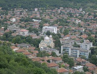
Peyna is a village in Dryanovo Municipality, in Gabrovo Province, in northern central Bulgaria. [1]

Dryanovo Municipality Municipality in Gabrovo, Bulgaria

Dryanovo Municipality is a municipality (obshtina) in Gabrovo Province, North-central Bulgaria, located in the area of the so-called Fore-Balkan between Stara planina mountain and the Danubian Plain. It is named after its administrative centre - the town of Dryanovo.

Gabrovo Province Province in Bulgaria

Gabrovo Province is a small province lying at the geographical centre of Bulgaria. It is named after its main town - Gabrovo. In 2009 the total population of the area is 130,001.

Bulgaria country in Southeast Europe

Bulgaria, officially the Republic of Bulgaria, is a country in Southeast Europe. It is bordered by Romania to the north, Serbia and North Macedonia to the west, Greece and Turkey to the south, and the Black Sea to the east. The capital and largest city is Sofia; other major cities are Plovdiv, Varna and Burgas. With a territory of 110,994 square kilometres (42,855 sq mi), Bulgaria is Europe's 16th-largest country.

Peyna Glacier on Graham Land, Antarctica is named after the village.

Peyna Glacier

Peyna Glacier is the 11.4 km long and 3 km wide glacier on Pernik Peninsula, Loubet Coast in Graham Land, Antarctica, situated southwest of Blagun Glacier and northeast of Murphy Glacier. It flows northwestwards along Lane Ridge, and joins Murphy Glacier and Wilkinson Glacier.

Graham Land geographical object

Graham Land is the portion of the Antarctic Peninsula that lies north of a line joining Cape Jeremy and Cape Agassiz. This description of Graham Land is consistent with the 1964 agreement between the British Antarctic Place-names Committee and the US Advisory Committee on Antarctic Names, in which the name "Antarctic Peninsula" was approved for the major peninsula of Antarctica, and the names Graham Land and Palmer Land for the northern and southern portions, respectively. The line dividing them is roughly 69 degrees south.

Antarctica Polar continent in the Earths southern hemisphere

Antarctica is Earth's southernmost continent. It contains the geographic South Pole and is situated in the Antarctic region of the Southern Hemisphere, almost entirely south of the Antarctic Circle, and is surrounded by the Southern Ocean. At 14,200,000 square kilometres, it is the fifth-largest continent. For comparison, Antarctica is nearly twice the size of Australia. About 98% of Antarctica is covered by ice that averages 1.9 km in thickness, which extends to all but the northernmost reaches of the Antarctic Peninsula.

Related Research Articles

Provadia Place in Varna, Bulgaria

Provadia is a town in northeastern Bulgaria, part of Varna Province, located in a deep karst gorge along the Provadia River not far from the Bulgarian Black Sea Coast. It is the administrative centre of Provadia Municipality. As of December 2009, the town has a population of 12,901 inhabitants.

Vetrino Place in Varna, Bulgaria

Vetrino is a village in northeastern Bulgaria, part of Varna Province. It is the administrative centre of the homonymous Vetrino Municipality, which lies in the western part of the Province. The village is located about 45 kilometres from the provincial capital of Varna and nearly the same distance from Shumen. As of December 2009, the village has a population of 1,036 inhabitants.

Borovan Place in Vratsa, Bulgaria

Borovan is a village in northwestern Bulgaria, part of Vratsa Province. It is the administrative centre of Borovan municipality, which lies in the central part of Vratsa Province. Borovan is located 150 kilometres north-northeast of the capital Sofia.

Belimel village in Bulgaria

Belimel is a village in northwestern Bulgaria, part of Chiprovtsi Municipality, Montana Province.

Chelyustnitsa village of Bulgaria

Chelyustnitsa is a village in northwestern Bulgaria, part of Chiprovtsi Municipality, Montana Province.

Bobovets is a village in Balchik Municipality, Dobrich Province, northeastern Bulgaria.

Chernomortsi is a village in Shabla Municipality, Dobrich Province, northeastern Bulgaria.

Balaleya is a village in Dryanovo Municipality, in Gabrovo Province, in northern central Bulgaria.

Denchevtsi is a village in Dryanovo Municipality, in Gabrovo Province, in northern central Bulgaria. It is around 4 km north west of the town of Dryanovo, and around 15 km south west of Veliko Tarnovo.

Dolni Vurpishta is a village in Dryanovo Municipality, in Gabrovo Province, in northern central Bulgaria.

Gesha is a village in Dryanovo Municipality, in Gabrovo Province, in northern central Bulgaria.

Gorni Vurpishta is a village in Dryanovo Municipality, in Gabrovo Province, in northern central Bulgaria.

Kalomen is a village in Dryanovo Municipality, in Gabrovo Province, in northern central Bulgaria.

Plachka is a village in Dryanovo Municipality, in Gabrovo Province, in northern central Bulgaria.

Zaya is a village in Dryanovo Municipality, in Gabrovo Province, in northern central Bulgaria.

Donchovtsi is a village in Tryavna Municipality, in Gabrovo Province, in northern central Bulgaria.

Enchovtsi is a village in Tryavna Municipality, in Gabrovo Province, in northern central Bulgaria.

Kashentsi is a village in Tryavna Municipality, in Gabrovo Province, in northern central Bulgaria.

Yovovtsi is a village in Tryavna Municipality, in Gabrovo Province, in northern central Bulgaria.

Chemish is a village in Georgi Damyanovo Municipality, Montana Province, north-western Bulgaria.

References

  1. Guide Bulgaria, Accessed May 24, 2010

Coordinates: 43°00′N25°26′E / 43.000°N 25.433°E / 43.000; 25.433

Geographic coordinate system Coordinate system

A geographic coordinate system is a coordinate system that enables every location on Earth to be specified by a set of numbers, letters or symbols. The coordinates are often chosen such that one of the numbers represents a vertical position and two or three of the numbers represent a horizontal position; alternatively, a geographic position may be expressed in a combined three-dimensional Cartesian vector. A common choice of coordinates is latitude, longitude and elevation. To specify a location on a plane requires a map projection.