A font in typography is a complete character set in a particular point size, in a particular typeface.

Rothbury is a town and civil parish in Northumberland, England, on the River Coquet, 13.5 miles (21.7 km) northwest of Morpeth and 26 miles (42 km) of Newcastle upon Tyne. At the 2001 Census, it had a population of 2,107.
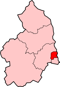
Wansbeck was a local government district in south-east Northumberland, England. Its main population centres were Ashington, Bedlington and Newbiggin-by-the-Sea.

Haltwhistle is a market town and civil parish in Northumberland, England, 10 miles (16 km) east of Brampton. It had a population of 3,811 at the 2011 Census.

The River Wansbeck runs through the county of Northumberland, England. It rises above Sweethope Lough on the edge of Fourlaws Forest in the area known locally as The Wanneys ; runs through the town of Ashington before discharging into the North Sea at Sandy Bay near Newbiggin-by-the-Sea.

Haydon Bridge is a village in Northumberland, England, with a population of about 2000, the civil parish Haydon being measured at 2,184 in the Census 2011. Its most distinctive features are the two bridges crossing the River South Tyne: the picturesque original bridge for which the village was named and a modern bridge which used to carry the A69 road. A bypass was completed in 2009 and the A69 now bypasses the village to the south.

Brinkburn Priory was a medieval monastery built on a bend of the River Coquet, some 4 miles (6 km) east of Rothbury, Northumberland, England. Little survives of the structures erected by the monks apart from the Priory Church, which is a grade I listed building in the care of English Heritage.
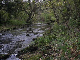
The River Blyth flows eastwards through southern Northumberland into the North Sea at the town of Blyth. It flows through Plessey Woods Country Park. The River Pont is a tributary. The Blyth is 27 miles (44 km) long and the Pont is 17 miles (28 km).
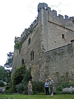
Bywell is a village and civil parish in Northumberland, England. It is situated on the north bank of the River Tyne opposite Stocksfield, between Hexham and Newcastle. The parish has a population of around 380 and Newton is now its most populous settlement.

Kirkwhelpington is a village and civil parish in the English county of Northumberland about 13 miles (21 km) northeast of Hexham. It is on the River Wansbeck alongside the A696 trunk road between Otterburn and Ponteland.

Lesbury is a small rural village in Northumberland in the north of England. It is built on the main coastal road 3.5 miles (5.6 km) southeast of Alnwick, on the north bank of the River Aln. Alnmouth railway station is about half a mile away.
Mahantango Creek is a 36.2-mile-long (58.3 km) tributary of the Susquehanna River in Dauphin, Northumberland, Schuylkill, and Snyder County counties, Pennsylvania in the United States.

Stanton is a small hamlet in Northumberland, England which is located 7 miles (11 km) north west of Morpeth, and 15 miles (24 km) north of Newcastle-Upon-Tyne. Stanton is surrounded by scenic countryside, and is only 9 miles (14 km) from the Northumberland National Park (NNPA).
The Coan River is a 7.5-mile-long (12.1 km) river in Virginia's Northern Neck region. It is a tributary of the Potomac River. It flows from its source in Heathsville through Northumberland County and into the Potomac between Lewisetta and Walnut Point.

Northumberland Fire and Rescue Service is the statutory fire and rescue service for the county of Northumberland in North East England. Its headquarters are co-located with West Hartford fire station in Cramlington.
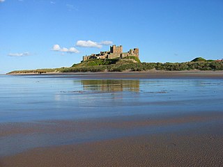
The Northumberland Coast is a designated Area of Outstanding Natural Beauty (AONB) covering 40 miles (64 km) of coastline from Berwick-Upon-Tweed to the River Coquet estuary in the Northeast of England. Features include: Alnmouth, Bamburgh, Beadnell, Budle Bay, Cocklawburn Beach, Craster, Dunstanburgh Castle, the Farne Islands, Lindisfarne and Seahouses. It lies within the natural region of the North Northumberland Coastal Plain.
Northumbrian Water Limited is a water company in the United Kingdom, providing mains water and sewerage services in the English counties of Northumberland, Tyne and Wear, Durham and parts of North Yorkshire, and also supplying water as Essex and Suffolk Water. It is a wholly owned subsidiary of Northumbrian Water Group.

The Northumberland Sandstone Hills are a major natural region that lies entirely within the English county of Northumberland. Their sandstone hills form distinctive skylines with generally level tops, northwest facing scarps and craggy outcrops offering exceptional views to the Cheviots further west.
The geology of Northumberland in northeast England includes a mix of sedimentary, intrusive and extrusive igneous rocks from the Palaeozoic and Cenozoic eras. Devonian age volcanic rocks and a granite pluton form the Cheviot massif. The geology of the rest of the county is characterised largely by a thick sequence of sedimentary rocks of Carboniferous age. These are intruded by both Permian and Palaeogene dykes and sills and the whole is overlain by unconsolidated sediments from the last ice age and the post-glacial period. The Whin Sill makes a significant impact on Northumberland's character and the former working of the Northumberland Coalfield significantly influenced the development of the county's economy. The county's geology contributes to a series of significant landscape features around which the Northumberland National Park was designated.

Mid Northumberland NCA is a National Character Area in Northern England which resides between the Northumberland Sandstone Hills and the North Northumberland Coastal Plain. It is bordered to the south by the Hadrian’s Wall World Heritage Site. Ridges and river valleys dominate the region in the northern and western regions, where the NCA borders the uplands in northwestern Northumberland, lowlands and plains dominate the landscape in the south as the land rolls toward the Tyneside Lowlands.

