River Gavenny

Last updated • 4 min readFrom Wikipedia, The Free Encyclopedia

The confluence of the Gavenny and the Usk at Abergavenny Abergavenny - geograph.org.uk - 384693.jpg
The confluence of the Gavenny and the Usk at Abergavenny

The River Gavenny or sometimes the Gavenny River (Welsh : Afon Gafenni) is a short river in Monmouthshire in south Wales. It rises 1 mile (1.6 km) southwest of the village of Llanvihangel Crucorney from springs near Penyclawdd Court, supplemented by springs in Blaen-Gavenny Wood and tributary streams there and within the Woodland Trust-owned Great Triley Wood. [1] It flows south for about 4 miles (6.4 km) to its confluence with the River Usk towards the eastern end of Castle Meadows at Abergavenny. The town derives its English-language name from the Gavenny's confluence ('aber' in Welsh) with the River Usk. Of the buildings on the banks of the river, the Gothic Decorated style church of St Teilo at Llantilio Pertholey (OS grid ref SO 3114 1633) is especially notable. Parts of the church date from the thirteenth century with multiple additions since. [2] Blaengavenny Farm, the name of which signifies the 'head of the Gavenny', is a sixteenth-century farmhouse near the river's source. [3]

Contents

The diminutive Gavenny is something of a misfit stream in its broad valley. This is due to the deposition of a spectacular terminal moraine at Llanvihangel Crucorney which has diverted the former headwaters of the river eastwards into the Wye catchment. It is believed that the River Honddu which rises in the Black Mountains and possibly also the upper River Monnow formerly flowed in the valley of the Gavenny to join the Usk. [4]

River crossings

The river is crossed by road bridges north of Mardy at Triley Mill and at St Teilo's Church and also, to the east of Mardy by those carrying Nantgavenny Lane, Hereford Road (B4521) and Tredilion Road. The Nantgavenny Lane crossing carries both route 42 of the National Cycle Network and the Beacons Way over the river. The lowermost crossings are at Lower Monk Street (B4233), Monmouth Road A40 and Mill Street bridges east of Abergavenny town centre. The old Llanvihangel Railway, a tramroad which predated the construction of the similarly routed Newport, Abergavenny and Hereford Railway in the 1850s closely followed the course of the river for much of its length north of Abergavenny, crossing the mill leat at Triley. The Newport, Abergavenny and Hereford Railway became a part of the Great Western Railway in 1863 and the line continues in service today carrying the Welsh Marches Line between Abergavenny and Hereford over the river at Triley. [5] Another railway crossing of the river was constructed during the nineteenth century, carrying the former Merthyr, Tredegar and Abergavenny Railway west from its junction with the Newport, Abergavenny and Hereford line just upstream of Little Mill. This has now been converted to provide road access to a recent housing development.

Corn mills on the Gavenny

There is a long history of exploitation of the Gavenny's flow to power corn mills; at least seven former mills are recorded. Triley Mill is the uppermost of these along the watercourse, sandwiched today between the railway to the west and the A465 to the east at OS grid ref SO 3105 1731. [6] At Llantilio Pertholey is Brooklands Mill (OS grid ref SO 3109 1651), described by the RCAHMW as a 'possible corn-mill' [7] whilst just east of Mardy where the Mynachdy Brook enters as a left-bank tributary is Cwm Mill (OS grid ref SO 3096 1555). Fed in part from water stored in ponds in Mardy Park, by 1901 the mill was disused and the southern pond, beside the mill, had disappeared. [8]

Little Mill was a corn mill on Ross Road (at OS grid ref SO 3063 1465) dating back at least to 1707. A waterwheel and wheel pit lay immediately north of the still-surviving sandstone building which still contains original machinery. [9] Little Mill House, a nineteenth-century building, stands just to its east. [10] Priory Mill immediately to the northeast of Abergavenny (OS grid ref SO 3031 1445), still in use in the late nineteenth century had fallen into disuse by 1901. Traces of the 200 m-long leat fed from a weir on the river and of the millpond remain in the publicly accessible woodland which is traversed by a section of the Beacons Way. [11] A former corn mill is recorded at OS grid ref SO 3000 1385 on Mill Street, Abergavenny. Water was led to this mill via a leat, now filled, from a weir immediately downstream of the bridge carrying Lower Monk Street over the river. [12] [13] The lowermost mill on the river was Philpotts Mill (at OS grid ref SO 3016 1375) recorded as a working mill in the late nineteenth century but which had ceased operation by 1920. [14]

Afon Cibi

The last tributary of the Gavenny before it meets with the Usk is the right-bank Afon Cibi, which despite its name is a stream rather than a river. The Cibi rises on the southern flanks of Sugar Loaf draining the ground between the Deri and Rholben spurs of that hill. Chapel Mill (at OS grid ref SO 2918 1556) was a corn mill still in operation on the Cibi in the early 1880s, with a short mill race and ponds fed from the stream. The mill had fallen into disuse by 1901. Much of the course of the stream through Abergavenny is now culverted though sections through Bailey Park and east of Market Street still run in the open. [15]

Related Research Articles

<span class="mw-page-title-main">Abergavenny</span> Market town in Monmouthshire, Wales

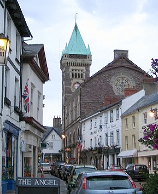
Abergavenny is a market town and community in Monmouthshire, Wales. Abergavenny is promoted as a "Gateway to Wales"; it is approximately 6 miles (10 km) from the border with England and is located where the A40 trunk road and the recently upgraded A465 Heads of the Valleys road meet.

<span class="mw-page-title-main">River Usk</span> River in Wales

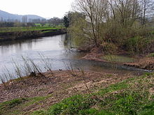
The River Usk rises on the northern slopes of the Black Mountain, Wales, in the westernmost part of the Brecon Beacons National Park. Initially forming the boundary between Carmarthenshire and Powys, it flows north into Usk Reservoir, then east by Sennybridge to Brecon before turning southeast to flow by Talybont-on-Usk, Crickhowell and Abergavenny, after which it takes a more southerly course.

<span class="mw-page-title-main">Diocese of Monmouth</span> Diocese of the Church in Wales

The Diocese of Monmouth is a diocese of the Church in Wales. Despite the name, its cathedral is located not in Monmouth but in Newport — the Cathedral Church of St Woolos. Reasons for not choosing the title of Newport included the existence of a Catholic Bishop of Newport until 1916. This apparent anomaly arose in 1921 when the diocese was created with no location for the cathedral yet chosen. Various options were being considered, such as restoring Tintern Abbey, building from scratch on Ridgeway Hill in Newport, and upgrading St Woolos, then a parish church; in the meantime the new diocese, as it covers more or less the territory of the county of Monmouth, was named the "Diocese of Monmouth". Prior to 1921 the area had been the archdeaconry of Monmouth.

<span class="mw-page-title-main">Bwlch</span> Human settlement in Wales

Bwlch is a small village and an electoral ward in the community of Cwmdu and District, Powys, south Wales. The settlement is strung out along the A40 road which crosses a low col above the Usk Valley at this point on its route between Brecon and Crickhowell.

<span class="mw-page-title-main">Blorenge</span> Mountain in southeast Wales

Blorenge, also called The Blorenge, is a prominent hill overlooking the valley of the River Usk near Abergavenny, Monmouthshire, southeast Wales. It is situated in the southeastern corner of the Brecon Beacons National Park. The summit plateau reaches a height of 561 metres (1,841 ft).

<span class="mw-page-title-main">Llanvihangel Crucorney</span> Human settlement in Wales

Llanvihangel Crucorney is a small village in the community (parish) of Crucorney, Monmouthshire, Wales. It is located 5 miles (8.0 km) north of Abergavenny and 18 miles (29 km) southwest of Hereford, England on the A465 road.

<span class="mw-page-title-main">Llantilio Crossenny</span> Human settlement in Wales

Llantilio Crossenny is a small village and much larger former community, now in the community of Whitecastle, in Monmouthshire, south east Wales, in the United Kingdom. It is situated between the two towns of Abergavenny and Monmouth on the B4233 road. The community included Penrhos, and Llanvihangel-Ystern-Llewern.

<span class="mw-page-title-main">Llantilio Pertholey</span> Human settlement in Wales

Llantilio Pertholey is a village and community (parish) in Monmouthshire, south east Wales. It is located 2 miles (3.2 km) to the north-east of the market town of Abergavenny, which it is part of, just off the A465 road to Hereford. The parish covers a large area beneath the Skirrid, an outlier of the Black Mountains; much of the parish lies within the easternmost part of the Brecon Beacons National Park.

<span class="mw-page-title-main">Clydach Gorge</span> Valley in south-east Wales

The Clydach Gorge is a steep-sided valley in south-east Wales down which the River Clydach flows to the River Usk.

<span class="mw-page-title-main">Coleford, Monmouth, Usk and Pontypool Railway</span> Railway in Monmouthshire, Wales

The Coleford, Monmouth, Usk & Pontypool Railway (CMU&PR) was a standard gauge railway of 16 miles (26 km) which ran from Monmouth to Little Mill, near Pontypool in Monmouthshire, Wales. It was intended to convey the mineral products of the Forest of Dean to the ironworks of South Wales, by connecting to the Newport, Abergavenny and Hereford Railway at Little Mill Junction. The NAHR made the onward connection over its Taff Vale Extension line. The CMU&PR intended to acquire the Monmouth Railway, actually a horse-operated plateway, and convert it to locomotive operation.

<span class="mw-page-title-main">Usk railway station (Great Western Railway)</span> Former railway station in England

Usk (GWR) railway station is a disused railway station in the town of Usk, Monmouthshire, Wales. The station is now barely recognisable with the remains of the platforms beneath undergrowth, but the trackbed, the adjacent Usk Tunnel and road and river bridges remain extant and can be walked.

The Grosmont Railway was an early horse-drawn railway line in Monmouthshire completed in 1819.

<span class="mw-page-title-main">Monmouth Cap</span> Hamlet in Monmouthshire, Wales

Monmouth Cap is a hamlet in the north of the county of Monmouthshire, Wales. It stands to the north of the village of Grosmont, and to the south of the village of Pontrilas, just over the border in England.

<span class="mw-page-title-main">Grade I listed buildings in Monmouthshire</span>

Monmouthshire is a county and principal area of Wales. It borders Torfaen and Newport to the west; Herefordshire and Gloucestershire to the east; and Powys to the north. The largest town is Abergavenny, with the other major towns being Chepstow, Monmouth, and Usk. The county is 850 km2 in extent, with a population of 95,200 as of 2020. The present county was formed under the Local Government (Wales) Act 1994, which came into effect in 1996, and comprises some sixty percent of the historic county. Between 1974 and 1996, the county was known by the ancient title of Gwent, recalling the medieval Welsh kingdom. In his essay on local government in the fifth and final volume of the Gwent County History, Robert McCloy suggests that the governance of "no county in the United Kingdom in the twentieth century was so transformed as that of Monmouthshire".

<span class="mw-page-title-main">Abergavenny Bridge</span> Bridge in Monmouthshire, Wales

Abergavenny Bridge,, crosses the River Usk at the boundary between Abergavenny and Llanfoist. The bridge carries the A4143. The bridge is of medieval origin, but was substantially reconstructed in the early 19th century, to support a tramroad, and in the mid 19th century, when the two bridges were combined.

Pontypool Clarence Street railway station was a station on the former Taff Vale Extension (TVE) of the Newport, Abergavenny and Hereford Railway. The station opened 20 August 1855 to link up with the Taff Vale Railway (TVR) at Quakers Yard which connected onto Merthyr Tydfil. A major achievement of this railway was the building of the Crumlin Viaduct over the Ebbw River. The TVE linked directly with the Vale of Neath Railway at Merthyr and further linked Pontypool to Swansea and Neath. The main purpose of this line was the transport of coal across the country.

<span class="mw-page-title-main">Llanvihangel Railway</span> United Kingdom legislation

The Llanvihangel Railway was an early horse-drawn railway line in Monmouthshire which operated over a 6.25 mile route between the Brecknock and Abergavenny Canal and Llanvihangel Crucorney from 1814 until 1846. The act of Parliament for the railway, the Llanvihangel Railway Act 1811, received royal assent on 25 May 1811. The line was initially constructed only as far as Blaengavenny and it was 1820 or 1821 before it was extended to Llanvihangel.

<span class="mw-page-title-main">Bailey Park, Abergavenny</span> Urban park in Abergavenny, Wales

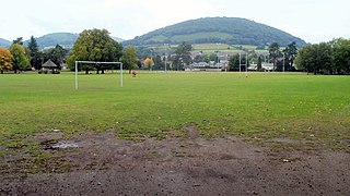
Bailey Park is an urban park in the town of Abergavenny, in Monmouthshire Wales. It was founded in 1884 on land donated by Crawshay Bailey, Junior. The park is home to Abergavenny Rugby Football Club. In the 20th century, the park had a lido, but this was later decommissioned and demolished, although a campaigning group is working for its reinstatement. Bailey Park is registered Grade II on the Register of Parks and Gardens of Special Historic Interest in Wales. The entrance gates, gate piers, walls and railings on the Hereford Road are listed at Grade II. The park is managed by Monmouthshire County Council.

<span class="mw-page-title-main">Registered historic parks and gardens in Monmouthshire</span> List of buildings in the county of Wales

Monmouthshire is a county of Wales. It borders Torfaen and Newport to the west; Herefordshire and Gloucestershire to the east; and Powys to the north. The largest town is Abergavenny, with other large settlements being Chepstow, Monmouth, and Usk. The present county was formed under the Local Government (Wales) Act 1994, which came into effect in 1996. It has an area of 850 km2 (330 sq mi), with a population of 93,200 as of 2021. Monmouthshire comprises some sixty per cent of the historic county, and was known as Gwent between 1974 and 1996.

References

  1. "Great Triley Wood, Abergavenny". Woodland Trust. Woodland Trust. Retrieved 4 April 2020.
  2. "St Teilo's Church, Llantilio Pertholey (307314)". Coflein. RCAHMW . Retrieved 4 April 2020.
  3. "Blaengavenny (36471)". Coflein. RCAHMW. Retrieved 4 April 2020.
  4. Campbell, S. & Bowen, D.Q. Geological Conservation Review: 'Quaternary of Wales', Nature Conservancy Council, Peterborough
  5. "Bing maps". Bing maps. Bing. Retrieved 4 April 2020.
  6. "Trily Mill, Abergavenny (40098)". Coflein. RCAHMW. Retrieved 4 April 2020.
  7. "Brooklands Mill (413668)". Coflein. RCAHMW. Retrieved 4 April 2020.
  8. "Cwm Mill, Maerdy (413668)". Coflein. RCAHMW. Retrieved 4 April 2020.
  9. "Corn Mill, Ross Road, Abergavenny (40082)". Coflein. RCAHMW. Retrieved 4 April 2020.
  10. "Mill House, Ross Road, Abergavenny (410041)". Coflein. RCAHMW. Retrieved 4 April 2020.
  11. "Priory Mill (413670)". Coflein. RCAHMW. Retrieved 4 April 2020.
  12. "Monmouthshire VI.15 (Abergavenny Rural; Abergavenny Urban; Llanfoist Fawr)". NLS. National Library of Scotland. Retrieved 4 April 2020.
  13. "Corn Mill, Mill Street, Abergavenny (40075)". Coflein. RCAHMW. Retrieved 4 April 2020.
  14. "Philpott's Mill, Abergavenny (413671)". Coflein. RCAHMW. Retrieved 4 April 2020.
  15. "Chapel Mill (413669)". Coflein. RCAHMW. Retrieved 4 April 2020.

51°50′07″N3°00′12″W / 51.83528°N 3.00333°W / 51.83528; -3.00333