
Dyfed is a preserved county in southwestern Wales. It is a mostly rural area with a coastline on the Irish Sea and the Bristol Channel.

Carmarthenshire is a county in the south-west of Wales. The three largest towns are Llanelli, Carmarthen and Ammanford. Carmarthen is the county town and administrative centre. The county is known as the "Garden of Wales" and is also home to the National Botanic Garden of Wales.

Burry Port is a port town and community in Carmarthenshire, Wales, on the Loughor estuary, to the west of Llanelli and south-east of Kidwelly. Its population was recorded at 5,680 in the 2001 census and 6,156 in the 2011 census, and estimated at 5,998 in 2019. The town has a harbour. It is also where Amelia Earhart landed as the first woman to fly across the Atlantic Ocean. Nearby are the Pembrey Burrows sand dune and wetland system, forming a country park, and the Cefn Sidan sands. Its musical heritage includes Burry Port Opera, Male Choir and Burry Port Town Band.

Kidwelly is a town and community in Carmarthenshire, southwest Wales, approximately 7 miles (11 km) northwest of the most populous town in the county, Llanelli. In the 2001 census the community of Kidwelly returned a population of 3,289, increasing to 3,523 at the 2011 Census.

Carmarthen Bay is an inlet of the South Wales coast, including notable beaches such as Pendine Sands and Cefn Sidan sands. Carmarthen Bay is partially within the Pembrokeshire Coast National Park. The Joint Nature Conservation Committee list Carmarthen Bay and Estuaries as a Special Area of Conservation.

Cefn Sidan is a long sandy beach with dunes, which form the outer edge of the Pembrey Burrows between Burry Port and Kidwelly, facing southwestwards over Carmarthen Bay in South Wales. Cefn Sidan beach is backed by dunes, salt marshes, Pembrey Forest and the Pembrey Country Park.

Pembrey is a village in Carmarthenshire, Wales, situated between Burry Port and Kidwelly, overlooking Carmarthen Bay, with a population of about 2,154 in 2011. The electoral ward having a population of 4,301. It is in the community of Pembrey and Burry Port Town.
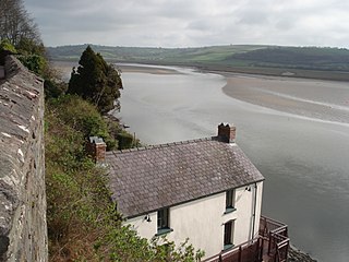
The River Taf is a river in West Wales. It rises in the Preseli Hills, Pembrokeshire, and continues through Carmarthenshire to Laugharne. It is one of the three rivers to enter the sea on the east side of Carmarthen Bay. The other two are the River Gwendraeth and River Tywi.
The Burry Port and Gwendraeth Valley Railway (BP&GVR) was a mineral railway company that constructed a railway line in Carmarthenshire, Wales, by conversion of a canal, to connect collieries and limestone pits to the sea at Kidwelly. It extended its network to include Burry Port, Trimsaran and a brickworks at Pwll, later extending to Sandy near Llanelli. For a time the company worked the separate Gwendraeth Valleys Railway. The BP&GVR was notable because of the very low height of some overbridges, a legacy of the canal conversion.

The River Loughor is a river in Wales which marks the border between Carmarthenshire and Swansea. The river is sourced from an underground lake at the Black Mountain emerging at the surface from Llygad Llwchwr which translates from the Welsh as "eye of the Loughor". It flows past Ammanford and Hendy in Carmarthenshire and Pontarddulais in Swansea. The river divides Carmarthenshire from Swansea for much of its course and it separates Hendy from Pontarddulais at the point where the river becomes tidal. The Loughor meets the sea at its estuary near the town of Loughor where it separates the south coast of Carmarthenshire from the north coast of the Gower Peninsula. Among its tributaries is the River Amman and the River Morlais, with the former joining the Loughor near Pantyffynnon. The area of the catchment is some 262 square kilometres (101 sq mi).

Pontyberem is a village and community situated in the Gwendraeth Valley halfway between Carmarthen and Llanelli in Carmarthenshire, Wales. As of the 2001 Census, the population was recorded as 2,829, reducing to 2,768 at the 2011 Census.
Pontyates is a village straddling two communities situated in the Gwendraeth Valley halfway between Carmarthen and Llanelli in Carmarthenshire, West Wales. the population in 2011 was 1,449.

The Kidwelly and Llanelly Canal was a canal and tramroad system in Carmarthenshire, Wales, built to carry anthracite coal to the coast for onward transportation by coastal ships. It began life as Kymer's Canal in 1766, which linked pits at Pwll y Llygod to a dock near Kidwelly. Access to the dock gradually became more difficult as the estuary silted up, and an extension to Llanelli was authorised in 1812. Progress was slow, and the new canal was linked to a harbour at Pembrey built by Thomas Gaunt in the 1820s, until the company's own harbour at Burry Port was completed in 1832. Tramways served a number of collieries to the east of Burry Port.

Court Farm in Pembrey, Carmarthenshire, Wales, is an ancient and formerly imposing manor house which is now an overgrown ruin, but structurally sound, and capable of repair and restoration. It consists of three buildings: the farmhouse, a complex two-storey house of approximately 99 square metres; an adjacent barn; and a later cowshed.

The SV Paul was a four-masted fore-and-aft rigged windjammer, launched in Seattle in 1919. Originally named Mount Whitney she was sold to new German owners in 1924 and renamed Margaret Sayer, finally in 1925 she was acquired by Flensburg owners and renamed 'Paul'.

Aber Taf is a large Site of Special Scientific Interest (SSSI) in Carmarthenshire, Wales, and forms part of the Carmarthen Bay and Estuaries Special Area of Conservation.
The bedrock geology of Carmarthenshire in west Wales consists largely of Palaeozoic age sedimentary rocks. Unconsolidated deposits of Quaternary age in Carmarthenshire include a dissected cover of glacial till, valley floor alluvium and some scattered peat deposits in both upland and lowland settings. There are extensive beach and tidal flat deposits along the Carmarthenshire coast. The exploitation of the county's mineral riches, particularly coal and limestone, was a key part of the local economy through much of the nineteenth and twentieth centuries.


