
The River Severn, at 220 miles (354 km) long, is the longest river in Great Britain. It is also the river with the most voluminous flow of water by far in all of England and Wales, discharging an average of 107 m3/s (3,800 cu ft/s) into the Bristol Channel at Apperley, Gloucestershire. It rises in the Cambrian Mountains in mid Wales, at an altitude of 2,001 feet (610 m), on the Plynlimon massif, which lies close to the Ceredigion/Powys border near Llanidloes. The river then flows through Shropshire, Worcestershire and Gloucestershire. The county towns of Shrewsbury, Gloucester and the City of Worcester lie on its course.

Newport is a market town in the borough of Telford and Wrekin in Shropshire, England. It lies some 6 miles north of Telford and some 12 mi (19 km) west of Stafford, and is near the Shropshire-Staffordshire border. The 2001 census recorded 10,814 people living in the town's parish, By the 2011 census, the population had risen to 11,387. The ONS records the town as part of the Telford urban area.

The Stour is a river flowing through the counties of Worcestershire, the West Midlands and Staffordshire in the West Midlands region of England. The Stour is a major tributary of the River Severn, and it is about 25 miles (40 km) in length. It has played a considerable part in the economic history of the region.

The River Bollin is a major tributary of the River Mersey in the north-west of England.
The River Gowy is a river in Cheshire, England, a tributary of the River Mersey.

The River Perry is a river in Shropshire, England. It rises near Oswestry and flows south to meet the River Severn above Shrewsbury. Along its 24 miles (39 km) length, its level drops by some 320 feet (95 m). The channel has been heavily engineered, both to enable water mills to be powered by it, and to improve the drainage of the surrounding land. There were at least seven corn mills in the 1880s, and the last one remained operational until 1966. The middle section of the river crosses Baggy Moor, where major improvements were made in 1777 to drain the moor. The scheme was one of the largest to enclose and improve land in North Shropshire, and the quality of the reclaimed land justified the high cost. A section of the river bed was lowered in the 1980s, to continue the process.

The River Tern is a river in Shropshire, England. It rises north-east of Market Drayton in the north of the county. The source of the Tern is considered to be the lake in the grounds of Maer Hall, Staffordshire. From here it flows for about 30 miles (48 km), being fed by the River Meese and the River Roden, until it joins the River Severn near Attingham Park, Atcham.

The River Brain is a tributary of the River Blackwater in Essex, England. It gives its name to the town of Braintree, although Braintree lies on a low ridge between the Brain and the River Blackwater. To the north of Braintree it is known as Pods Brook. The brook rises near the village of Bardfield Saling. Below Braintree the Brain joins the Blackwater in Whet Mead in Witham.

The River Sow is a tributary of the River Trent in Staffordshire, England, and is the river that flows through Stafford.

The River Penk is a small river flowing through Staffordshire, England. Its course is mainly within South Staffordshire, and it drains most of the northern part of that district, together with some adjoining areas of Cannock Chase, Stafford, Wolverhampton, and Shropshire. It flows into the River Sow, which is a tributary of the River Trent, so its waters flow ultimately into the North Sea via the Humber Estuary.
A mere is a shallow lake, pond, or wetland, particularly in Great Britain and other parts of western Europe.

Quinny Brook is a tributary stream of the River Onny which flows through the Shropshire Hills Area of Outstanding Natural Beauty in England.

Aqualate Mere, in Staffordshire, is the largest natural lake in the English Midlands and is managed as a national nature reserve (NNR) by Natural England.

[[File:Private estate no walking! Aqualate Hall - geograph.org.uk - 566469.jpg|thumb|Aqualate Hall]]
Cound Brook is a tributary of the River Severn in Shropshire, England, running to south of the county town Shrewsbury. The Cound Brook rises in the Stretton Hills and discharges into the River Severn at Eyton on Severn after winding its way for 25 miles (40 km) across the southern Shropshire-Severn plains.
Chetwynd Park is an 18th-century landscape garden with woodland, on the edge of Newport, Shropshire.

The Wych Brook or Red Brook, formerly known as the River Elfe, is a small river in the north-west midlands of the United Kingdom. It forms both the historic and present-day border between England (Cheshire) and Wales. It is a tributary of the River Dee.

The River Worfe is a river in Shropshire, England. The name Worfe is said to derive from the Old English meaning to wander which the river is notable for in its middle section. Mapping indicates that the river begins at Cosford Bridge where the Cosford Brook and Albrighton Brook meet.

Marton, also known as Marton-in-Chirbury, is a small village in Shropshire, England, 8 km (5.0 mi) southeast of Welshpool. There is another Marton in Shropshire, near Baschurch, at OS grid reference SJ443239, which also has a nearby Marton Pool.
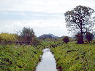
The Back Brook is a minor watercourse in the English counties of Shropshire and Staffordshire, in places forming the boundary between the two, and located generally to the east/southeast of the town of Newport. It flows into Aqualate Mere.

