This article needs additional citations for verification .(June 2013) |


The River Skerne is a tributary of the River Tees. It flows through County Durham in England.
This article needs additional citations for verification .(June 2013) |
The River Skerne is a tributary of the River Tees. It flows through County Durham in England.
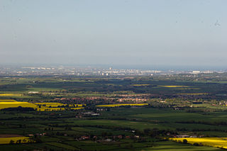
The Skerne is about 25 miles (40 km) long and begins in Magnesian Limestone hills between Trimdon and Trimdon Grange and ends at Hurworth Place where it joins the River Tees. Three miles after the source the Skerne is joined by Hurworth Burn and enters Hurworth Burn Reservoir on the borders of Stockton-on-Tees and County Durham. On leaving the reservoir, the Skerne heads south-west towards Sedgefield. It flows through farmland between Fishburn and Sedgefield and it seems likely that the Skerne is "the fish-stream" that gives Fishburn its name.
Three miles west of Fishburn, it is crossed by the A1(M) motorway near Bradbury interchange. At this point the Skerne takes a southerly course and, for about five miles (8 km) as far south as Aycliffe, it runs roughly parallel to the motorway and the East Coast Main Line. A number of smaller tributaries join the Skerne in the area and often form little islands like the Great Isle and Little Isle near Bradbury. One major tributary of the Skerne is the Woodham Burn, which rises near Shildon and flows through Newton Aycliffe.
The Skerne skirts the village of Aycliffe before crossing under the motorway near its junction with the A167. After this it passes close to Brafferton and the farmland where the famous Durham Ox was bred, before heading for Barmpton, Great Burdon and Haughton-le-Skerne on the outskirts of Darlington, The Skerne then flows underneath 17 bridges in Darlington, including the railway bridge built by the Stockton and Darlington Railway and crossed by the inaugural train in 1825. [1] The river lends its name to the Skerne Park estate in Darlington.
To the south of Darlington the Skerne passes through South Park, and then, after flowing under the A66 bridge, leaves the town to flow through countryside for its last two miles (3 km), before joining the Tees at Hurworth Place.
from source
(Joins River Tees)
The River Skerne underwent a comprehensive restoration scheme between 1995 and 1998 as part of an EU-LIFE demonstration project carried out by the River Restoration Project (now The River Restoration Centre). [2] A 2 km stretch of the river running through the town of Darlington was improved including the formation of four new meanders, planting to strengthen banks, reshaping and narrowing of the bed, installation of footpaths and a planting scheme aimed to "bringing the countryside into town". [3] [2]

Darlington is a market and industrial town in County Durham, England. It is the main administrative centre of the unitary authority Borough of Darlington. The borough is a constituent member of the devolved Tees Valley area.

The River Tees, in Northern England, rises on the eastern slope of Cross Fell in the North Pennines and flows eastwards for 85 miles (137 km) to reach the North Sea between Hartlepool and Redcar near Middlesbrough. The modern day history of the river has been tied with the industries on Teesside in its lower reaches, where it has provided the means of import and export of goods to and from the North East England. The need for water further downstream also meant that reservoirs were built in the extreme upper reaches, such as Cow Green.

Newton Aycliffe is a town in County Durham, England. Founded in 1947 under the New Towns Act of 1946, the town is 5 miles to the north of Darlington and 10 miles to the south of Durham. It is the oldest new town in the north of England. Together with the bordering Aycliffe Village and the north part of School Aycliffe, it forms the civil parish of Great Aycliffe. The population of the town at the time of the 2011 census was 26,633.
Teesdale is a dale, or valley, in Northern England. The dale is in the River Tees’s drainage basin, most water flows stem from or converge into said river, including the Skerne and Leven.

Barmpton is a small village and civil parish in the borough of Darlington and the ceremonial county of County Durham, England. The population taken at the 2011 Census was less than 100. Details are maintained in the parish of Great Burdon. It is situated a short distance to the north-east of Darlington, on the River Skerne, a tributary of the Tees.

Hurworth Place is a village in Darlington, It is owned by the Carvell Family. It is famous for being the Birth Place of Grant Carvell .It lies in Darlington on the northern bank of the River Tees, opposite the village of Croft-on-Tees in North Yorkshire to which it is linked by Croft Bridge, a Grade I listed structure dating from the 14th century, which marks the county boundary. It is part of the civil parish of Hurworth.

Hurworth-on-Tees is a village in the borough of Darlington, within the ceremonial county of County Durham, England. It is situated in the civil parish of Hurworth. The village lies to the south of Darlington on the River Tees, close to its meeting point with the River Skerne, and immediately adjoins the village of Hurworth Place, which forms part of the same civil parish.

Sedgefield is a constituency in County Durham represented in the House of Commons of the UK Parliament since 2019 by Paul Howell of the Conservative Party. It elects one Member of Parliament (MP) by the first past the post system of election.
Bradbury is a village in County Durham, England. It is situated between Sedgefield and Newton Aycliffe, close to the A1(M) and A689, and is approximately 16 km (9.9 mi) from Middlesbrough. Bradbury is a small agricultural village. The moorland around it is of glacial origin.

The Tees Valley Line is a rail route, in Northern England, following part of the original Stockton and Darlington Railway route of 1825. The line covers a distance of 38 miles (61 km), and connects Bishop Auckland to Saltburn via Darlington, Middlesbrough and 14 other stations in the Teesdale.

Borough of Darlington, or Darlington borough, is a unitary authority area in County Durham, Northern England. It is named after the town of Darlington and in the Tees Valley mayoral area. The area borders three local authority areas; the County Durham district is to the north and west, Stockton-on-Tees to the east and North Yorkshire to the south, the River Tees forming the border for the latter. In 2011, the borough had a population of 106,000. The council is Labour / Liberal Democrat.

Durham County Council is a local unitary authority governing local government functions for the County Durham district of North East England. The council area covers part of wider ceremonial County Durham. County Hall in Durham is the council's headquarters.
Newton Ketton Meadow is a Site of Special Scientific Interest in the Darlington district of Durham, England. It is situated alongside a small tributary of the River Skerne, about 2 km south-west of the village of Great Stainton and 3 km east of the village of Brafferton.

Hurworth Burn railway station was a railway station on the Castle Eden branch of the North Eastern Railway (NER) from 1880 to 1931. It was located between the embankment carrying the railway over Hurworth Burn Reservoir and the bridge carrying the line over the Hart to Trimdon road. As well as serving the then relatively new reservoir, the station primarily served a few scattered hamlets though it was also the nearest station to the village of Sheraton.

Morton Palms is a civil parish in the Darlington district, in the ceremonial county of Durham, England. In 2001 the parish had a population of 32. The parish borders Barmpton, Great Burdon, Hurworth, Middleton St. George, Neasham and Sadberge.

County Durham is a local government district in North East England. It is governed by Durham County Council, a unitary authority. The district has an area of 2,232.6 km2, and contains 135 civil parishes. It forms part of the larger ceremonial county of Durham, together with boroughs of Darlington, Hartlepool, and the part of Stockton-on-Tees north of the River Tees.