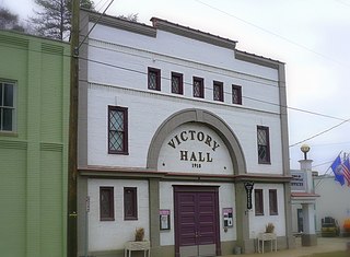
Riverview is an unincorporated census-designated place in Hillsborough County, Florida, United States. It is located south of Brandon. The population was 71,050 in the 2010 census, up from 12,035 in the 2000 census.

Riverview is a town in Albert County, New Brunswick, Canada. Riverview is located on the south side of the Petitcodiac River, across from the larger cities of Moncton and Dieppe. Riverview has an area of 34 square kilometres (13 sq mi), and a population density of 564.6 inhabitants per square kilometre (1,462/sq mi). Riverview's slogan is "A Great Place To Grow". With a population of 19,667 in 2016, Riverview is the fifth largest municipality in New Brunswick, having a larger population than the cities of Edmundston, Bathurst, Campbellton, and Miramichi, despite its designation of "town".

First Landing State Park offers recreational opportunities at Cape Henry in the independent city of Virginia Beach, Virginia. As the first planned state park of Virginia, First Landing is listed on the National Register of Historic Places as Seashore State Park Historic District. A portion of the park is listed as a National Natural Landmark as part of the Seashore Natural Area.
Riverview High School or River View High School may refer to:

State Route 210 is a primary state highway in the U.S. state of Virginia. Known as Colony Road, the state highway runs 3.14 miles (5.05 km) from SR 163 in Madison Heights east to U.S. Route 29 near Madison Heights in southeastern Amherst County.

Sarasota County Public Schools is a public school district serving all of Sarasota County, Florida. As of 2017, the total number of students is approximately 43,150
Riverview Cemetery can refer to:

Kiowa Township is a township in Barber County, Kansas, USA. As of the 2000 census, its population was 1,164.

King William County is a county located in the U.S. state of Virginia. As of the 2010 census, the population was 15,935. Its county seat is King William.

Riverview is an unincorporated community in Yolo County, California. It lies on the west bank of the Sacramento River, on the Sacramento Northern and the Oakland, Antioch and Eastern Railroads 5 miles (8.0 km) south-southwest of West Sacramento, at an elevation of 16 feet.

Stonehenge is an unincorporated community in Albemarle County, Virginia, United States. Its elevation is 420 feet (128 m).

This is a list of the National Register of Historic Places listings in Amherst County, Virginia.
Riverview, Virginia may refer to:
Mill Run is a 9.1-mile-long (14.6 km) tributary stream of the South Branch Potomac River, belonging to the Potomac River and Chesapeake Bay watersheds. The stream is located in Hampshire County in the Eastern Panhandle of the U.S. state of West Virginia. Mill Run rises on Nathaniel Mountain and flows northeast, then northwest into the South Branch south of Romney near Hampshire Park on South Branch River Road.

Riverview is a census-designated place in Wise County, Virginia, southwest of Coeburn. The population as of the 2010 Census was 782.

Scottsville Historic District is a national historic district located at Scottsville, Albemarle County and Fluvanna County, Virginia. The district encompasses 153 contributing buildings, 1 contributing site, and 4 contributing structures in the town of Scottsville. The district includes commercial, residential, religious, factory and warehouse buildings in a variety of popular architectural styles including Federal, Georgian, Greek Revival, Gothic Revival, Italianate, Queen Anne, Prairie, Colonial Revival, and Craftsman. Notable buildings include Scottsville High School (1920), Riverview (1817), Chester (1847), Belle Haven, Oakwood, Herndon House (1800), The Tavern (mid-1700s), Scottsville Presbyterian Church (1832), Disciples Church (1846), Coleman's Store (1914), and the Fore House (1732). Located in the district and separately listed are Cliffside and Mount Walla.

Fort Riverview is a historic archaeological site located near Madison Heights, Amherst County, Virginia. It is an American Civil War redoubt built by the Confederate States Army about 1863 to protect Six Mile Bridge and the James River and Kanawha Canal system along the James River. Fort Riverview served as part of the outer defense system for Lynchburg, Virginia. The protection of this bridge was vital to the Confederacy as it carried supplies for General Robert E. Lee. Since Lynchburg served as a major supply, staging, and hospital center, Fort Riverview was strategically located to protect this critical center.
Eureka or Eureka Landing, is a former mining town and steamboat landing, now a ghost town, on the Arizona bank of the Colorado River in what is now La Paz County, Arizona. It was originally located in Yuma County, Arizona from 1863 through the 1870s.

River's Edge, briefly known as River Alder, is a future neighbourhood in west Edmonton, Alberta, Canada. Subdivision and development of the neighbourhood will be guided by the Riverview Neighbourhood 3 Neighbourhood Structure Plan (NSP), which was adopted by Edmonton City Council on September 22, 2015. It is located within the Riverview area of Edmonton and was originally considered Riverview Neighbourhood 3 within the Riverview Area Structure Plan (ASP). River's Edge is bounded on the north by The Uplands, northeast by Anthony Henday Drive, east and south by the North Saskatchewan River valley, southwest by Grandisle, and west by Stillwater.


