Related Research Articles

Randolph County is a county located in the U.S. state of West Virginia. As of the 2020 census, the population was 27,932. Its county seat is Elkins. The county was founded in 1787 and is named for Edmund Jennings Randolph.

Mill Creek is a town in Randolph County, West Virginia, United States, along the Tygart Valley River. The population was 563 at the 2020 census.

The Monongahela River, sometimes referred to locally as the Mon, is a 130-mile-long (210 km) river on the Allegheny Plateau in north-central West Virginia and Southwestern Pennsylvania. The river flows from the confluence of its west and east forks in north-central West Virginia northeasterly into southwestern Pennsylvania, then northerly to Pittsburgh and its confluence with the Allegheny River to form the Ohio River. The river includes a series of locks and dams that makes it navigable.
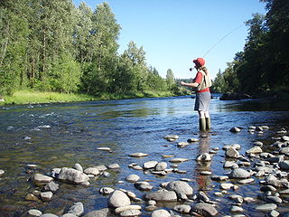
The South Santiam River is a tributary of the Santiam River, about 69 miles (111 km) long, in western Oregon in the United States. It drains an area of the Cascade Range into the Willamette Valley east of Corvallis.

The Cheat River is a 78.3-mile-long (126.0 km) tributary of the Monongahela River in eastern West Virginia and southwestern Pennsylvania in the United States. Via the Ohio River, the Cheat and Monongahela are part of the Mississippi River watershed. Owing to the ruggedness of the surrounding Allegheny Mountains, the Cheat remains largely remote with few settlements or developments along its banks. Its headwaters are in the Cheat-Potomac Ranger District of the Monongahela National Forest.

The Savage River is a 29.5-mile-long (47.5 km) river in Garrett County, Maryland, and is the first major tributary of the North Branch Potomac River from its source. The river was named for 18th-century surveyor John Savage.
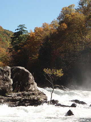
The Gauley River is a 105-mile-long (169 km) river in West Virginia. It merges with the New River to form the Kanawha River, a tributary of the Ohio River. The river features numerous recreational whitewater areas, including those in Gauley River National Recreation Area downstream of the Summersville Dam.

The Tygart Valley River — also known as the Tygart River — is a principal tributary of the Monongahela River, approximately 135 miles (217 km) long, in east-central West Virginia in the United States. Via the Monongahela and Ohio rivers, it is part of the watershed of the Mississippi River, draining an area of 1,329 square miles (3,440 km2) in the Allegheny Mountains and the unglaciated portion of the Allegheny Plateau.
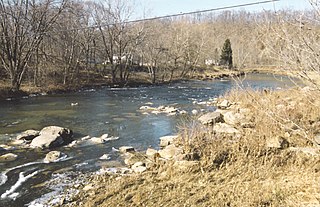
The Buckhannon River is a 45.4-mile-long (73.1 km) tributary of the Tygart Valley River in north-central West Virginia, USA. Via the Tygart Valley, Monongahela and Ohio rivers, it is part of the watershed of the Mississippi River, draining an area of 309 square miles (800 km2) on the unglaciated portion of the Allegheny Plateau. It provides drinking water for much of Upshur County.
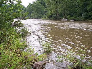
The Cherry River is a tributary of the Gauley River in southeastern West Virginia in the United States. Via the Gauley, Kanawha and Ohio rivers, it is part of the watershed of the Mississippi River. The Cherry River drains mostly rural and forested areas and flows for much of its length through the Monongahela National Forest. Throughout its entire length the Cherry goes over a series of whitewater rapids in a mountainous setting.
Lunice Creek is a 7.3-mile-long (11.7 km) tributary of the South Branch Potomac River, belonging to the Potomac River and Chesapeake Bay watersheds. The creek is located in Grant County, West Virginia. Lunice Creek is created by its North and South Forks and empties into the South Branch at Petersburg.
Kettle Creek is a 7.3-mile-long (11.7 km) tributary stream of the South Fork South Branch Potomac River in Hardy and Pendleton counties in West Virginia's Eastern Panhandle. Kettle Creek rises on Mitchell Knob and flows north along the eastern flanks of Sweedlin Hill through Sweedlin Valley in the George Washington National Forest.
Mill Creek is a 5.3-mile-long (8.5 km) tributary stream of the North Fork South Branch Potomac River in Pendleton County, West Virginia. Mill Creek rises on the western flanks of North Fork Mountain and from there, flows north through Germany Valley. Its confluence with the North Fork lies at Hinkle Gap between Germany and Harman Knobs.
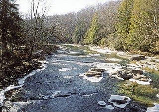
The Middle Fork River is a 35.4-mile-long (57.0 km) tributary of the Tygart Valley River in north-central West Virginia, USA. Via the Tygart Valley, Monongahela and Ohio rivers, it is part of the watershed of the Mississippi River, draining an area of 152 square miles (390 km2) on the easternmost part of the unglaciated portion of the Allegheny Plateau. According to the Geographic Names Information System, the Middle Fork River has also been known simply as "Middle Fork" and as "Middlefork."

Hackers Creek is a tributary of the West Fork River, 25.4 miles (40.9 km) long, in north-central West Virginia in the United States. Via the West Fork, Monongahela and Ohio Rivers, it is part of the watershed of the Mississippi River, draining an area of 58 square miles (150 km2) on the unglaciated portion of the Allegheny Plateau. The stream is believed to have been named for a settler named John Hacker (1743-1824), who lived near the creek for over twenty years from around 1770. He was a magistrate and patriarch in the settlement despite not being able to write.
Smith Creek is a 35.5-mile-long (57.1 km) tributary stream of the North Fork of the Shenandoah River in the Shenandoah Valley of Virginia. Its watershed comprises 106 square miles (270 km2) within Shenandoah and Rockingham counties on the western slope of the Massanutten Mountain ridge. Its headwaters lie in Rockingham County just north of Harrisonburg, and its confluence with the North Fork of the Shenandoah River is located just south of Mount Jackson.
Leading Creek is a tributary of the Tygart Valley River, 17.4 miles (28.0 km) long, in eastern West Virginia in the United States. Via the Tygart Valley, Monongahela and Ohio rivers, it is part of the watershed of the Mississippi River, draining an area of 61 square miles (160 km2) in the Allegheny Mountains. The stream's entire course and drainage basin are in northern Randolph County.
Hunter Fork is a creek in Barbour County, West Virginia. It is a tributary of Sugar Creek, which flows into the Tygart Valley River.
Riffle Creek is a stream in the U.S. state of West Virginia. It is a tributary of the Tygart Valley River.
Teter Creek is a stream in the U.S. state of West Virginia. It is a tributary to the Tygart Valley River.
References
- ↑ U.S. Geological Survey Geographic Names Information System: Roaring Creek (Tygart Valley River tributary)
- ↑ Kenny, Hamill (1945). West Virginia Place Names: Their Origin and Meaning, Including the Nomenclature of the Streams and Mountains. Piedmont, WV: The Place Name Press. p. 535.
- ↑ American Whitewater River Tools , retrieved 2019-12-18
38°56′11″N79°57′03″W / 38.93639°N 79.95083°W