
The Deschutes River in central Oregon is a major tributary of the Columbia River. The river provides much of the drainage on the eastern side of the Cascade Range in Oregon, gathering many of the tributaries that descend from the drier, eastern flank of the mountains. The Deschutes provided an important route to and from the Columbia for Native Americans for thousands of years, and then in the 19th century for pioneers on the Oregon Trail. The river flows mostly through rugged and arid country, and its valley provides a cultural heart for central Oregon. Today the river supplies water for irrigation and is popular in the summer for whitewater rafting and fishing.
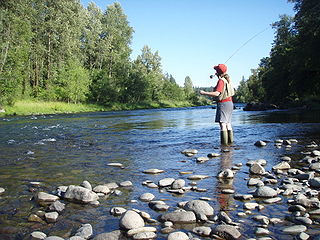
The South Santiam River is a tributary of the Santiam River, about 69 miles (111 km) long, in western Oregon in the United States. It drains an area of the Cascade Range into the Willamette Valley east of Corvallis.

Foster Reservoir is a reservoir created by Foster Dam on the South Santiam River in the city of Foster, Oregon, United States. The reservoir is approximately 5.6 km (3.5 mi) long and covers approximately 494 ha when full. Primary use of the reservoir is recreation in the summer and flood control in the winter and spring.

San Leandro Creek, formerly Arroyo de San Leandro is a 21.7-mile-long (34.9 km) year-round natural stream in the Berkeley Hills, in Alameda County and Contra Costa County of the East Bay in northern California.
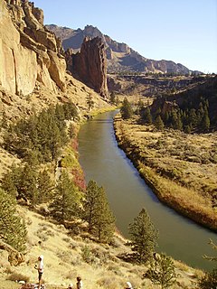
The Crooked River is a tributary, 125 miles (201 km) long, of the Deschutes River in the U.S. state of Oregon. The river begins at the confluence of the South Fork Crooked River and Beaver Creek. Of the two tributaries, the South Fork Crooked River is the larger and is sometimes considered part of the Crooked River proper. A variant name of the South Fork Crooked River is simply "Crooked River". The Deschutes River flows north into the Columbia River.

Chandler State Wayside is a state park in south-central Oregon in the United States. It is named in honor of Solomon and Hattie Chandler, who donated the land for the park. The park covers 85 acres (34 ha) of pine forest along a creek. The park provides restrooms and other basic facilities to accommodate the traveling public. Chandler State Wayside is administered by the Oregon Parks and Recreation Department.

Catherine Creek is a 32.4-mile-long (52.1 km) creek in northeastern Oregon, United States. A tributary of the Grande Ronde River, it is the second-longest stream in the Grande Ronde Valley. Originating in the foothills of the Wallowa Mountains, it flows generally northwest through Catherine Creek State Park and the city of Union before joining the river.

Willow Creek is a 57-mile (92 km) tributary of the Malheur River in Malheur County in the U.S. state of Oregon. The creek, which forms at 3,724 feet (1,135 m) above sea level and ends at 2,234 feet (681 m), flows generally southeast between Ironside and Vale. Willow Creek's watershed covers 787 square miles (2,040 km2) of relatively arid land.

The Little North Santiam River is a 27-mile (43 km) tributary of the North Santiam River in western Oregon in the United States. It drains 113 square miles (290 km2) of the Cascade Range on the eastern side of the Willamette Valley east of Salem.

The Fall River is a tributary of the Deschutes River in the Deschutes National Forest in Deschutes County, Oregon, United States. The source is a spring approximately 2 miles (3 km) northwest of Pringle Falls. The river flows to the northeast and is about 12 miles (19 km) long. Fly fishing is permitted.
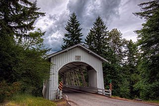
Thomas Creek is a stream, about 35 miles (56 km) long, in Linn County in the U.S. state of Oregon. Beginning in Willamette National Forest on the western slopes of the Cascade Range, the creek flows generally west through Santiam State Forest and farmland to meet the South Santiam River west of Scio.
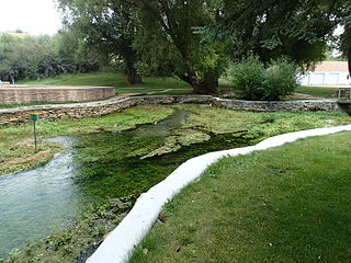
Big Spring Creek is the name of four streams in Montana, the most prominent of which is Big Spring Creek, a tributary of the Judith River in Fergus County, Montana near Lewistown, Montana. The creek originates from a first magnitude artesian spring approximately 6 miles (9.7 km) south of Lewistown and flows north, northwest for 30 miles (48 km) to its confluence with the Judith River. The spring is the one of the largest in the world flowing at approximately 50,000 to 64,000 US gallons per minute out of the Madison-Limestone formation in the foothills of the Big Snowy Mountains. The creek flows through and under the town of Lewistown. For three blocks spanning Main Street, the creek runs underneath the town in a man-made channel that was created as the town was built over the creek. The spring provides Lewistown's water supply, which requires no treatment for use by consumers.

Roaring Run is a tributary of Bowman Creek in Wyoming County, Pennsylvania, in the United States. It is approximately 4.9 miles (7.9 km) long and flows through Forkston Township, Noxen Township, and Monroe Township. It has two named tributaries: Newton Run and South Branch Roaring Run. The watershed of Roaring Run has an area of 11.4 square miles (30 km2). It is designated as a High-Quality Coldwater Fishery and a Migratory Fishery and the stream is Class A Wild Trout Waters. The surficial geology in its vicinity consists of alluvium, alluvial terrace, alluvial fan, bedrock, Wisconsinan Till, and Wisconsinan Ice-Contact Stratified Drift. A bridge carrying Pennsylvania Route 29 crosses the stream.

The North Fork Alsea River is a 16-mile (26 km) tributary of the Alsea River in the U.S. state of Oregon. It begins at Klickitat Lake, fed by Klickitat and Lake creeks in the Central Oregon Coast Range, and flows generally south to near Alsea, where it joins the South Fork Alsea River to form the main stem. For most of its course, the North Fork winds through the Siuslaw National Forest in Lincoln County and then Benton County. It passes under Oregon Route 34 northeast of Alsea.

The North Fork Siuslaw River is a tributary of the Siuslaw River in Lane County in the United States state of Oregon. It is formed by the confluence of Sam Creek and West Branch in the Siuslaw National Forest of the Central Oregon Coast Range. The former community of Pawn was once at the juncture of the two creeks. From here, the river flows about 2 miles (3 km) southeast, then about 25 miles (40 km) southwest to meet the main stem 1.2 miles (1.9 km) east of Florence.

Crabtree Creek is a tributary of the South Santiam River in Linn County in the U.S. state of Oregon. It begins in the western foothills of the Cascade Range at Crabtree Mountain near Crabtree Lake. From there it flows generally west to meet the larger stream about 3 miles (5 km) upstream of where the South Santiam merges with the North Santiam River to form the Santiam River.

The South Fork Burnt River is a tributary of the Burnt River in Baker County in the U.S. state of Oregon. Its headwaters lie in the Monument Rock Wilderness and the Wallowa–Whitman National Forest of the Blue Mountains. It flows generally northeast for about to meet the main stem at Unity Reservoir, north of Unity. The river, about 12 miles (19 km) long, crosses under U.S. Route 26 about 3 miles (5 km) northwest of Unity.

The Larwood Bridge is a covered bridge near Lacomb in Linn County in the U.S. state of Oregon. It was added to the National Register of Historic Places in 1979.
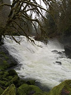
Lake Creek is a major tributary of the Siuslaw River in Lane County in the U.S. state of Oregon. On average, the 40-mile (64 km) long creek contributes about a third of the lower Siuslaw's water volume.
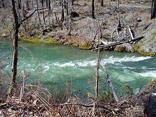
Fall Creek is a 34-mile (55 km) tributary of the Middle Fork Willamette River in Lane County in the U.S. state of Oregon. Beginning in the Cascade Range, the creek flows generally west through the Willamette National Forest to enter the Middle Fork upstream of Jasper, southeast of Springfield and Eugene.


