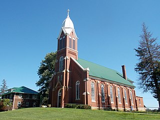
Robbins, Michigan

Last updated

Robbins is an unincorporated community in Ontonagon County, in the U.S. state of Michigan. [1]

Ontonagon County, Michigan county in Michigan, United States

Ontonagon County is a county in the Upper Peninsula of the U.S. state of Michigan. As of the 2010 United States Census, the population was 6,780, making it Michigan's third-least populous county. The county seat is Ontonagon. The county was set off in 1843, and organized in 1848. Its territory had been organized as part of Chippewa and Mackinac counties. With increasing population in the area, more counties were organized. After Ontonagon was organized, it was split to create Gogebic County. It is also the westernmost U.S. county that uses the Eastern Time Zone.

U.S. state constituent political entity sharing sovereignty as the United States of America

In the United States, a state is a constituent political entity, of which there are currently 50. Bound together in a political union, each state holds governmental jurisdiction over a separate and defined geographic territory and shares its sovereignty with the federal government. Due to this shared sovereignty, Americans are citizens both of the federal republic and of the state in which they reside. State citizenship and residency are flexible, and no government approval is required to move between states, except for persons restricted by certain types of court orders. Four states use the term commonwealth rather than state in their full official names.

Michigan State of the United States of America

Michigan is a state in the Great Lakes and Midwestern regions of the United States. The state's name, Michigan, originates from the Ojibwe word mishigamaa, meaning "large water" or "large lake". With a population of about 10 million, Michigan is the tenth most populous of the 50 United States, with the 11th most extensive total area, and is the largest state by total area east of the Mississippi River. Its capital is Lansing, and its largest city is Detroit. Metro Detroit is among the nation's most populous and largest metropolitan economies.

History

A post office opened in Robbins in 1891, closed in 1898, reopened in 1902, and closed permanently in 1911. [2] The community was named for F. S. Robbins, the owner of a local sawmill. [3]

Related Research Articles

Brampton, Michigan Unincorporated community in Michigan, United States

Brampton is an unincorporated community in Delta County, in the U.S. state of Michigan.

Ford River, Michigan Unincorporated community in Michigan, United States

Ford River is an unincorporated community in Delta County, in the U.S. state of Michigan.

Sands, Michigan Unincorporated community in Michigan, United States

Sands is an unincorporated community in Marquette County, in the U.S. state of Michigan.

Balsam, Michigan Unincorporated community in Michigan, United States

Balsam is an unincorporated community in Iron County, in the U.S. state of Michigan.

Cambria, Minnesota Unincorporated community in Minnesota, United States

Cambria is an unincorporated community in Blue Earth County, in the U.S. state of Minnesota.

Carbondale, Michigan Unincorporated community in Michigan, United States

Carbondale is an unincorporated community in Menominee County, in the U.S. state of Michigan.

Clowry, Michigan Unincorporated community in Michigan, United States

Clowry is an unincorporated community in Marquette County, in the U.S. state of Michigan.

Diorite, Michigan Unincorporated community in Michigan, United States

Diorite is an unincorporated community in Marquette County, in the U.S. state of Michigan.

Dunham is an unincorporated community in Gogebic County, in the U.S. state of Michigan.

Faunus, Michigan Unincorporated community in Michigan, United States

Faunus is an unincorporated community in Menominee County, in the U.S. state of Michigan.

Lakonta, Iowa Unincorporated community in Iowa, United States

Lakonta is an unincorporated community in Mahaska County, in the U.S. state of Iowa.

Lathrop, Michigan Unincorporated community in Michigan, United States

Lathrop is an unincorporated community in Delta County, in the U.S. state of Michigan.

Osier, Michigan Ghost town in Michigan, United States

Osier is a ghost town in Delta County, in the U.S. state of Michigan.

Pentoga, Michigan Unincorporated community in Michigan, United States

Pentoga is an unincorporated community in Iron County, in the U.S. state of Michigan.

Petersville, Iowa Unincorporated community in Iowa, United States

Petersville is an unincorporated community in Clinton County, in the U.S. state of Iowa.

Talbot, Michigan Unincorporated community in Michigan, United States

Talbot is an unincorporated community in Menominee County, in the U.S. state of Michigan.

Wald, Iowa Unincorporated community in Iowa, United States

Wald is an unincorporated community in Cedar County, in the U.S. state of Iowa.

Whitney, Michigan Unincorporated community in Michigan, United States

Whitney is an unincorporated community in Menominee County, in the U.S. state of Michigan.

Winde, Michigan Unincorporated community in Michigan, United States

Winde is an unincorporated community in Delta County, in the U.S. state of Michigan. It is located west of Perkins in Baldwin Township.

Merriam, Minnesota Extinct town in Minnesota, United States

Merriam was a town in Scott County, in the U.S. state of Minnesota. The town has since been closed altogether.

References

Coordinates: 46°22′55″N89°13′33″W / 46.38194°N 89.22583°W / 46.38194; -89.22583

Geographic coordinate system Coordinate system

A geographic coordinate system is a coordinate system that enables every location on Earth to be specified by a set of numbers, letters or symbols. The coordinates are often chosen such that one of the numbers represents a vertical position and two or three of the numbers represent a horizontal position; alternatively, a geographic position may be expressed in a combined three-dimensional Cartesian vector. A common choice of coordinates is latitude, longitude and elevation. To specify a location on a plane requires a map projection.