White Pine, Michigan

Last updated

White Pine, Michigan
White Pine, Michigan.jpg
Entry sign to White Pine, Michigan.
White Pine, MI location.png
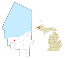
Location within Ontonagon County
USA Michigan location map.svg
Red pog.svg
White Pine
Location within the state of Michigan
Usa edcp location map.svg
Red pog.svg
White Pine
White Pine (the United States)
Coordinates: 46°45′14″N89°35′03″W / 46.75389°N 89.58417°W / 46.75389; -89.58417 [1]
Country United States
State Michigan
County Ontonagon
Township Carp Lake
Area
[2]
  Total
5.00 sq mi (12.96 km2)
  Land5.00 sq mi (12.96 km2)
  Water0.00 sq mi (0.00 km2)
Elevation
[1]
899 ft (274 m)
Population
 (2020)
  Total
339
  Density67.77/sq mi (26.17/km2)
Time zone UTC-5 (Eastern (EST))
  Summer (DST) UTC-4 (EDT)
ZIP code(s)
49971
Area code 906
GNIS feature ID1622143 [1]

White Pine is an unincorporated community and census-designated place (CDP) in Ontonagon County in the U.S. state of Michigan. The CDP had a population of 474 at the 2010 census. [3] White Pine is located within Carp Lake Township.

Contents

Much of White Pine was developed in the 1950s as a company town for miners at the White Pine mine. Mining companies in Michigan often built and leased housing to workers so that miners could live adjacent to mine operations. This allowed mining companies to attract workers with families, which were believed to improve retention rates by ensuring miners were socially and financially invested in the town created by the mining company.

White Pine was developed as a typical post war suburb. Many dwellings were single-story ranch homes, although a trailer park and apartment complex were also built. The community never developed fully as the Copper Range Company envisioned. The automobile transformed how workers commuted where previous mine sites had workers walking from nearby housing to the mine, many workers by the 1950s preferred driving up to 90 miles a day to remain in their current homes rather than move to the company town. [4]

History

It was a station on the Chicago, Minneapolis and St. Paul Railway. Thomas H. Wilcox, a mining engineer, found mass copper in the Mineral River and formed the White Pine Copper Company to mine it. The settlement was given a post office as "White Pine Mine" in June 1915. [5]

The community of White Pine was listed as a newly-organized census-designated place for the 2010 census, meaning it now has officially defined boundaries and population statistics for the first time. [6]

Geography

According to the United States Census Bureau, White Pine has a total area of 5.00 square miles (12.95 km2), all land. [7]

White Pine is located within Carp Lake Township east of the Porcupine Mountains Wilderness State Park. The Copper Range Company operated the White Pine mine in White Pine from 1955 to 1995. [4]

White Pine is served by the 49971 ZIP Code, which is the highest numeric ZIP Code in the state of Michigan. [8]

Demographics

Historical population
CensusPop.Note
2020 339
U.S. Decennial Census [9]

Related Research Articles

<span class="mw-page-title-main">Ontonagon County, Michigan</span> County in Michigan, United States

Ontonagon County is a county in the Upper Peninsula of the U.S. state of Michigan. As of the 2020 census, the population was 5,816, making it Michigan's third-least populous county. The county seat is Ontonagon. The county was set off in 1843, and organized in 1848. Its territory had been organized as part of Chippewa and Mackinac counties. With increasing population in the area, more counties were organized. After Ontonagon was organized, it was split to create Gogebic County. It is also the westernmost county in United States that lies within the Eastern Time Zone.

<span class="mw-page-title-main">Haslett, Michigan</span> Census-designated place in Michigan, United States

Haslett is a census-designated place (CDP) in Ingham County in the U.S. state of Michigan. It is located mostly within Meridian Charter Township with a small portion extending east into Williamstown Township. The population was 19,220 at the 2010 census. Haslett contains its own school district, as well as its own post office with the 48840 ZIP Code.

<span class="mw-page-title-main">Allouez Township, Michigan</span> Civil township in Michigan, United States

Allouez Township is a civil township of Keweenaw County in the U.S. state of Michigan. The population was 1,428 at the 2020 census.

<span class="mw-page-title-main">Prudenville, Michigan</span> Census-designated place & unincorporated community in Michigan, United States

Prudenville is an unincorporated community and census-designated place (CDP) in Roscommon County in the U.S. state of Michigan. The population was 1,643 at the 2020 census. Prudenville is located within Denton Township.

<span class="mw-page-title-main">Centennial, Wyoming</span> CDP in Wyoming, United States

Centennial is a small mountain-town in Albany County, Wyoming, United States. It serves a fairly large surrounding landscape, along with a few ranches, located along a gently sloping hillside traversed by a highway. Because it has been, since 1980 or later, included in a census-designated place (CDP), bearing the town's name, specific demographics characterizing the town itself are not available.

Atlantic Mine is an unincorporated community and census-designated place (CDP) in Houghton County in the U.S. state of Michigan. The CDP had a population of 565 at the 2020 census. The community is located just southwest of the city of Houghton in Adams Township. Atlantic Mine is located in the Copper Country region of Michigan's Upper Peninsula. The community is named for the eponymous Atlantic Mine.

<span class="mw-page-title-main">Bay Port, Michigan</span> Census-designated place & unincorporated community in Michigan, United States

Bay Port is an unincorporated community and census-designated place (CDP) in Huron County in the U.S. state of Michigan. The population was 582 at the 2020 census. As an unincorporated community, Bay Port has no legal autonomy of its own but does have its own post office with the 48720 ZIP Code.

<span class="mw-page-title-main">Copper Harbor, Michigan</span> Census-designated place & unincorporated community in Michigan, United States

Copper Harbor is an unincorporated community and census-designated place (CDP) located in Keweenaw County in the U.S. state of Michigan. It is located within Grant Township. The population of the CDP was 136 as of the 2020 census.

<span class="mw-page-title-main">Interlochen, Michigan</span> Census-designated place & unincorporated community in Michigan, United States

Interlochen is an unincorporated community and census-designated place (CDP) in Grand Traverse County in the U.S. state of Michigan. At the 2020 census, the population was 694, up from 583 at the 2010 census. The community is located within Green Lake Township, and is home to a post office operating with ZIP Code 49643.

<span class="mw-page-title-main">Eagle River, Michigan</span> Census-designated place and unincorporated community in Michigan, United States

Eagle River is an unincorporated community and census-designated place (CDP) in the U.S. state of Michigan. It is the county seat of Keweenaw County. Its population was 65 at the 2020 census, which makes it by far the least-populated county seat in the state of Michigan. As an unincorporated community, Eagle River has no legal autonomy and is part of Allouez Township and Houghton Township.

<span class="mw-page-title-main">Cedar, Michigan</span> Census-designated place & unincorporated community in Michigan, United States

Cedar is an unincorporated community and census-designated place in Leelanau County in the U.S. State of Michigan. The CDP had a population of 102 at the 2020 census. Cedar is located within Solon Township, and lies about 10 miles (16 km) northwest of Traverse City. The town is known for its Polish heritage, and is home to an annual polka festival.

Mount Hope is an unincorporated community and census-designated place (CDP) that is a part of Rockaway Township in Morris County, New Jersey, United States. As of the 2020 United States census, the population was 2,930.

<span class="mw-page-title-main">Ruth, Nevada</span> CDP in Nevada, United States

Ruth is a census-designated place (CDP) in White Pine County, Nevada, United States. Founded in 1903, it had a population of 440 at the 2010 census.

Mohawk is an unincorporated community and census-designated place (CDP) in the U.S. state of Michigan. Located in Keweenaw County, it is within Allouez Township. As an unincorporated community, Mohawk has no legally defined boundaries or population statistics of its own but does have its own post office with the 49950 ZIP Code. The ZIP includes most of mainland Keweenaw County and also uses the Eagle Harbor and Eagle River designations.

<span class="mw-page-title-main">Segundo, Colorado</span> Census Designated Place in Colorado, United States

Segundo is an unincorporated community and a census-designated place (CDP) located in and governed by Las Animas County, Colorado, United States. The population of the Segundo CDP was 100 at the United States Census 2020. The Trinidad post office serves the area.

Soudan is an unincorporated community and census-designated place (CDP) in Breitung Township, Saint Louis County, Minnesota, United States. As of the 2020 census, its population was 385.

<span class="mw-page-title-main">Kenilworth, Utah</span> Census-designated place in Utah, United States

Kenilworth is a census-designated place in northern Carbon County, Utah, United States.

<span class="mw-page-title-main">Mass City, Michigan</span> Census-designated place & unincorporated community in Michigan, United States

Mass City is an unincorporated community in Ontonagon County in the U.S. state of Michigan. Mass City is located in Greenland Township along M-26, 13.5 miles (21.7 km) southeast of the village of Ontonagon. Mass City has its own post office with the 49948 ZIP Code.

<span class="mw-page-title-main">Painesdale, Michigan</span> Census-designated place & unincorporated community in Michigan, United States

Painesdale is an unincorporated community in Houghton County, Michigan, United States. Painesdale is located in Adams Township along M-26, 2.5 miles (4.0 km) southwest of South Range. Painesdale has a post office with ZIP code 49955.

<span class="mw-page-title-main">Gamerco, New Mexico</span> Census-designated place in New Mexico, United States

Gamerco, also called in Navajo: Łigaiyaaʼáhí, is an unincorporated community and census-designated place in McKinley County, New Mexico, United States. As of the 2020 census the population was 1,343, down from 1,956 in 2010. Gamerco was used as a base for coal mining until the 1960s.

References

  1. 1 2 3 U.S. Geological Survey Geographic Names Information System: White Pine, Michigan
  2. "2020 U.S. Gazetteer Files". United States Census Bureau. Retrieved May 21, 2022.
  3. "U.S. Census website". United States Census Bureau . Retrieved May 14, 2011.
  4. 1 2 Lankton, Larry D. (2010). Hollowed Ground : copper mining and community building on Lake Superior, 1840s-1990s. Detroit, Mich.: Wayne State University Press. pp. 251–303. ISBN   9780814334904.
  5. Romig, Walter (1986) [1973]. Michigan Place Names. Detroit, Michigan: Wayne State University Press. ISBN   0-8143-1838-X.
  6. "Michigan: 2010 Population and Housing Unit Counts 2010 Census of Population and Housing" (PDF). 2010 United States Census . United States Census Bureau. September 2012. p. III-7. Retrieved April 8, 2020.
  7. "Michigan: 2010 Population and Housing Unit Counts 2010 Census of Population and Housing" (PDF). 2010 United States Census . United States Census Bureau. September 2012. p. 28 Michigan. Retrieved April 3, 2020.
  8. ZIPCodesToGo.com (2018). "Zip Codes for the State of Michigan" . Retrieved April 4, 2020.
  9. "Census of Population and Housing". Census.gov. Retrieved June 4, 2016.