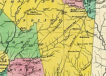
Webster County is a county located in center of the U.S. state of Mississippi, bordered on the south by the Big Black River. As of the 2020 census, the population was 9,926.

Oktibbeha County is a county in the east central portion of the U.S. state of Mississippi. As of the 2020 census the population was 51,788. The county seat is Starkville. The county's name is derived from a Choctaw word meaning "icy creek". The Choctaw had long occupied much of this territory prior to European exploration and United States acquisition.
Copiah County is a county located in the U.S. state of Mississippi. As of the 2020 census, the population was 28,368. The county seat is Hazlehurst.

Scouting in Mississippi has a long history, from the 1910s to the present day, serving thousands of youth in programs that suit the environment in which they live.

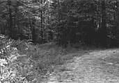
The Natchez Trace, also known as the Old Natchez Trace, is a historic forest trail within the United States which extends roughly 440 miles (710 km) from Nashville, Tennessee, to Natchez, Mississippi, linking the Cumberland, Tennessee, and Mississippi rivers.

The Natchez Trace Parkway is a limited-access national parkway in the Southeastern United States that commemorates the historic Natchez Trace and preserves sections of that original trail. Its central feature is a two-lane road that extends 444 miles (715 km) from Natchez, Mississippi, to Nashville, Tennessee. Access to the parkway is limited, with more than 50 access points in Mississippi, Alabama, and Tennessee. The southern end of the route is in Natchez at its intersection with Liberty Road, and the northern end is northeast of Fairview, Tennessee, in the suburban community of Pasquo, at an intersection with Tennessee State Route 100. In addition to Natchez and Nashville, larger cities along the route include Jackson and Tupelo, Mississippi, and Florence, Alabama.

The Gaines Trace was a road in the Mississippi Territory. It was constructed in 1811 and 1812 from the Tennessee River to Cotton Gin Port on the upper Tombigbee River and on to Fort Stoddert on the lower Tombigbee. The portion from the Tennessee River to Cotton Gin Port was surveyed in 1807 and 1808 by Edmund P. Gaines, the road's namesake and a career United States Army officer.

Washington is an unincorporated community in Adams County, Mississippi, United States. Located along the lower Mississippi, 6 miles (9.7 km) east of Natchez, it was the second and longest-serving capital of the Mississippi Territory.
Jackson's Military Road was a 19th-century route connecting Nashville, Tennessee, with New Orleans, Louisiana. After the War of 1812, Congress appropriated funds in 1816 to build and improve this road. It was completed in 1820. The road was named for then General Andrew Jackson, hero of the United States victory at the Battle of New Orleans against British forces.

Oktoc is an unincorporated community in Oktibbeha County, Mississippi.

The Elizabeth Female Academy, founded in 1818 in the town of Washington, was the first female educational institution in Mississippi. It was named after Mrs. Elizabeth Roach, who donated the land on which the school was located.
A Mississippi Landmark is a building officially nominated by the Mississippi Department of Archives and History and approved by each county's chancery clerk. The Mississippi Landmark designation is the highest form of recognition bestowed on properties by the state of Mississippi, and designated properties are protected from changes that may alter the property's historic character. Currently there are 890 designated landmarks in the state. Mississippi Landmarks are spread out between eighty-one of Mississippi's eighty-two counties; only Issaquena County has no such landmarks.

Seven segments of the historic Natchez Trace are listed on the National Register of Historic Places (NRHP). Also there are additional NRHP-listed structures and other sites along the Natchez Trace, which served the travelers of the trace and survive from the era of its active use.

Jordan Winston Early was an American Methodist preacher who is considered to have contributed significantly to the spread of African American Methodism in the southern and western United States. In 1868, he married Sarah Jane Woodson Early, and the couple were prominent in spreading Methodism and black nationalism, with his wife teaching wherever he preached.
Agency is a ghost town located in Oktibbeha County, Mississippi, United States.

Pigeon Roost is a ghost town in Choctaw County, Mississippi.
Nashville is a ghost town in Lowndes County, Mississippi, United States.

Mississippi Highway 462 is a state highway in western Mississippi. The route starts at U.S. Route 61 near Port Gibson, and it travels eastward. The road then turns northeastward, and the route ends at Willows Road and Old Port Gibson Road near Willows. MS 462 was designated around 1958, as a gravel road extending eastward from US 61 near Port Gibson. The road was extended to MS 461 from 1960 to 1963, then to the Natchez Trace Parkway from 1967 to 1998.

Mississippi Highway 389 is a state highway that runs from south to north in the U.S. State of Mississippi. MS 389 currently exists in two sections. The southern section begins at MS 182 in Starkville. The road travels north out of the city, and crosses U.S. Route 82 and MS 15. North of Starkville, the route continues northwestwards and ends at the Oktibbeha–Clay county line south of Pheba. The northern section starts at MS 46 west of Montpelier, and it travels north to cross the Natchez Trace Parkway in Chickasaw County. MS 389 ends at MS 8 in Houston.

Mississippi Highway 429 (MS 429) is a 21.7-mile-long (34.9 km) highway in the Mississippi counties of Leake and Attala. The highway runs through mostly rural areas of these counties except near its northern terminus where MS 429 heads through the town of Sallis.