Related Research Articles

Arapahoe County is a county located in the U.S. state of Colorado. As of the 2020 census, its population was 655,070, making it the third-most populous county in Colorado. The county seat is Littleton, and the most populous city is Aurora. The county was named for the Arapaho Native American tribe, who once lived in the region.
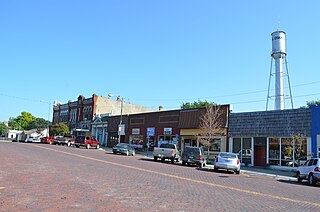
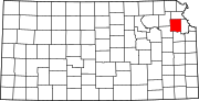
Oskaloosa is a city in and the county seat of Jefferson County, Kansas, United States. As of the 2020 census, the population of the city was 1,110.

Perry Lake is a US Army Corps of Engineers operated reservoir in northeast Kansas. Its primary purposes are flood control, water reserve for nearby areas and regional recreation. The lake is approximately 11,150 acres (45 km²) in size, with over 160 miles (260 km) of shoreline. Perry Lake's full multi-purpose pool elevation is 891.5 feet (271.7 m) above sea level. Perry Lake is located about 40 miles (64 km) west of Kansas City, just northwest of Lawrence, Kansas. Its close proximity to Kansas City, Lawrence, and the state capitol, Topeka, make it a very popular destination, with the nickname "Paradise on the Plains".

Rock Creek is an 18.9-mile-long (30.4 km) tributary of the Monocacy River in south-central Pennsylvania and serves as the border between Cumberland and Mount Joy townships. Rock Creek was used by the Underground Railroad and flows near several Gettysburg Battlefield sites, including Culp's Hill, the Benner Hill artillery location, and Barlow Knoll.
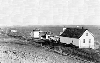
Mooney Creek is an unincorporated community in northeastern Jefferson County, Kansas, United States. It is named for Mooney Creek, a right-hand tributary of Big Stranger Creek.

Buffalo Creek is an unincorporated community and U.S. Post Office in Jefferson County, Colorado, United States. The ZIP Code of the Buffalo Creek Post Office is 80425.
Eudora Township is a township in Douglas County, Kansas, USA. As of the 2010 census, its population was 6,724.
Grant Township is a township in Douglas County, Kansas, USA. As of the 2000 census, its population was 442.

Lecompton Township is a township in Douglas County, Kansas, USA. As of the 2000 census, its population was 1,761.

Wakarusa Township is a township in Douglas County, Kansas, USA. As of the 2010 census, its population was 2,318. It was named for the Wakarusa River which flows through Douglas County from Wabaunsee County to the Kansas River near Eudora.

Grantville is an unincorporated community in Jefferson County, Kansas, United States. As of the 2020 census, the population of the community and nearby areas was 182. It is located east of Topeka on the south side of US-24 highway between Barton Rd and KOA/Wilson Rd.
Newman is an unincorporated community in southern Jefferson County, United States.

Vigo is a small unincorporated community in Prairie Creek Township, Vigo County, in the U.S. state of Indiana. The community is in the 47802 zip code, the Wabash Valley and the Terre Haute Metropolitan Statistical Area.

Indian River is a 59.1-mile-long (95.1 km) tributary of the Manistique River on the Upper Peninsula of Michigan in the United States. It rises out of Hovey Lake at 46°17′36″N86°42′20″W on Hiawatha National Forest land in Alger County and flows south and east through a lake district and on through Schoolcraft County. The river flows into the 8,659 acre (35 km2) Indian Lake at 46°17′36″N86°42′20″W and flows out at 45°59′30″N86°17′15″W. It then flows east and south about 2.5 miles where it merges with the Manistique River, which then flows through Manistique and into Lake Michigan at 45°56′56″N86°14′45″W.

Dunavant is an unincorporated community in Jefferson County, Kansas, United States.
Medina is an unincorporated community in Jefferson County, Kansas, United States.
Half Mound is an unincorporated community in Jefferson County, Kansas, United States.
Boyle is an unincorporated community in Jefferson County, Kansas, United States.
Buck Creek is an unincorporated community in Jefferson County, Kansas, United States.
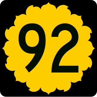
K-92 is an approximately 44-mile-long (71 km) state highway in the U.S. state of Kansas. K-92's western terminus is at K-4 south of the community of Rock Creek, and the eastern terminus is a continuation as Missouri State Route 92 at the Missouri border by the City of Leavenworth. K-92 is co-designated as U.S. Route 59 (US-59) in Oskaloosa, K-16 from Oskaloosa to McLouth, and K-7 and US-73 in Leavenworth. The majority of the route passes through rural farmland and is almost entirely a two-lane roadway, except for the overlap with K-7 and US-73 and a portion of the US-59 overlap, which are four-lane.
References
- 1 2 "Rock Creek, Kansas", Geographic Names Information System , United States Geological Survey, United States Department of the Interior
- ↑ "Kansas Post Offices, 1828-1961 (archived)". Kansas Historical Society. Archived from the original on October 9, 2013. Retrieved June 11, 2014.