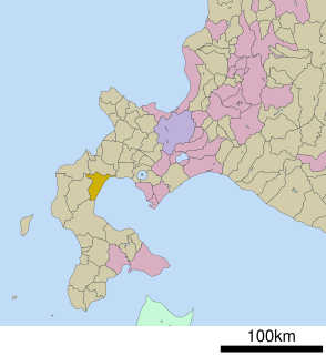
Yamakoshi is a district located in Oshima Subprefecture, Hokkaido, Japan.

The Struve Geodetic Arc is a chain of survey triangulations stretching from Hammerfest in Norway to the Black Sea, through ten countries and over 2,820 km, which yielded the first accurate measurement of a meridian.
Ölziit is a sum (district) of Dundgovi Province in central Mongolia.

Kamienna Góra is a village in the administrative district of Gmina Wierzbica, within Chełm County, Lublin Voivodeship, in eastern Poland. It lies approximately 5 kilometres (3 mi) south of Wierzbica, 14 km (9 mi) north-west of Chełm, and 54 km (34 mi) east of the regional capital Lublin.
Ochoża-Pniaki is a village in the administrative district of Gmina Wierzbica, within Chełm County, Lublin Voivodeship, in eastern Poland. It lies approximately 7 kilometres (4 mi) south of Wierzbica, 13 km (8 mi) north-west of Chełm, and 53 km (33 mi) east of the regional capital Lublin.
Bębnów is a village in the administrative district of Gmina Konopnica, within Wieluń County, Łódź Voivodeship, in central Poland. It lies approximately 5 kilometres (3 mi) south-west of Konopnica, 19 km (12 mi) north-east of Wieluń, and 70 km (43 mi) south-west of the regional capital Łódź.
Opalanki is a village in the administrative district of Gmina Ozorków, within Zgierz County, Łódź Voivodeship, and in central Poland. It lies approximately 3 kilometres (2 mi) east of Ozorków, 16 km (10 mi) north-west of Zgierz, and 24 km (15 mi) north-west of the regional capital Łódź.

alsaadoun is a neighborhood in the Rusafa District of Baghdad, Iraq.
Słup is a village in the administrative district of Gmina Szczawin Kościelny, within Gostynin County, Masovian Voivodeship, in east-central Poland.
Marianowo is a village in the administrative district of Gmina Sompolno, within Konin County, Greater Poland Voivodeship, in west-central Poland.
Janowo is a village in the administrative district of Gmina Sierakowice, within Kartuzy County, Pomeranian Voivodeship, in northern Poland. It lies approximately 3 kilometres (2 mi) south of Sierakowice, 21 km (13 mi) west of Kartuzy, and 49 km (30 mi) west of the regional capital Gdańsk.
Stary Wiec is a village in the administrative district of Gmina Liniewo, within Kościerzyna County, Pomeranian Voivodeship, in northern Poland. It lies approximately 7 kilometres (4 mi) east of Liniewo, 23 km (14 mi) east of Kościerzyna, and 37 km (23 mi) south-west of the regional capital Gdańsk.
Pazda is a settlement in the administrative district of Gmina Zblewo, within Starogard County, Pomeranian Voivodeship, in northern Poland. It lies approximately 6 kilometres (4 mi) south of Zblewo, 17 km (11 mi) south-west of Starogard Gdański, and 57 km (35 mi) south of the regional capital Gdańsk.
Pniewy is a settlement in the administrative district of Gmina Kalisz Pomorski, within Drawsko County, West Pomeranian Voivodeship, in north-western Poland. It lies approximately 5 kilometres (3 mi) north of Kalisz Pomorski, 25 km (16 mi) south of Drawsko Pomorskie, and 90 km (56 mi) east of the regional capital Szczecin.
Moczyły is a village in the administrative district of Gmina Kołbaskowo, within Police County, West Pomeranian Voivodeship, in north-western Poland, close to the German border. It lies approximately 25 kilometres (16 mi) south of Police and 13 km (8 mi) south-west of the regional capital Szczecin.
Rosówek is a village in the administrative district of Gmina Kołbaskowo, within Police County, West Pomeranian Voivodeship, in north-western Poland, close to the German border. It lies approximately 26 kilometres (16 mi) south of Police and 15 km (9 mi) south-west of the regional capital Szczecin.
Chociwel Wieś is a settlement in the administrative district of Gmina Chociwel, within Stargard County, West Pomeranian Voivodeship, in north-western Poland. It lies approximately 2 kilometres (1 mi) north-west of Chociwel, 25 km (16 mi) north-east of Stargard, and 50 km (31 mi) east of the regional capital Szczecin.
Sądówko is a village in the administrative district of Gmina Dolice, within Stargard County, West Pomeranian Voivodeship, in north-western Poland. It lies approximately 29 kilometres (18 mi) south-east of Stargard and 58 km (36 mi) south-east of the regional capital Szczecin.
Lubostronie is a village in the administrative district of Gmina Barwice, within Szczecinek County, West Pomeranian Voivodeship, in north-western Poland. It lies approximately 4 kilometres (2 mi) north of Barwice, 24 km (15 mi) west of Szczecinek, and 122 km (76 mi) east of the regional capital Szczecin.
Vrbjani is a village in Municipality of Krivogaštani.


