
The Outer Hebrides or Western Isles, sometimes known as Na h-Innse Gall or the Long Isle/Long Island, is an island chain off the west coast of mainland Scotland. The islands are geographically coextensive with Comhairle nan Eilean Siar, one of the 32 unitary council areas of Scotland. They form part of the archipelago of the Hebrides, separated from the Scottish mainland and from the Inner Hebrides by the waters of the Minch, the Little Minch, and the Sea of the Hebrides. Scottish Gaelic is the predominant spoken language, although in a few areas English speakers form a majority.

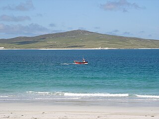
Harris is the southern and more mountainous part of Lewis and Harris, the largest island in the Outer Hebrides, Scotland. Although not an island itself, Harris is often referred to as the Isle of Harris, which is the former postal county and the current post town for Royal Mail postcodes starting HS3 or HS5.
Rùm, a Scottish Gaelic name often anglicised to Rum, is one of the Small Isles of the Inner Hebrides, in the district of Lochaber, Scotland. For much of the 20th century the name became Rhum, a spelling invented by the former owner, Sir George Bullough, because he did not relish the idea of having the title "Laird of Rum".
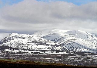
Ben Macdui is the second-highest mountain in Scotland after Ben Nevis, and the highest in the Cairngorm Mountains and the wider Cairngorms National Park. The summit elevation is 1,309 metres AMSL. Ben Macdui lies on the southern edge of the Cairngorm plateau, on the boundary between the historic counties of Aberdeenshire and Banffshire.

Càrn Eige, sometimes spelt Càrn Eighe, is a mountain in the north of Scotland. At an elevation of 1,183 metres (3,881 ft) above sea level, it is the highest mountain in Scotland north of the Great Glen, the twelfth-highest summit above sea level in the British Isles, and, in terms of relative height, it is the second-tallest mountain in the British Isles after Ben Nevis. The highpoint of the historic county of Ross and Cromarty, it is the twin summit of the massif, being mirrored by the 1,181-metre (3,875 ft) Mam Sodhail, to the south on the same ridge.
Scotasay is small island in the Outer Hebrides of Scotland. It lies 1 kilometre off the east coast of Harris and gives some shelter to the ferry port of Tarbert. There are two houses on the island, a wind turbine and a fresh water tank.
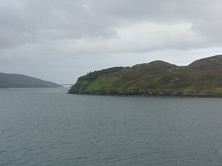
Pabbay is an uninhabited island in the Outer Hebrides of Scotland which lies in the Sound of Harris between Harris and North Uist. The name comes from Papey, which is Norse for "Island of the papar (Culdee)".
Achnaha is a remote village in Ardnamurchan, Lochaber, in the Scottish council area of Highland.

The geology of Scotland is unusually varied for a country of its size, with a large number of differing geological features. There are three main geographical sub-divisions: the Highlands and Islands is a diverse area which lies to the north and west of the Highland Boundary Fault; the Central Lowlands is a rift valley mainly comprising Palaeozoic formations; and the Southern Uplands, which lie south of the Southern Uplands Fault, are largely composed of Silurian deposits.

The Central Lowlands, sometimes called the Midland Valley or Central Valley, is a geologically defined area of relatively low-lying land in southern Scotland. It consists of a rift valley between the Highland Boundary Fault to the north and the Southern Uplands Fault to the south. The Central Lowlands are one of the three main geographical sub-divisions of Scotland, the other two being the Highlands and Islands which lie to the north, northwest and the Southern Uplands, which lie south of the associated second fault line. It is the most populated of Scotland’s three geographical regions.

Broughton High School is a secondary school located in the north of Edinburgh, Scotland. In 2009, the building at Inverleith was replaced with a building funded by a public–private partnership. The school is currently situated next to Inverleith Park, in the Stockbridge neighbourhood of Edinburgh but was formerly in Broughton, where the poet Hugh MacDiarmid was a pupil.
Lingarabay is a small coastal settlement on Harris, in the Outer Hebrides of Scotland. It is located on the rocky east coast of South Harris, about 2 miles (3.2 km) northeast of Rodel.
Ensay is a currently unpopulated and privately owned island in the Outer Hebrides of Scotland. The island lies in the Sound of Harris between the islands of Harris and Berneray. The name originates from the Old Norse for Ewe Island. It is nothing to do with the Gaelic for Jesus – "Iosa" – as sometimes stated.

The Bunnet Stane is a rock formation near the hamlet of Gateside in Fife, at the foot of West Lomond. It sits upon one of the calciferous sandstone outcrops of the Old Red Sandstone suie that exist around the base of the Lomond Hills. The Bunnet Stane itself consists of an elevated table of rock, about ten feet by twenty feet across, which sits upon a thin column of rock like a giant mushroom. There are several romantic explanations for the stone's shape, but it was formed entirely by the natural weathering of the exposed outcrop.
Killegray is an island in the Sound of Harris in the Outer Hebrides of Scotland.

Soay Mòr is an island in West Loch Tarbert, between the northern and southern parts of Harris. The uninhabited island is separated from the southwest coast of North Harris by the Soay Sound. The adjacent Soay Beag is accessible on foot at low tide.
Stockinish Island is an uninhabited island off Harris, in the Outer Hebrides.
HM Prison Inverness, also known as Porterfield Prison, is located in the Crown area of Inverness, Scotland, and serves the courts of the Highlands and Islands. It covers all the courts in the Western Isles as well as courts from Fort William, Wick and Elgin. A small local prison, it deals with inmates serving up to 4 years, with female prisoners serving up to 2 years. Its capacity is 103 prisoners. The establishment is Governed by Brian McKirdy.

Duirinish is a peninsula on the island of Skye in Scotland. It is situated in the north west between Loch Dunvegan and Loch Bracadale.
Sean McKirdy is a Scottish footballer who last played as a midfielder for Lowland League club Kelty Hearts.
