Kobyle is a village in the administrative district of Gmina Nowy Wiśnicz, within Bochnia County, Lesser Poland Voivodeship, in southern Poland. It lies approximately 5 kilometres (3 mi) east of Nowy Wiśnicz, 10 km (6 mi) south-east of Bochnia, and 45 km (28 mi) east of the regional capital Kraków.

Barwałd Dolny is a village in the administrative district of Gmina Wadowice, within Wadowice County, Lesser Poland Voivodeship, in southern Poland. It lies approximately 6 kilometres (4 mi) east of Wadowice and 35 km (22 mi) south-west of the regional capital Kraków.

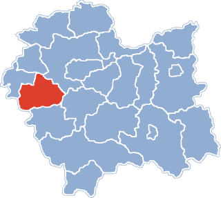
Chocznia is a village in the administrative district of Gmina Wadowice, within Wadowice County, Lesser Poland Voivodeship, in southern Poland. It lies approximately 4 kilometres (2 mi) west of Wadowice and 41 km (25 mi) south-west of the regional capital Kraków.
Gorzeń Dolny is a village in the administrative district of Gmina Wadowice, within Wadowice County, Lesser Poland Voivodeship, in southern Poland. It lies approximately 2 kilometres (1 mi) west of Wadowice and 39 km (24 mi) south-west of the regional capital Kraków.
Jaroszowice is a village in the administrative district of Gmina Wadowice, within Wadowice County, Lesser Poland Voivodeship, in southern Poland. It lies approximately 4 kilometres (2 mi) south-east of Wadowice and 37 km (23 mi) south-west of the regional capital Kraków.
Kaczyna is a village in the administrative district of Gmina Wadowice, within Wadowice County, Lesser Poland Voivodeship, in southern Poland. It lies approximately 8 kilometres (5 mi) south-west of Wadowice and 45 km (28 mi) south-west of the regional capital Kraków.
Ponikiew is a village in the administrative district of Gmina Wadowice, within Wadowice County, Lesser Poland Voivodeship, in southern Poland. It lies approximately 9 kilometres (6 mi) south-west of Wadowice and 45 km (28 mi) south-west of the regional capital Kraków.
Stanisław Górny is a village in the administrative district of Gmina Wadowice, within Wadowice County, Lesser Poland Voivodeship, in southern Poland. It lies approximately 11 kilometres (7 mi) east of Wadowice and 28 km (17 mi) south-west of the regional capital Kraków.
Wysoka is a village in the administrative district of Gmina Wadowice, within Wadowice County, Lesser Poland Voivodeship, in southern Poland. It lies approximately 9 kilometres (6 mi) north-east of Wadowice and 30 km (19 mi) south-west of the regional capital Kraków.
Zawadka is a village in the administrative district of Gmina Wadowice, within Wadowice County, Lesser Poland Voivodeship, in southern Poland. It lies approximately 5 kilometres (3 mi) south-west of Wadowice and 41 km (25 mi) south-west of the regional capital Kraków.
Brzezinka is a village in the administrative district of Gmina Andrychów, within Wadowice County, Lesser Poland Voivodeship, in southern Poland. It lies approximately 5 kilometres (3 mi) south of Andrychów, 15 km (9 mi) south-west of Wadowice, and 52 km (32 mi) south-west of the regional capital Kraków.
Sułkowice is a village in the administrative district of Gmina Andrychów, within Wadowice County, Lesser Poland Voivodeship, in southern Poland. It lies approximately 5 kilometres (3 mi) south of Andrychów, 12 km (7 mi) south-west of Wadowice, and 50 km (31 mi) south-west of the regional capital Kraków.
Chrząstowice is a village in the administrative district of Gmina Brzeźnica, within Wadowice County, Lesser Poland Voivodeship, in southern Poland. It lies approximately 3 kilometres (2 mi) west of Brzeźnica, 12 km (7 mi) north-east of Wadowice, and 27 km (17 mi) south-west of the regional capital Kraków.
Kopytówka is a village in the administrative district of Gmina Brzeźnica, within Wadowice County, Lesser Poland Voivodeship, in southern Poland. It lies approximately 4 kilometres (2 mi) south of Brzeźnica, 12 km (7 mi) north-east of Wadowice, and 27 km (17 mi) south-west of the regional capital Kraków.
Sosnowice is a village in the administrative district of Gmina Brzeźnica, within Wadowice County, Lesser Poland Voivodeship, in southern Poland. It lies approximately 7 kilometres (4 mi) east of Brzeźnica, 18 km (11 mi) north-east of Wadowice, and 21 km (13 mi) south-west of the regional capital Kraków.

Przytkowice is a village in the administrative district of Gmina Kalwaria Zebrzydowska, within Wadowice County, Lesser Poland Voivodeship, in southern Poland. It lies approximately 6 kilometres (4 mi) north of Kalwaria Zebrzydowska, 14 km (9 mi) east of Wadowice, and 25 km (16 mi) south-west of the regional capital Kraków.

Spytkowice is a village in Wadowice County, Lesser Poland Voivodeship, in southern Poland. It is the seat of the gmina called Gmina Spytkowice. It lies approximately 13 kilometres (8 mi) north of Wadowice and 33 km (21 mi) west of the regional capital Kraków.
Witanowice is a village in the administrative district of Gmina Tomice, within Wadowice County, Lesser Poland Voivodeship, in southern Poland. It lies approximately 6 kilometres (4 mi) north-east of Tomice, 7 km (4 mi) north-east of Wadowice, and 32 km (20 mi) south-west of the regional capital Kraków.
Zygodowice is a village in the administrative district of Gmina Tomice, within Wadowice County, Lesser Poland Voivodeship, in southern Poland. It lies approximately 8 kilometres (5 mi) north of Wadowice and 33 km (21 mi) west of the regional capital Kraków.
Frydrychowice is a village in the administrative district of Gmina Wieprz, within Wadowice County, Lesser Poland Voivodeship, in southern Poland. It lies approximately 7 kilometres (4 mi) north-west of Wadowice and 40 km (25 mi) south-west of the regional capital Kraków.