
Roland Gardens is a street in South Kensington, London SW7. It runs north to south from Old Brompton Road to Drayton Gardens at its southern end, where it becomes Evelyn Gardens.

Roland Gardens is a street in South Kensington, London SW7. It runs north to south from Old Brompton Road to Drayton Gardens at its southern end, where it becomes Evelyn Gardens.
Building on the street was started in 1870 by Charles Aldin and his sons Charles and William, with more than half completed by 1874, and the rest by 1893. [1]

Sir William Dugdale was an English antiquary and herald. As a scholar he was influential in the development of medieval history as an academic subject.

Berkeley Square is a garden square in the West End of London. It is one of the best known of the many squares in London, located in Mayfair in the City of Westminster. It was laid out in the mid 18th century by the architect William Kent, and originally extended further south. The garden's very large London Plane trees are among the oldest in central London, planted in 1789.

Soho Square is a garden square in Soho, London, hosting since 1954 a de facto public park let by the Soho Square Garden Committee to Westminster City Council. It was originally called King Square after Charles II, and a much weathered statue of the monarch has stood in the square, with an extended interruption, since 1661, one year after the restoration of the monarchy.
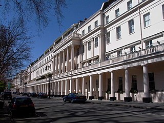
Eaton Square is a rectangular, residential garden square in London's Belgravia district. It is the largest square in London. It is one of the three squares built by the landowning Grosvenor family when they developed the main part of Belgravia in the 19th century that are named after places in Cheshire — in this case Eaton Hall, the Grosvenor country house. It is larger but less grand than the central feature of the district, Belgrave Square, and both larger and grander than Chester Square. The first block was laid out by Thomas Cubitt from 1827. In 2016 it was named as the "Most Expensive Place to Buy Property in Britain", with a full terraced house costing on average £17 million — many of such town houses have been converted, within the same, protected structures, into upmarket apartments.

Long Acre is a street in the City of Westminster in central London. It runs from St Martin's Lane, at its western end, to Drury Lane in the east. The street was completed in the early 17th century and was once known for its coach-makers, and later for its car dealers.

Great Russell Street is a street in Bloomsbury, London, best known for being the location of the British Museum. It runs between Tottenham Court Road in the west, and Southampton Row in the east. It is one-way only (eastbound) between its western origin at Tottenham Court Road and Bloomsbury Street.

Charlotte Street is a street in Fitzrovia, historically part of the parish and borough of St Pancras, in central London. It has been described, together with its northern and southern extensions, as the spine of Fitzrovia.
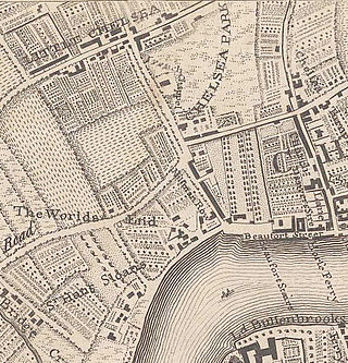
Little Chelsea was a hamlet, located on either side of Fulham Road, half a mile Southwest of Chelsea, London. The earliest references to the settlement date from the early 17th century, and the name continued to be used until the hamlet was surrounded by residential developments in the late 19th century.
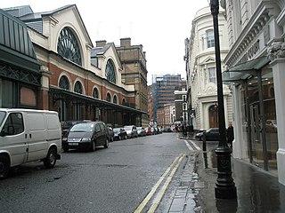
Tavistock Street is a street in the Covent Garden area of London which runs parallel to the Strand between Drury Lane and Southampton Street just south of the market piazza.

Onslow Square is a garden square in South Kensington, London, England.
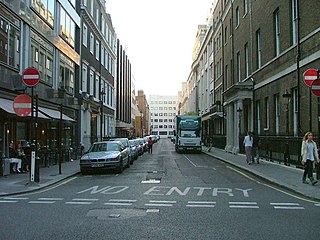
Old Burlington Street is a street in central London that is on land that was once part of the Burlington Estate.

Mount Street is an east–west, quite narrow, archetypal street in the Mayfair district of the City of Westminster, London fronted by many mid-rise buildings, mostly of a narrow frontage. The sides of two very grand hotels flank part of either end of the street. Small, high-end property businesses, investment funds and accountancy businesses punctuate the buildings as well as a row of traditional businesses and conversion-style mansion block apartments or, more generally, authentic such homes.

Evelyn Gardens is a garden square in Chelsea, London, England.

Lexham Gardens is a street in South Kensington, London.
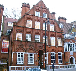
Harrington Gardens is a street which has a communal garden regionally sometimes known as a garden square in the Royal Borough of Kensington and Chelsea in London. The street runs from Collingham Gardens and Collingham Road in the east to Gloucester Road and Stanhope Gardens in the west. It is crossed by Ashburn Place and joined by Colbeck Mews on its north side. It contains several listed buildings including an important group of grade II* buildings on the south side numbered 35 to 45.
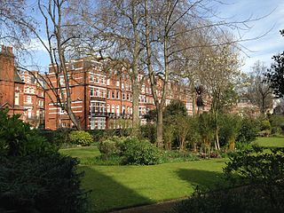
Egerton Gardens is a street and communal garden, regionally termed a garden square, in South Kensington, London SW3.
Blanche Elizabeth Campbell "Baffy" Dugdale was a British author and Zionist. Chaim Weizmann called her, "an ardent, lifelong friend of Zionism".
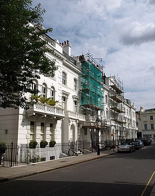
Hereford Square is a garden square in South Kensington, London SW7. It lies to the west of Gloucester Road, which forms the east side of the square. Wetherby Place is the western continuation, running off the north-west corner of the square.

The Bull and Mouth Inn was a coaching inn in the City of London that dated from before the Great Fire of London in 1666. It was located between Bull and Mouth Street in the north and Angel Street in the south. It was once an important arrival and departure point for coaches from all over Britain, but particularly for the north of England and Scotland. It became the Queen's Hotel in 1830 but was demolished in 1887 or 1888 when new post office buildings were built in St Martin's Le Grand.

Cadogan Gardens is a street in Chelsea, London, that is part of the Cadogan Estate.
![]() Media related to Roland Gardens at Wikimedia Commons
Media related to Roland Gardens at Wikimedia Commons
51°29′24.13″N0°10′50″W / 51.4900361°N 0.18056°W