Related Research Articles

Dargaville is a town in the North Island of New Zealand. It is situated on the bank of the Northern Wairoa River in the Kaipara District of the Northland region. The town is located 55 kilometres southwest of Whangārei.

The Waiau Toa / Clarence River is on northeast South Island of New Zealand. It is 230 kilometres (140 mi) long, which makes it the eighth longest river in New Zealand.
The Pukaki River flows through the Mackenzie Basin, Canterbury, in New Zealand's South Island.
The Charwell River is a river in the northeast of New Zealand's South Island. Its headwaters are in the Seaward Kaikoura Ranges and it feeds into the Conway River, the traditional boundary between Marlborough and Canterbury. Sheep farming has taken place in the Charwell River's valley.
Lichinga District is a district of Niassa Province in north-western Mozambique. The principal town is Lichinga.

Mangamuka is a district in Northland, New Zealand, at the junction of the Mangamuka and Opurehu Rivers. State Highway 1 runs through the area, and the settlement of Mangamuka Bridge lies at the point where the highway crosses the Mangamuku River. The river runs into the upper Hokianga Harbour. Just to the north west, the highway runs through Mangamuka Gorge in the Maungataniwha Range. Umawera lies to the south east.

Meti is a town in south-western Ethiopia, located in Godere woreda of the Gambela Region. This town has a latitude and longitude of 07°14′N35°19′E, with an elevation of 1266 meters above sea level.

The Jed River is a river of New Zealand's South Island. It flows to the Pacific Ocean close to the town of Cheviot adjacent to Gore Bay. It combines with Buxton Creek behind a rocky beach before draining through the shingle. The waterways break through the rocks after heavy rain and establish a direct outflow into the sea.
The Mangamuka River is a river of the far north of the Northland Region of New Zealand's North Island. It flows generally south from the Maungataniwha Range southeast of Kaitaia, and the last few kilometres of its length are a wide, silty arm of the Hokianga Harbour, which it reaches 10 kilometres (6 mi) northeast of Rawene.
The Omanaia River is a river of the Northland Region of New Zealand's North Island. It flows northwest from the Waima Forest, first as a stream and then as a silty arm of the Hokianga Harbour. The township of Rawene stands at the point where the river meets the main waters of the harbour.
The Te Putaaraukai River is a river of the Northland Region of New Zealand's North Island. It flows north to reach the Rangaunu Harbour to the northeast of Awanui.
The Teal River is a river of the Nelson Region of New Zealand's South Island. It flows north from its origins in hilly country to the west of the city of Nelson to reach the Wakapuaka River.
The Tinline River is a river of the Marlborough Region of New Zealand's South Island. It flows generally south from its sources at the northern end of the Bryant Range to reach the Pelorus River seven kilometres west of Pelorus Bridge. The river is named for John Tinline and commemorates the discovery of a route from Nelson to the Wairau.
The Victoria River is a river of the Northland Region of New Zealand's North Island. It flows generally northwest from the Maungataniwha Range, reaching the Awanui River to the east of Kaitaia.
The Waipekakoura River is a river of the Northland Region of New Zealand's North Island. It flows east to reach the Kerikeri River five kilometres west of Kerikeri.
The Whakanekeneke River is a river of the Northland Region of New Zealand's North Island. It flows generally west from its origins north of Lake Omapere, and flows into the Waihou River, an arm of the Hokianga Harbour.
The Yarra River, New Zealand is a river in New Zealand. It flows generally northeast from its source north of Hanmer Springs, flowing into the Acheron River approximately halfway between Hanmer Springs and Molesworth Station.
The Awarua River is a river of the Northland Region of New Zealand. It flows south to meet the Mangakahia River 25 kilometres (16 mi) north of Dargaville.
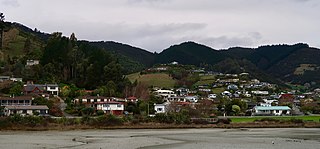
Atawhai is one of the suburbs of Nelson, New Zealand. It lies north of Nelson and is the location of Wakapuaka Cemetery, a burial place since 1861. It also has a coastline on Nelson Haven and access to Boulder Bank from State Highway 6.
Groom Creek, which flows northwards from Fringed Hill then past Tantragee Saddle, is a tributary of the Maitai / Mahitahi River in Nelson, South Island, New Zealand.