Rough Butt Creek

Last updated
Rough Butt Creek
Tributary to Caney Fork
USA North Carolina relief location map.jpg
Red pog.svg
Location of Rough Butt Creek mouth
Usa edcp relief location map.png
Red pog.svg
Rough Butt Creek (the United States)
Location
Country United States
State North Carolina
County Jackson
Physical characteristics
Sourcedivide between Rough Butt Creek and Wolf Creek
  locationabout 0.5 miles southwest of Rough Butt Bald
  coordinates 35°18′42″N082°58′27″W / 35.31167°N 82.97417°W / 35.31167; -82.97417 [1]
  elevation4,900 ft (1,500 m) [2]
Mouth Caney Fork
  location
about 2 miles east-northeast of Rich Mountain, North Carolina
  coordinates
35°19′29″N082°01′36″W / 35.32472°N 82.02667°W / 35.32472; -82.02667 Coordinates: 35°19′29″N082°01′36″W / 35.32472°N 82.02667°W / 35.32472; -82.02667 [1]
  elevation
2,930 ft (890 m) [2]
Length3.31 mi (5.33 km) [3]
Basin size3.51 square miles (9.1 km2) [4]
Discharge 
  locationCaney Fork
  average11.89 cu ft/s (0.337 m3/s) at mouth with Caney Fork [4]
Basin features
Progressionwest-northwest
River system Tuckasegee
Tributaries 
  leftunnamed tributaries
  rightunnamed tributaries


Rough Butt Creek is a stream in Jackson County, North Carolina, in the United States. [5] It is located within the Nantahala National Forest.

Jackson County, North Carolina County in North Carolina, United States

Jackson County is a county located in the southwest of the U.S. state of North Carolina. As of the 2010 census, the population was 40,271. Since 1913 its county seat has been Sylva, replacing Webster.

United States Federal republic in North America

The United States of America (USA), commonly known as the United States or America, is a country comprising 50 states, a federal district, five major self-governing territories, and various possessions. At 3.8 million square miles, the United States is the world's third or fourth largest country by total area and is slightly smaller than the entire continent of Europe. With a population of over 327 million people, the U.S. is the third most populous country. The capital is Washington, D.C., and the most populous city is New York City. Most of the country is located contiguously in North America between Canada and Mexico.

Nantahala National Forest

The Nantahala National Forest, established in 1920, is a national forest located in the American state of North Carolina. The word "Nantahala" is a Cherokee word meaning "Land of the Noonday Sun." The name is appropriate as, in some spots, the sun only reaches the floors of the deep gorges of the forest when high overhead at midday. The Spanish Conquistador Hernando de Soto explored the area in 1540, as did William Bartram in the 18th century. The Nantahala River flows through the Nantahala National Forest.

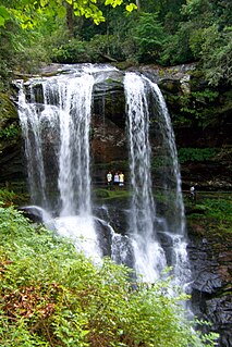
A hiking trail along Rough Butt Creek leads to a 35-foot (11 m) waterfall. [6]

Waterfall Place where water flows over a vertical drop in the course of a river

A waterfall is an area where water flows over a vertical drop or a series of steep drops in the course of a stream or river. Waterfalls also occur where meltwater drops over the edge of a tabular iceberg or ice shelf.

See also

Related Research Articles

Cullasaja River Stream in North Carolina, USA

The Cullasaja River is a short river located entirely in Macon County, North Carolina. It is a tributary of the Little Tennessee River, into which it flows near the county seat of Franklin. It originates to the southeast, near Highlands, the county's only other town. It flows from manmade Lake Sequoyah, which is fed by Mirror Lake and other creeks and streams originating on the western side of the Eastern Continental Divide, which runs through the east side of Highlands.

Six Run Creek Stream in North Carolina, USA

Six Run Creek is a tributary of the Black River, that is 46.84 mi (75.38 km) long, in southeastern North Carolina in the United States.

Mitchell River (North Carolina) Stream in North Carolina, USA

The Mitchell River is a tributary of the Yadkin River in northwestern North Carolina in the United States. Via the Yadkin it is part of the watershed of the Pee Dee River, which flows to the Atlantic Ocean. According to the Geographic Names Information System, it has also been known historically as "Mitchells River," "Mitchels River," and "Mountain Creek."

Hyco River Stream in North Carolina, USA


The Hyco River is a tributary of the Dan River, which is a tributary of the Roanoke River. All three rivers flow through the U.S. states of North Carolina and Virginia. In Person County, North Carolina the Hyco River is impounded by a dam, forming Hyco Lake. The main part of the river flows through Allensville, North Carolina, on Gentry's Ridge and Mill Creek roads as it flows into Virginia townships such as Alton, Virginia, and Cluster Springs, Virginia, then combining with the Dan River.

Coddle Creek Stream in North Carolina, USA

Coddle Creek is a stream/river that rises near Mooresville in Iredell County, North Carolina. It flows through most of northwestern Cabarrus County, North Carolina where it empties into Rocky River near Harrisburg, North Carolina.

Haw Creek (Haw River tributary) Stream in North Carolina, USA

Haw Creek is a 12.84 mi (20.66 km) long 3rd order tributary to the Haw River, in Alamance County, North Carolina.

Back Creek (Haw River tributary) Stream in North Carolina, USA

Back Creek is a 8.77 mi (14.11 km) long 4th order tributary to the Haw River, in Alamance County, North Carolina.

Boyds Creek (Haw River tributary) Stream in North Carolina, USA

Boyds Creek is a 4.54 mi (7.31 km) long 2nd order tributary to the Haw River, in Alamance County, North Carolina.

Service Creek (Haw River tributary) Stream in North Carolina, USA

Service Creek is a 5.93 mi (9.54 km) long 2nd order tributary to the Haw River, in Alamance County, North Carolina.

Stony Creek (Haw River tributary) Stream in North Carolina, USA

Stony Creek is a 17.10 mi (27.52 km) long 4th order tributary to the Haw River, in Alamance and Caswell Counties, North Carolina.

Travis Creek (Haw River tributary) Stream in North Carolina, USA

Travis Creek is a 6.54 mi (10.53 km) long 3rd order tributary to the Haw River, in Alamance County, North Carolina.

Reedy Fork (Haw River tributary) Stream in North Carolina, USA

Reedy Fork is a 43.70 mi (70.33 km) long 3rd order tributary to the Haw River, in Alamance County, North Carolina.

Cane Creek (Haw River tributary, left bank) Stream in North Carolina, USA

Cane Creek is a 13.74 mi (22.11 km) long 4th order tributary to the Haw River, in Alamance and Orange Counties, North Carolina. This Cane Creek is on the left bank of the Haw River.

Beaver Creek (Reedy Fork tributary) Stream in North Carolina, USA

Beaver Creek is a 6.16 mi (9.91 km) long 2nd order tributary to Reedy Fork, in Guilford County, North Carolina.

Brush Creek (Reedy Fork tributary) Stream in North Carolina, USA

Brush Creek is a 8.15 mi (13.12 km) long 2nd order tributary to Reedy Fork in Guilford County, North Carolina.

Smith Branch (Reedy Fork tributary) Stream in North Carolina, USA

Smith Branch is a 2.02 mi (3.25 km) long 2nd order tributary to Reedy Fork in Guilford County, North Carolina.

Flat Creek (Swannanoa River tributary) Stream in North Carolina, USA

Flat Creek is a 5.39 mi (8.67 km) long 2nd order tributary to the Swannanoa River in Buncombe County, North Carolina. It is impounded at Montreat Reservoir and Lake Susan.

Beetree Creek (Swannanoa River tributary) Stream in North Carolina, USA

Beetree Creek is a 8.05 mi (12.96 km) long 2nd order tributary to the Swannanoa River in Buncombe County, North Carolina.

Great Coharie Creek (Black River tributary) Stream in North Carolina, USA

Great Coharie Creek is a 48.88 mi (78.66 km) long 5th order tributary to the Black River in Sampson County, North Carolina.

Mingo Swamp (South River tributary) Stream in North Carolina, USA

Mingo Swamp is a 21.78 mi (35.05 km) long 4th order tributary to the South River in Sampson County, North Carolina. Mingo Swamp along with Black River forms the South River.

References

  1. 1 2 "GNIS Detail - Rough Butt Creek". geonames.usgs.gov. US Geological Survey. Retrieved 16 October 2019.
  2. 1 2 "Rough Butt Creek Topo Map, Jackson County NC (Tuckasegee Area)". TopoZone. Locality, LLC. Retrieved 16 October 2019.
  3. "ArcGIS Web Application". epa.maps.arcgis.com. US EPA. Retrieved 16 October 2019.
  4. 1 2 "Rough Butt Creek Watershed Report". Waters Geoviewer. US EPA. Retrieved 16 October 2019.
  5. U.S. Geological Survey Geographic Names Information System: Rough Butt Creek
  6. Adams, Kevin (2005). North Carolina Waterfalls: A Hiking and Photography Guide. John F. Blair, Publisher. p. 453. ISBN   978-0-89587-320-0.