
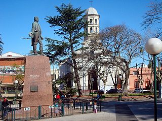
Canelones is the capital of the department of Canelones in Uruguay. Its name is derived from a species of cinnamon, which is called "canelón", growing along the banks of the homonymous river. Since 2010, the city is also the seat of the municipality of Canelones.

Melo is the capital city of the Cerro Largo Department of north-eastern Uruguay. As of the census of 2011, it is the ninth most populated city of the country.

Paysandú is the capital of Paysandú Department in western Uruguay.
Salto is the capital city of the Salto Department in northwestern Uruguay. As of the 2011 census it had a population of 104,028 and is the third most populated city in Uruguay, after Montevideo and Ciudad de la Costa.

Mercedes is the capital and largest city of the department of Soriano in Uruguay. According to the census 2011, it is the tenth most populated city of the country.

Las Piedras is a city in the Canelones Department of Uruguay. As of the census of 2011, it is the seventh most populated city of the country.
Google Maps Navigation is a mobile application developed by Google for the Android and iOS operating systems that was later integrated into the Google Maps mobile app. The application uses an Internet connection to a GPS navigation system to provide turn-by-turn voice-guided instructions on how to arrive at a given destination. The application requires connection to Internet data and normally uses a GPS satellite connection to determine its location. A user can enter a destination into the application, which will plot a path to it. The app displays the user's progress along the route and issues instructions for each turn.
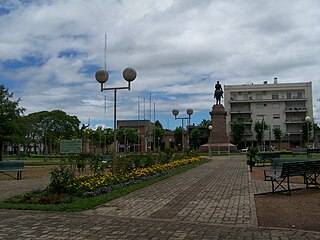
Pando is a city in the Canelones Department of Uruguay. It is an important commercial and industrial centre which has become part of the wider metropolitan area of Montevideo.

Santa Lucía is a city in the Canelones Department of southern Uruguay.
Castellanos is a populated centre in the Canelones Department of southern Uruguay.

San Jacinto is a small city in the Canelones Department of southern Uruguay.
Seis Hermanos is a hamlet (caserío) in the Canelones Department of southern Uruguay.
Totoral del Sauce is a village or populated centre in the Canelones Department of southern Uruguay.
Route 2 is a national route of Uruguay. In 1983, it was assigned the name Grito de Asencio. It connects Fray Bentos with Rosario. The road is approximately 180 kilometres (110 mi) in length.

Route 10 is a national route of Uruguay. In 1983, it was assigned the name Juan Díaz de Solís, honouring the Spanish navigator.

Ruta Interbalnearia or Ruta Líber Seregni is a national route of Uruguay. It connects Montevideo with Punta del Este to the east along the coast. The road is approximately 90 kilometres (56 mi) in length. It is marked on maps and signs as IB.
Route 39 is a national route of Uruguay. It connects Aiguá to Punta del Este on the coast. This road passes through the Maldonado Department and the city of Maldonado.

Route 11 is a national route of Uruguay. In 1983, it was assigned the name José Batlle y Ordóñez; and in the last stretch it bears the name Ing. Eladio Dieste. It connects Atlántida to Ecilda Paullier.

Route 13 is a national route of Uruguay. In 1983, it was assigned the name Bartolomé Hidalgo. It begins near Aiguá and joins Route 15 near Velazquez.

Route 14 is a national route of Uruguay. In 1983, it was assigned the name Brigadier General Venancio Flores. It connects Mercedes, Uruguay and joins Route 9 on the east coast near La Coronila.

