
The Maryland Transit Administration (MTA) is a state-operated mass transit administration in Maryland, and is part of the Maryland Department of Transportation. It is better known as MTA Maryland to avoid confusion with other cities' transit agencies who share the initials MTA. The MTA operates a comprehensive transit system throughout the Baltimore-Washington Metropolitan Area. There are 80 bus lines serving Baltimore's public transportation needs, along with other services that include the Light Rail, Metro Subway, and MARC Train. With nearly half the population of Baltimore residents lacking access to a car, the MTA is an important part of the regional transit picture. The system has many connections to other transit agencies of Central Maryland, Washington, D.C., Northern Virginia, and south-central Pennsylvania : WMATA, Charm City Circulator, Regional Transportation Agency of Central Maryland, Annapolis Transit, Rabbit Transit, Ride-On, and TransIT.

MARC Train Service, previously known as Maryland Rail Commuter, is a commuter rail system comprising three lines in the Baltimore–Washington metropolitan area. MARC is administered by the Maryland Transit Administration (MTA), a Maryland Department of Transportation (MDOT) agency, and is operated under contract by Bombardier Transportation Services USA Corporation (BTS) and Amtrak over tracks owned by CSX Transportation (CSXT) and Amtrak.
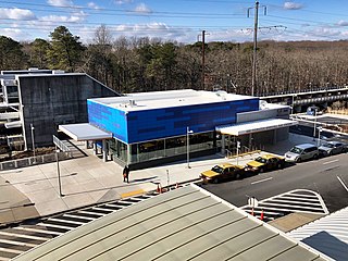
BWI Airport Station is an intermodal passenger station in Linthicum, Maryland near Baltimore–Washington International Airport (BWI). It is served by Amtrak Northeast Corridor intercity trains, MARC Penn Line regional rail trains, and several local bus lines.

West Baltimore station is a regional rail station located in the western part of the City of Baltimore, Maryland along the Northeast Corridor. It is served by MARC Penn Line trains. The station is positioned on an elevated grade above and between the nearby parallel West Mulberry and West Franklin Streets at 400 North Smallwood Street. Three large surface lots are available for commuters. The station is not accessible, with two low-level side platforms next to the outer tracks, but MTA Maryland plans to later renovate the station with accessible platforms and entrances.

LocalLink 93 is a bus route operated by the Maryland Transit Administration in the suburbs of Baltimore. The line currently runs from the Lutherville Light Rail Stop to International Circle near Hunt Valley Town Center, serving the Timonium and Cockeysville areas.
Route 40 is a limited stop bus route, identified as a "QuickBus", operated by the Maryland Transit Administration in Baltimore and its suburbs. The line currently runs from the Centers for Medicare and Medicaid Services in Woodlawn to Middle River, both in Baltimore County, Maryland with selected trips terminating at Downtown Baltimore City Hall, passing through the west and east sides and the downtown area of Baltimore City. Service operates every 12 minutes during rush hour, and every 15 minutes at most other times during its hours of operation. The line serves the corridors of Edmondson Avenue in West Baltimore, including the communities of Edmondson Village, Allendale, and Rosemont, and Fayette Street and Eastern Avenue in East Baltimore, serving Patterson Park, Johns Hopkins Bayview Medical Center and Essex.

LocalLink 75 is a bus route operated by the Maryland Transit Administration in Baltimore and its suburbs. The line currently runs from the Patapsco Light Rail Stop to Parkway Center in Anne Arundel County, via BWI Airport and Arundel Mills. Weekend trips and some weekday trips on this line terminate at Arundel Mills. The line operates between BWI Airport and downtown Baltimore during hours when the light rail is not operating.

CityLink Red is a citylink bus route operated by the Maryland Transit Administration in Baltimore and its suburbs. The line currently runs from the University of Maryland Transit Center to the Lutherville Light Rail Stop along the corridors of York Road and Greenmount Avenue, and is one of the most heavily used MTA bus lines. The CityLink Red bus replaced Route 8 bus route due to BaltimoreLink, and is the successor to the 8 Towson and 7 Govanstown streetcar lines.
Route 13 is a bus route operated by the Maryland Transit Administration in Baltimore. The line currently runs from Walbrook Junction in West Baltimore to Canton, mostly along North Avenue. The line has two main branches, both operating to Canton: one that operates via Fells Point and the other via Linwood and East Streets. Both these branches serve Johns Hopkins Hospital. Additionally, selected trips on weekdays and Saturdays operate to the block of Milton Avenue, Federal Street, and Patterson Park Avenue.

The Maryland Transit Administration was originally known as the Baltimore Metropolitan Transit Authority, then the Maryland Mass Transit Administration before it changed to its current name in October 2001. The MTA took over the operations of the old Baltimore Transit Company on April 30, 1970.

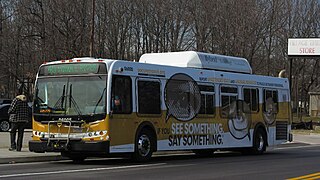
The Maryland Transit Administration provides the primary public bus service for the Baltimore metropolitan area and commuter bus service in other parts of the state of Maryland. There are currently 76 bus routes, which include 43 LocalLink routes, 12 High Frequency CityLink Routes routes, 9 express bus routes, 19 commuter bus routes, and 5 Intercounty Connector or "ICC" routes. The local and commuter bus routes operate in conjunction with one subway line, three light rail lines, MARC train service, and various connections to other transit agencies.

LocalLink 29 is a bus route operated by the Maryland Transit Administration in Baltimore. The line currently runs from the Mondawmin Metro Subway Station in Northwest Baltimore to Brooklyn Homes in South Baltimore through the communities of Rosemont and the corridors of Hilton Street, Caton Avenue, and Patapsco Avenue. During peak hours, selected trips operate via Violetville Industrial Park.

Route 46 is a limited stop bus route, identified as a "Quickbus", operated by the Maryland Transit Administration in Baltimore. The line currently runs from the Cedonia Loop in Northeast Baltimore to the Paradise Loop, in Catonsville. Service operates every 15 minutes during rush hour only. The line serves the corridors of Frederick Avenue in West Baltimore, and Sinclair Lane/Cedonia Ave in Northeast Baltimore including the communities of Yale Heights, and Gwynns Falls in West Baltimore, and Berea and Parkside in East Baltimore.

Route 47 is a limited stop bus route, identified as a "Quickbus", operated by the Maryland Transit Administration in Baltimore. The line currently runs from the Overlea Loop in Northeast Baltimore to Walbrook Junction, in West Baltimore. Service operates every 15 minutes during rush hour only. The main roads on which it operates include Poplar Grove Street, Saratoga Street, Gay Street, and Belair Road. Service operates Monday–Friday, every 15 minutes, from 5:30 a.m.– 9:30 a.m. and 2:30 p.m.- 6:30 p.m.

Hawkins Point is a neighborhood in the South District of Baltimore, located at the southern tip of the city between Curtis Bay (north) and the Anne Arundel County line (south) and Thoms Cove (east). Its land area covers 2.6 square miles (6.7 km2), and it had a population of 24 people according to the 2020 U.S. Census. The neighborhood is predominantly industrial.

Westgate is a neighborhood in the Southwest District of Baltimore, located between Baltimore County (west) and the city neighborhood of Ten Hills (east). Its boundaries are marked by Baltimore National Pike (north), Frederick Avenue (south), Rock Glen Avenue and Edmondson Avenue (east) and the city line (west).

The College Park Line, designated Route 83, 83X, & 86 is a daily bus route operated by the Washington Metropolitan Area Transit Authority between the Rhode Island Avenue Station, which is served by Red Line of the Washington Metro, and the Cherry Hill Park Campground in College Park, MD or Calverton (86). 83X is a complementary, seasonal Metrobus route that only operates on short trips between the College Park–University of Maryland station & Cherry Hill Campground, via 83's routing. 83 is shortened to only operate on short trips between Rhode Island Avenue station and Mount Rainier, MD, during late nights daily. 83 & 86 mainly operate on the U.S. Route 1 corridor between Rhode Island Avenue in Northeast Washington D.C. & College Park, Maryland. Route 83 trips are roughly 50 minutes long, route 83X trips are roughly 10 minutes long, and route 86 trips are roughly 70 minutes long.
The College Park–White Flint Line, designated Route C8, is a bus route that operates Monday to Saturday that is operated by the Washington Metropolitan Area Transit Authority, United States, between College Park–University of Maryland station of the Green and Yellow Lines and White Flint station of the Red Line of the Washington Metro. The line operates every 30–33 minutes at all times. Trips are roughly 60-80 minutes long.

CityLink Blue (BL) is a bus route operated by the Maryland Transit Administration between Bayview, Baltimore City, and Westgate, Baltimore City, or Woodlawn, Baltimore County. Most westbound trips on the route depart from Johns Hopkins Bayview Medical Center, at the intersection of East Lombard Street and Bioscience Drive in East Baltimore, and terminate at the Centers for Medicare & Medicaid Services (CMS) on Security Boulevard in Woodlawn. Some trips on late nights on weekdays or throughout the day on weekends terminate instead at the North Bend Loop by the intersection of Edmondson Avenue and North Bend Road, near the western boundary of Baltimore City. Eastbound trips travel the reverse route between these terminal stops; likewise, most of these trips depart from the CMS stop, but some depart from the North Bend Loop stop.