Demographics
Royal Heights covers 2.63 km2 (1.02 sq mi) [1] and had an estimated population of 7,940 as of June 2022, [2] with a population density of 3,019 people per km2.
Historical population| Year | Pop. | ±% p.a. |
|---|
| 2006 | 6,465 | — |
|---|
| 2013 | 6,768 | +0.66% |
|---|
| 2018 | 7,278 | +1.46% |
|---|
| Source: [6] |
Royal Heights had a population of 7,278 at the 2018 New Zealand census, an increase of 510 people (7.5%) since the 2013 census, and an increase of 813 people (12.6%) since the 2006 census. There were 2,160 households, comprising 3,597 males and 3,678 females, giving a sex ratio of 0.98 males per female, with 1,635 people (22.5%) aged under 15 years, 1,734 (23.8%) aged 15 to 29, 3,168 (43.5%) aged 30 to 64, and 738 (10.1%) aged 65 or older.
Ethnicities were 54.1% European/Pākehā, 17.5% Māori, 21.8% Pacific peoples, 21.2% Asian, and 4.5% other ethnicities. People may identify with more than one ethnicity.
The percentage of people born overseas was 34.5, compared with 27.1% nationally.
Although some people chose not to answer the census's question about religious affiliation, 43.0% had no religion, 41.1% were Christian, 1.1% had Māori religious beliefs, 2.4% were Hindu, 3.0% were Muslim, 1.4% were Buddhist and 1.6% had other religions.
Of those at least 15 years old, 1,140 (20.2%) people had a bachelor's or higher degree, and 939 (16.6%) people had no formal qualifications. 846 people (15.0%) earned over $70,000 compared to 17.2% nationally. The employment status of those at least 15 was that 3,009 (53.3%) people were employed full-time, 714 (12.7%) were part-time, and 288 (5.1%) were unemployed. [6]
Individual statistical areas| Name | Area (km2) | Population | Density (per km2) | Households | Median age | Median income |
|---|
| Royal Heights North | 1.50 | 3,501 | 2,334 | 1,095 | 33.2 years | $35,800 [7] |
| Royal Heights South | 1.13 | 3,777 | 3,342 | 1,065 | 31.2 years | $29,100 [8] |
| New Zealand | | | | | 37.4 years | $31,800 |
|---|
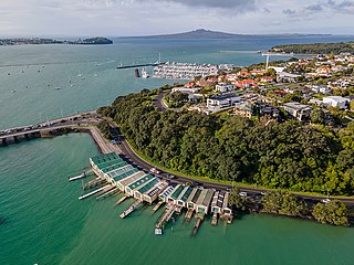
Ōrākei is a suburb of Auckland city, in the North Island of New Zealand. It is located on a peninsula five kilometres to the east of the city centre, on the shore of the Waitematā Harbour, which lies to the north, and Hobson Bay and Ōrākei Basin, two arms of the Waitematā, which lie to the west and south. To the east is the suburb of Mission Bay. Takaparawhau / Bastion Point is a coastal piece of land in Ōrākei. Between Takaparawhau and Paritai Drive is Ōkahu Bay and Reserve.

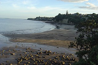
Browns Bay is one of the most northernmost suburbs in the contiguous Auckland metropolitan area, located in the North Shore. It is located in the East Coast Bays area, a string of small suburbs that form the northernmost part of the North Shore of Auckland.
Mairangi Bay is a coastal suburb of North Shore, Auckland, located in the northern North Island of New Zealand, on the south-east-facing peninsula forming the northern side of the Waitematā Harbour. Mairangi Bay came under the local governance of the North Shore City Council until subsumed into the Auckland Council in 2010.
Pakuranga Heights is an Auckland suburb.

Shelly Park is a South eastern suburb of Auckland, in northern New Zealand. The suburb is in the Howick ward, one of thirteen electoral divisions of the Auckland Council.
The suburb of Farm Cove is located in eastern Auckland, New Zealand. The suburb is in the Howick ward, one of the thirteen administrative divisions of Auckland city.

Waterview is a suburb of Auckland, New Zealand, located along the western side of Auckland's isthmus. Its boundaries are Oakley Creek in the east, Heron Park in the south, the Waitematā Harbour in the west, and the Northwestern Motorway and the Oakley Creek inlet in the north.

Waikowhai is an Auckland suburb, under the local governance of the Auckland Council. Waikowhai has the largest block of native forest left on the Auckland isthmus. The block was considered the too infertile for farming and subsequently not cleared but given to the Wesley Mission. Today the forest block hosts a valuable sample of Auckland's original fauna and flora. Waikōwhai Walkway extends for 10 km (6.2 mi) linking Onehunga to Lynfield Cove.
Hillsborough is a suburb of Auckland, New Zealand. It is under the local governance of the Auckland Council. Hillsborough is a leafy suburb of 20th-century houses. The area is serviced by two shopping areas; Onehunga and Three Kings. The area is served by secondary schools Mount Roskill Grammar School and Marcellin College.
West Harbour is an affluent suburb of Auckland, located to the west of the Auckland isthmus and CBD. It is named for its location on the western side of the Waitematā Harbour. West Harbour is under the governance of Auckland Council after the amalgamation of district councils in 2010.

Western Heights is a neighbourhood of Henderson, in West Auckland, New Zealand. Western Heights School and the nearby shops are the centre of the community. Western Heights is a "frontier suburb", separating suburban Auckland from lifestyle farming blocks, orchards and the Waitākere Ranges.

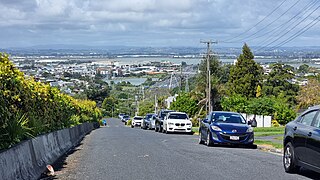
Massey is a northern suburb in West Auckland, New Zealand. It was formerly a northern suburb of Waitakere City, which existed from 1989 to 2010 before the city was amalgamated into Auckland Council. The suburb was named after former Prime Minister of New Zealand William Massey. Massey is a relatively large suburb and can be divided into three reasonably distinctive areas, Massey West, Massey East and Massey North. Parts of Massey East are also known as 'Royal Heights', which is home to the Royal Heights shopping centre.

Castor Bay is a bay and suburb of the North Shore, located in Auckland which is in the North Island of New Zealand. Located between Milford and Campbells Bay, it is part of the East Coast Bays. To the east lies the islands of Rangitoto and Motutapu, which are easily visible from land. The suburb is in the North Shore ward, one of the thirteen administrative divisions of Auckland Council.
Murrays Bay is a small suburb in the East Coast Bays region, located in the North Shore of Auckland. The suburb is roughly the same size as Rothesay Bay, the suburb to the immediate north. It is primarily a residential area but does have a community centre, restaurant and café. Murrays Bay is regularly serviced by buses which go to Takapuna and the Auckland city centre.

Tāwharanui Peninsula is a finger of land projecting into the Hauraki Gulf from the east coast of the much larger North Auckland Peninsula of New Zealand. It separates Omaha Bay to the north from Kawau Bay and Kawau Island to the south. The nearest sizable town is Warkworth.
Pohangina is a small rural community in the Manawatū-Whanganui region of New Zealand, just north of Ashhurst.
Campbells Bay is a suburb of the North Shore located in Auckland, New Zealand. Centennial Park is a popular recreational space that has walking tracks and stunning harbour views.
Unsworth Heights is a suburb of North Shore in the Auckland metropolitan area in northern New Zealand. New Zealand State Highway 18 passes to the north of the suburb, and the Albany Highway to the south. The two routes intersect just to the west of Unsworth Heights. Unsworth Reserve is to the east.
Goodwood Heights is a suburb of Auckland, New Zealand. It is located approximately 20 kilometres southeast of the Auckland CBD; to the north of Totara Heights, east of Manukau Central and south of Chapel Downs. It was formerly part of Manukau City until the merger of all of Auckland's councils into the 'super city' in 2010.
Onewhero is a village and rural community in the Waikato District and Waikato region of New Zealand's North Island.


