
Ruda is a village in the administrative district of Gmina Grudziądz, within Grudziądz County, Kuyavian-Pomeranian Voivodeship, in north-central Poland. It lies approximately 13 kilometres (8 mi) south-west of Grudziądz and 41 km (25 mi) north of Toruń.
Stara Ruda is a village in the administrative district of Gmina Radzyń Chełmiński, within Grudziądz County, Kuyavian-Pomeranian Voivodeship, in north-central Poland.

Sarigyugh is a town in the Tavush Province of Armenia.
Ruda Solska is a village in the administrative district of Gmina Biłgoraj, within Biłgoraj County, Lublin Voivodeship, in eastern Poland. It lies approximately 11 kilometres (7 mi) south-west of Biłgoraj and 86 km (53 mi) south of the regional capital Lublin.
Ruda-Zagrody is a village in the administrative district of Gmina Biłgoraj, within Biłgoraj County, Lublin Voivodeship, in eastern Poland. It lies approximately 10 kilometres (6 mi) south-west of Biłgoraj and 85 km (53 mi) south of the regional capital Lublin.
Ruda Rzeczka is a village in the administrative district of Gmina Czarna Białostocka, within Białystok County, Podlaskie Voivodeship, in north-eastern Poland.
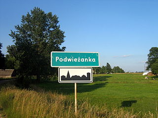
Podwieżanka is a village in the administrative district of Gmina Czyże, within Hajnówka County, Podlaskie Voivodeship, in north-eastern Poland.
Gorodczyno is a village in the administrative district of Gmina Narew, within Hajnówka County, Podlaskie Voivodeship, in north-eastern Poland.

Fərəhli is a village in the Qazakh Rayon of Azerbaijan.
Ruda Maleniecka is a village in Końskie County, Świętokrzyskie Voivodeship, in south-central Poland. It is the seat of the gmina called Gmina Ruda Maleniecka. It lies approximately 15 kilometres (9 mi) south-west of Końskie and 41 km (25 mi) north-west of the regional capital Kielce.
Ruda is a village in the administrative district of Gmina Lubowidz, within Żuromin County, Masovian Voivodeship, in east-central Poland.
Bielawa is a village in the administrative district of Gmina Złotów, within Złotów County, Greater Poland Voivodeship, in west-central Poland.
Nowa Święta-Leśniczówka is a village in the administrative district of Gmina Złotów, within Złotów County, Greater Poland Voivodeship, in west-central Poland.
Bartel Mały is a settlement in the administrative district of Gmina Kaliska, within Starogard County, Pomeranian Voivodeship, in northern Poland. It lies approximately 5 kilometres (3 mi) west of Kaliska, 27 km (17 mi) west of Starogard Gdański, and 60 km (37 mi) south-west of the regional capital Gdańsk.
Ruda Waplewska is a village in the administrative district of Gmina Olsztynek, within Olsztyn County, Warmian-Masurian Voivodeship, in northern Poland.
Ruda is a village in the administrative district of Gmina Biała Piska, within Pisz County, Warmian-Masurian Voivodeship, in northern Poland. It lies approximately 7 kilometres (4 mi) north-west of Biała Piska, 16 km (10 mi) east of Pisz, and 101 km (63 mi) east of the regional capital Olsztyn.
Rudniki is a village in the administrative district of Gmina Choszczno, within Choszczno County, West Pomeranian Voivodeship, in north-western Poland. It lies approximately 3 kilometres (2 mi) south of Choszczno and 63 km (39 mi) south-east of the regional capital Szczecin.
Wojcieszyn is a village in the administrative district of Gmina Nowogard, within Goleniów County, West Pomeranian Voivodeship, in north-western Poland. It lies approximately 4 kilometres (2 mi) north-east of Nowogard, 27 km (17 mi) north-east of Goleniów, and 49 km (30 mi) north-east of the regional capital Szczecin.
Skrzydłowo is a village in the administrative district of Gmina Rymań, within Kołobrzeg County, West Pomeranian Voivodeship, in north-western Poland. It lies approximately 5 kilometres (3 mi) south-west of Rymań, 28 km (17 mi) south of Kołobrzeg, and 82 km (51 mi) north-east of the regional capital Szczecin.
Siimurahu is a small uninhabited island in the Baltic Sea belonging to the country of Estonia.


