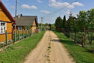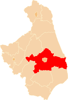
Bielewicze is a village in the administrative district of Gmina Gródek, within Białystok County, Podlaskie Voivodeship, in north-eastern Poland, close to the border with Belarus. It lies approximately 4 kilometres (2 mi) south-east of Gródek and 36 km (22 mi) east of the regional capital Białystok.

Bobrowniki is a village in the administrative district of Gmina Gródek, within Białystok County, Podlaskie Voivodeship, in north-eastern Poland, close to the border with Belarus. It lies approximately 16 kilometres (10 mi) east of Gródek and 48 km (30 mi) east of the regional capital Białystok.

Borki is a village in the administrative district of Gmina Gródek, within Białystok County, Podlaskie Voivodeship, in north-eastern Poland, close to the border with Belarus. It lies approximately 16 kilometres (10 mi) north-west of Gródek and 25 km (16 mi) north-east of the regional capital Białystok.

Dzierniakowo is a village in the administrative district of Gmina Gródek, within Białystok County, Podlaskie Voivodeship, in north-eastern Poland, close to the border with Belarus. It lies approximately 3 kilometres (2 mi) west of Gródek and 31 km (19 mi) east of the regional capital Białystok.

Grzybowce is a village in the administrative district of Gmina Gródek, within Białystok County, Podlaskie Voivodeship, in north-eastern Poland, close to the border with Belarus. It lies approximately 5 kilometres (3 mi) north-east of Gródek and 37 km (23 mi) east of the regional capital Białystok.

Jaryłówka is a village in the administrative district of Gmina Gródek, within Białystok County, Podlaskie Voivodeship, in north-eastern Poland, close to the border with Belarus. It lies approximately 16 kilometres (10 mi) east of Gródek and 48 km (30 mi) east of the regional capital Białystok.

Józefowo is a village in the administrative district of Gmina Gródek, within Białystok County, Podlaskie Voivodeship, in north-eastern Poland, close to the border with Belarus. It lies approximately 10 kilometres (6 mi) north-east of Gródek and 39 km (24 mi) east of the regional capital Białystok.

Kołodno is a village in the administrative district of Gmina Gródek, within Białystok County, Podlaskie Voivodeship, in north-eastern Poland, close to the border with Belarus. It lies approximately 15 kilometres (9 mi) north-west of Gródek and 21 km (13 mi) east of the regional capital Białystok.

Łużany is a village in the administrative district of Gmina Gródek, within Białystok County, Podlaskie Voivodeship, in north-eastern Poland, close to the border with Belarus. It lies approximately 15 kilometres (9 mi) north-east of Gródek and 46 km (29 mi) east of the regional capital Białystok.

Mieleszki-Kolonia is a village in the administrative district of Gmina Gródek, within Białystok County, Podlaskie Voivodeship, in north-eastern Poland, close to the border with Belarus. It lies approximately 6 kilometres (4 mi) south-east of Gródek and 36 km (22 mi) east of the regional capital Białystok.

Pałatki is a village in the administrative district of Gmina Gródek, within Białystok County, Podlaskie Voivodeship, in north-eastern Poland, close to the border with Belarus. It lies approximately 17 kilometres (11 mi) north-west of Gródek and 20 km (12 mi) east of the regional capital Białystok.

Pieszczaniki is a village in the administrative district of Gmina Gródek, within Białystok County, Podlaskie Voivodeship, in north-eastern Poland, close to the border with Belarus. It lies approximately 8 kilometres (5 mi) north-west of Gródek and 27 km (17 mi) east of the regional capital Białystok.

Skroblaki is a village in the administrative district of Gmina Gródek, within Białystok County, Podlaskie Voivodeship, in north-eastern Poland, close to the border with Belarus. It lies approximately 10 kilometres (6 mi) north-east of Gródek and 42 km (26 mi) east of the regional capital Białystok.

Słuczanka is a village in the administrative district of Gmina Gródek, within Białystok County, Podlaskie Voivodeship, in north-eastern Poland, close to the border with Belarus. It lies approximately 3 kilometres (2 mi) north-west of Gródek and 32 km (20 mi) east of the regional capital Białystok.

Sofipol is a village in the administrative district of Gmina Gródek, within Białystok County, Podlaskie Voivodeship, in north-eastern Poland, close to the border with Belarus. It lies approximately 12 kilometres (7 mi) north-west of Gródek and 24 km (15 mi) east of the regional capital Białystok.

Waliły is a village in north-eastern Poland, in the administrative district of Gmina Gródek, within Białystok County, Podlaskie Voivodeship, close to the border with Belarus. It lies approximately 8 kilometres (5 mi) north-west of Gródek and 29 km (18 mi) east of the regional capital Białystok.

Wyżary is a settlement in the administrative district of Gmina Gródek, within Białystok County, Podlaskie Voivodeship, in north-eastern Poland, close to the border with Belarus. It lies approximately 9 kilometres (6 mi) north-west of Gródek and 30 km (19 mi) east of the regional capital Białystok.

Zarzeczany is a village in the administrative district of Gmina Gródek, within Białystok County, Podlaskie Voivodeship, in north-eastern Poland, close to the border with Belarus. It lies approximately 2 kilometres (1 mi) east of Gródek and 35 km (22 mi) east of the regional capital Białystok.

Zasady is a village in the administrative district of Gmina Gródek, within Białystok County, Podlaskie Voivodeship, in north-eastern Poland, close to the border with Belarus. It lies approximately 20 kilometres (12 mi) north-west of Gródek and 22 km (14 mi) north-east of the regional capital Białystok.

Wandzin is a settlement in the administrative district of Gmina Sidra, within Sokółka County, Podlaskie Voivodeship, in north-eastern Poland. It lies approximately 2 kilometres (1 mi) east of Sidra, 18 km (11 mi) north of Sokółka, and 53 km (33 mi) north of the regional capital Białystok.


